")
The object of this dataset is to support the atmospheric correction data for the satellite and airborne remote-sensing. It provides the atmospheric aerosol and the column content of water vapor. The dataset is sectioned into two parts: the conventional observations data and the observations data synchronized with the airborne experiments. The instrument was on the roof of the 7# in the Wuxing Jiayuan community from 1 to 24 in June. After 25 June, it was moved to the ditch in the south of the Supperstaiton 15. The dataset provide the raw observations data and the retrieval data which contains the atmosphere aerosol optical depth (AOD) of the wavebands at the center of 1640 nm, 1020 nm, 936 nm, 870 nm, 670 nm, 500 nm, 440 nm, 380 nm and 340 nm, respectively, and the water vapor content is retrieved from the band data with a centroid wavelength of 936 nm. The continuous data was obtained from the 1 June to 20 September in 2012 with a one minute temporal resolution. The time used in this dataset is in UTC+8 Time. Instrument: The sun photometer is employed to measure the character of atmosphere. In HiWATER, the CE318-NE was used.
YU Wenping, WANG Zengyan, MA Mingguo
")
The main contents of this data set are forest, shrub and grassland sample plot survey data.The fixed samples are located in the drainage ditch valley of qilian mountain and the dayaokou valley where the hydrology observation and test site of the water source conservation forest research institute of gansu province is located. The information of the sample is as follows: Number elevation quadrat size longitude latitude surface type G1 2715 20 × 20 100 ° 17 '12 "38 ° 33' 29" qinghai spruce forest G2 2800 20×36 100°17 '07 "38°33' 27" moss spruce forest G3 2840 20×20 100°17 '37 "38°33' 05" moss spruce forest G4 2952 20 × 20 100 ° 17 '59 "38 ° 32' 47" qinghai spruce forest G5 3015 20 × 20 100 ° 18 '06 "38 ° 32' 42" qinghai spruce forest G6 3100 20 × 20 100 ° 18 '13 "38 ° 32' 31" thicket qinghai spruce forest G7 3300 23.5 × 20 thickets qinghai spruce forest G8 2800 20×20 100°13 '30 "38°33' 29" moss spruce forest B1 2700 12.8×25 moss spruce forest B2 2800 20×20 100°17 '38 "38°32' 59" moss spruce forest B3 2900 20×20 100°17 '59 "38°32' 51" grass spruce forest B4 3028 20×20 100°17 '59 "38°32' 39" moss spruce forest B5 3097 20×20 100°18 '02 "38°32' 32" moss spruce forest B6 3195 20 × 20 100 ° 18 '06 "38 ° 32' 25" qinghai spruce forest B7 2762 20 × 20 100 ° 17 '08 "38 ° 33' 21" qinghai spruce forest B8 2730 20×20 100°17 '06 "38°33' 27" moss spruce forest GM1 3690 5×5 100°18 '02 "38°32' 02" caragana scrub (middle) GM2 3690 5×5 100°18 '02 "38°32' 02" caragana scrub (rare) GM3 3700 5×5 100°18 '03 "38°32' 03" caragana + jilaliu shrub (dense) GM4 3600 5×5 100°18 '10 "38°32' 06" caragana + jila willow thicket (middle) GM5 3600 5×5 100°18 '10 "38°32' 06" caragana + jila willow shrub (sparse) GM6 3600 5×5 100°18 '10 "38°32' 06" caragana + jila willow thicket (dense) GM7 3500 5×5 100°18 '14 "38°32' 08" caragana + jila willow thicket (middle) GM8 3500 5×5 100°18 '14 "38°32' 08" caragana + jila willow thicket (dense) GM9 3500 5×5 100°18 '14 "38°32' 08" caragana + jila willow thicket (rare) GM10 3400 5×5 100°18 '18 "38°32' 12" golden pheasant scrub (rare) GM11 3400 5×5 100°18 '18 "38°32' 12" golden pheasant + golden raspberry shrub (dense) GM12 3400 5×5 100°18 '18 "38°32' 12" golden pheasant scrub (rare) GM13 3300 5 × 5 100 ° 18 '21 "38 ° 32' 21" giraliu thicket GM14 3300 5 × 5 100 ° 18 '21 "38 ° 32' 21" caragana + jila shrub GM15 3300 5 × 5 100 ° 18 '21 "38 ° 32' 21" caragana + jila shrub YC3 2700 1×1 100°17 '14 "38°33' 33" needle thatch field YC4 2750 1×1 100°17 '18 "38°33' 32" needle thatch field YC5 2800 1×1 100°17 '21 "38°33' 33" needle thatch field YC6 2850 1×1 100°17 '25 "38°33' 33" needle thatch field YC7 2900 1×1 100°17 '31 "38°33' 32" aster + needle thatch field YC8 2950 1×1 100°17 '44 "38°33' 23" needle thatch field YC9 2980 1×1 100°17 '48 "38°33' 25" needle thatch field The sample geodesic tree data were surveyed from July to August 2007.The survey included: 1. Basic survey of sample plots in drainage ditch basin: A) sample land setting: sample land number, elevation, slope direction, slope position, slope, soil layer thickness, sample land size, longitude and latitude, community type, soil type, operation status, age B) survey of each wood in the sample plots: sample plot number, tree number, tree species, tree classification, chest diameter, tree height, undershoot height, crown radius 2. Soil profile survey record sheet Including forest/vegetation status, major tree species, forest age, soil name, surface soil erosion, parent rock and material, drainage conditions, land use history, soil profile (soil layer, moisture, color, texture, structure, root system, gravel content) 3. Standard ground cover factor Standard land area, dominant tree species, stand/vegetation origin, elevation, slope direction, slope position, slope, cutting and utilization method, afforestation land preparation type, survey method, canopy coverage, living ground cover, dead cover cover, litter thickness (undivided strata, semi-decomposed layer, decomposed layer) 4. Canopy survey: 5. Draft quadrat (1m×1m) survey record sheet Including species name, number, coverage, average height 6. Results of determination of soil physical properties in source forest of qilian mountain (land sample survey) Contains the soil physical properties measurement process (+ wet mud weight aluminum box, aluminum box, soil moisture content, suddenly bulk density, etc.), bringing biomass measurement (total fresh weight of shrub and herb, fresh weight of sample, sample dry weight, etc.), litter dry weight (including mosses) layer and the largest capacity calculation process (of moss and litter thickness, total fresh weight, fresh weight of samples, the dry weight of the sample, soaking for 24 h after heavy, maximum water holding capacity, the largest water depth, the biggest hold water rate, maximum moisture capacity) 7. Bush sample survey: Including species name, number, coverage, average height 8. Standard sample land setting and questionnaire for each wooden inspection ruler Including tree species, tree classification, age, chest diameter, number of height, undershoot height, crown radius 9. Litter layer survey record sheet Including litter (decomposed layer, semi-decomposed layer, decomposed layer) thickness 10. Update survey records: Including tree species, natural regeneration (height <30cm, height 31-50cm, height >51cm), artificial regeneration (height <30cm, height 31-50cm, height >51cm) This data set can provide ground measured data for remote sensing inversion of forest structure parameters.
WANG Shunli, LUO Longfa, WANG Rongxin, CHE Zongxi, JING Wenmao

The dataset of soil temperature profile (5cm, 10cm, 15cm and 20cm) observations was obtained in the Yingke oasis and Huazhaizi desert steppe foci experimental areas from May 27 to Jul. 13, 2008. Diurnal observations were carried out in the bare land near No. 5 building of the resort at 6:00 and 12:00 from May 27 to Jun. 14, and in Yingke oasis No. 4 plot at 10:00 from Jun. 15 to Jul. 13. Besides, intensive observations were carried out at an interval of one hour from 6:00 on Jun. 2 to 6:00 on 3, 2008.
GE Yingchun, SHU Lele, WANG Jianhua, XU Zhen, SU Gaoli, LIANG Wenguang, YU Fan, Wang Jing, LI Xiaoyu

The dataset of ground-based microwave scatterometer (C-5 and LS-C-5; S-3; LS-S-3) and ground truth observations was obtained in the Linze grassland foci experimental area. Besides, TDR-200 was also used. Observation items included: (1) soil moisture of the grassland on Jul. 9, 2008. HH, HV, VV and VH polarization combinations were applied. (2) soil moisture of the maize field on Jul. 10, 2008. VV, HH, VH and HV polarization combinations were applied. (3) humidity of the grassland at around 11:30am on Jul. 11, 2008. VH, HH, VV and HV polarization combinations were applied.
CHEN Yan, JIA Mingquan, JIA Mingquan, LIU Zengcan, LIU Zengcan, XU Chunliang, QIN Wei, ZHAO Zizheng

The dataset of surface roughness measurements was obtained in No. 1 and 2 quadrates of the Biandukou foci experimental area during the pre-observation period. Both the quadrates were divided into 3×3 subsites, with each one spanning a 30×30 m2 plot. The original photos of each sampling point, surface height standard deviation (cm) and correlation length (cm) were included. With the roughness grid board 110cm long and the measuring intervals of 1cm, the samples were collected along the soil surface from south to north and from east to west, respectively. The coordinates of sample points would be got with the help of ArcView; and after geometric correction, surface height standard deviation (cm) and correlation length (cm) could be acquired based on the formula listed on pages 234-236, Microwave Remote Sensing, Vol. II. The roughness data files were initialized by the sample name, which was followed by the serial number, the name of the file, standard deviation and correlation length. Each .txt file is matched with one sample photo and standard deviation and correlation length represent the roughness. In addition, the length of 101 needles is also included for further checking. Those provide reliable ground data for improving and verifying the microwave remote sensing algorithms.
CAO Yongpan, CHAO Zhenhua, CHE Tao, QIN Chun, WU Yueru

The dateset of TIR (Patent No.: ZL 02 2 37640.2) emissivity measurements was obtained in No. 3 quadrate of the A'rou foci experimental area on Mar. 14, 2008. The observation site was covered with dry pasture with height less than 5cm, in which the center point of each grid was measured twice and was named in the form of A3-9 (number 9 point in No. 3 quadrate of A'rou). Each measurement was carried out at 45° and followed strictly the order: Tsky, Tcha, Tsm and Tcm. Meanwhile, the surface temperature was also acquired by the handheld infrared thermometer and the thermal imager (FLIR ThermaCAM). [emissivity=1- (Tcm^4 – Tsm^4)/ (Tcha^4 – Tsky^4)]. Those provide reliable data for retrieval and study of the surface temperature, and energy and radiation balance.
CAO Yongpan, GU Juan, LI Hua

The dataset of diurnal FPAR change observations was obtained by the quantum light meter (3415 series) in the Linze station foci experimental area. Each observation lasted from 9am to 5pm at intervals of 10 minutes, in the maize field and the sunflower field on Jun. 16, and in Wulidun farmland quadrates on Jul. 1, 2008. Located 15cm above the canopy, the quantum light meter was used to measure PARci and PARcr (at 0°, 30°, 45°, 60° and 90°); located 15cm above the ground, for PARgi and PARgr. And then PAR= (PARci- PARcr)- ( PARgi- PARgr); Fpar =PAR/ PARci. Data were archived as Excel files.
SONG Yi, BAI Yanfen, HAO Xiaohua, PAN Xiaoduo, SHU Lele, SONG Yi, WANG Yang, XU Zhen, ZHU Shijie

The dataset of snow spectral reflectance observations was obtained in the Binggou watershed foci experimental area from Dec. 5 to Dec. 15, 2007 during the pre-observation period. The aims of the measurements were to verify feasibility of the predetermined observation schemes and to collect data for retrieval from remote sensing approaches. All data were acquired by ASD spectrometer from Xinjiang Meteorological Administration. Observation items included: (1) Random observations on snow spectrum in the chosen snowpack at the Binggou cold region hydrometeorological station on Dec. 5, 6 and 7, 2007 (2) Snow spectrum observations in BG-A simultaneous with MODIS and Terra MISR on Dec. 10, 2007 (3) The pure and the mixed snow pixel spectrum in BG-A on Dec. 15, 2007 (4) Multi-angle snow spectrum in the chosen snowpack in BG-A on Dec. 15, 2007 Seven subfolders including raw data and pre-processed data are named after the acquisition time, Dec. 5, 2007, Dec. 6, 2007, Dec. 7, 2007, Dec. 10, 2007, Dec. 13, 2007, Dec. 15, 2007 and Dec. 15, 2007, respectively.
ZHANG Pu, LIU Yan
202024test test data 202024test test data 202024Test test data 202024test test data 202024test test data 202024test test data 202024test test data 202024test test data 202024test test data 202024test test data 202024test test data 202024test test data 202024test test data
MA Mingguo, DING Songchuang, GAO Song, Qian Jinbo, BAI Yunjie, WANG Xufeng, TAN Junlei, WANG Shuguo, GU Juan, WANG Shunli, LUO Longfa, WANG Rongxin, CHE Zongxi, JING Wenmao
 of the MUlti-Scale Observation EXperiment on Evapotranspiration over heterogeneous land surfaces 2012 (MUSOEXE-12)")
This dataset contains the flux measurements from the large aperture scintillometer (LAS) at site No.1 in the flux observation matrix. There were two types of LASs at site No.1: German BLS900 and China zzlas. The observation periods were from 7 June to 19 September, 2012, and 16 June to 19 September, 2012, for the BLS900 and the zzlas, respectively. The north tower is placed with the receiver of BLS900 and the transmitter of zzlas, and the south tower is placed with the transmitter of BLS900 and the receiver of zzlas. The site (north: 100.352° E, 38.884° N; south: 100.351° E, 38.855° N) was located in the Yingke irrigation district, which is near Zhangye, Gansu Province. The elevation is 1552.75 m. The underlying surface between the two towers contains corn, greenhouse, and village. The effective height of the LASs was 33.45 m; the path length was 3256 m. Data were sampled at 1 min intervals. Raw data acquired at 1 min intervals were processed and quality-controlled. The data were subsequently averaged over 30 min periods. The main quality control steps were as follows. (1) The data were rejected when Cn2 was beyond the saturated criterion (Cn2>3.05E-14). (2) Data were rejected when the demodulation signal was small (BLS900: Average X Intensity<1000; zzlas: Demod<-40 mv). (3) Data were rejected within 1 h of precipitation. (4) Data were rejected at night when weak turbulence occurred (u* was less than 0.1 m/s). The sensible heat flux was iteratively calculated by combining with meteorological data and based on Monin-Obukhov similarity theory. There were several instructions for the released data. (1) The data were primarily obtained from BLS900 measurements; missing flux measurements from the BLS900 were filled with measurements from the zzlas. Missing data were denoted by -6999. (2) The dataset contained the following variables: data/time (yyyy-mm-dd hh:mm:ss), the structural parameter of the air refractive index (Cn2, m-2/3), and the sensible heat flux (H_LAS, W/m^2). (3) In this dataset, the time of 0:30 corresponds to the average data for the period between 0:00 and 0:30; the data were stored in *.xlsx format. Moreover, suspicious data were marked in red. For more information, please refer to Liu et al. (2016) (for multi-scale observation experiment or sites information), Xu et al. (2013) (for data processing) in the Citation section.
LIU Shaomin, LI Xin, XU Ziwei
 of the MUlti-Scale Observation EXperiment on Evapotranspiration over heterogeneous land surfaces 2012 (MUSOEXE-12)")
This dataset contains the automatic weather station (AWS) measurements from site No.1 in the flux observation matrix from 10 June to 17 September, 2012. The site (100.3582° E, 38.8932° N) was located in a cropland (vegetable surface) in the Yingke irrigation district, which is near Zhangye, Gansu Province. The elevation is 1552.75 m. The installation heights and orientations of different sensors and measured quantities were as follows: air temperature and humidity (HMP155; 5 m, towards north), air pressure (PTB110; 2 m), rain gauge (TR525M; 10 m), wind speed and direction (03002; 10 m, towards north), a four-component radiometer (CNR4; 6 m, towards south), two infrared temperature sensors (SI-111; 6 m, vertically downward), soil temperature profile (109ss-L; 0, -0.02, -0.04, -0.1, -0.2, -0.4, -0.6, and -1.0 m), soil moisture profile (SM300; -0.02, -0.04, -0.1, -0.2, -0.4, -0.6, and -1.0 m), and soil heat flux (HFP01; 3 duplicates with one below the vegetation and the other between plants, 0.06 m). One of the infrared temperature sensors (IRT_2) was adjusted to a zenith angle of 50° after 6 August. The observations included the following: air temperature and humidity (Ta_5 m and RH_5 m) (℃ and %, respectively), air pressure (press, hpa), precipitation (rain, mm), wind speed (Ws_10 m, m/s), wind direction (WD_10 m, °), four-component radiation (DR, incoming shortwave radiation; UR, outgoing shortwave radiation; DLR_Cor, incoming longwave radiation; ULR_Cor, outgoing longwave radiation; Rn, net radiation; W/m^2), infrared temperature (IRT_1 and IR_2, ℃), soil heat flux (Gs_1, below the vegetation; Gs_2 and Gs_3, W/m^2), soil temperature profile (Ts_0 cm, Ts_2 cm, Ts_4 cm, Ts_10 cm, Ts_20 cm, Ts_40 cm, Ts_60 cm, and Ts_100 cm, ℃), and soil moisture profile (Ms_2 cm, Ms_4 cm, Ms_10 cm, Ms_20 cm, Ms_40 cm, Ms_60 cm, and Ms_100 cm, %). The data processing and quality control steps were as follows. (1) The AWS data were averaged over intervals of 10 min; therefore, there were 144 records per day. The missing data were filled with -6999. (2) Data in duplicate records were rejected. (3) Unphysical data were rejected. (4) In this dataset, the time of 0:10 corresponds to the average data for the period between 0:00 and 0:10; the data were stored in *.xlsx format. (5) Finally, the naming convention was AWS+ site no. Moreover, suspicious data were marked in red. For more information, please refer to Liu et al. (2016) (for multi-scale observation experiment or sites information), Xu et al. (2013) (for data processing) in the Citation section.
LIU Shaomin, LI Xin, XU Ziwei

The dataset of ground truth measurement synchronizing with MODIS was obtained in the Linze grassland foci experimental area on Jun. 2, 2008. Measurements were carried out twice at intervals of 125m in four quadrates (2km×2km), which were H01-H08, H09-H16, H17-H24 and H25-H32 respectively. Simultaneous ground data were mainly the canopy temperature, the half-height temperature, the land surface radiative temperature and the soil temperature (0-5cm) by the probe thermometer. For soil moisture, the soil temperature, soil moisture, the loss tangent, soil conductivity, and the real part and the imaginary part of soil complex permittivity were acquired by the POGO soil sensor, and soil gravimetric moisture, volumetric moisture, and soil bulk density after drying by the cutting ring inNo.1 quadrats (H01-H08), No.2 (H09-H16) and No.3 (H17-H24); and in No.4 quadrat 4 (H25-H32), soil moisture, soil conductivity, the soil temperature, the real part of soil complex permittivity were acquired by WET, soil gravimetric moisture, volumetric moisture, and soil bulk density after drying by the cutting ring. Complementary measurements were carried out on Jun. 3, 2008. The soil temperature, soil moisture, the loss tangent, soil conductivity, the real part and the imaginary part of soil complex permittivity were acquired by the POGO soil sensor, and soil gravimetric moisture, volumetric moisture, and soil bulk density after drying by the cutting ring in H41-H48, H49-H56 and H57-H64; and in H33-H40, soil moisture, soil conductivity, the soil temperature, and the real part of soil complex permittivity were acquired by WET, soil gravimetric moisture, volumetric moisture, and soil bulk density after drying by the cutting ring. Data were archived in Excel format. See WATER: Dataset of setting of the sampling plots and stripes in the Linze station foci experimental area for more information.
CHAO Zhenhua, NIAN Yanyun, WANG Xufeng, LIANG Wenguang
")
The data was directly clipped from China's 1:100,000 land-use data.China 1:100000 data of land use is a major application in the Chinese Academy of Sciences "five-year" project "the national resources and environment remote sensing macroscopic investigation and study of dynamic organized 19 Chinese Academy of Sciences institute of remote sensing science and technology team, by means of satellite remote sensing, in three years based on Landsat MSS, TM and ETM remote sensing data established China 1:100000 images and vector of land use database.A hierarchical land cover classification system was adopted for the land use data of heihe basin of 1:100,000, and the whole basin was divided into 6 primary categories (arable land, forest land, grassland, water area, urban and rural areas, industrial and mining areas, residential land and unused land) and 26 secondary categories.The data type is vector polygon, which is stored in Shape format.There are two types of data projection: WGS84/ALBERS;Data coverage covers the new heihe watershed boundary (lack of outer Mongolia data).
LIU Jiyuan, WANG Jianhua
")
On 7 July 2012 (UTC+8), a CASI/SASI sensor boarded on the Y-12 aircraft was used to obtain the visible/near Infrared hyperspectral image, which is located in the observation experimental area. The relative flight altitude is 2000 meters, The wavelength of CASI and SASI is 380-1050 nm and 950-2450 nm, respectively. The spatial resolution of CASI and SASI is 1 m and 2.4 m, respectively. Through the ground sample points and atmospheric data, the data product are recorded in reflectance processed by geometric correction and atmospheric correction based on 6S model.
XIAO Qing, Wen Jianguang
")
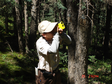
The fixed forest sample plot is located in the drainage ditch of Dayekou, Qilian Mountain, where the hydrological observation field of Gansu Water Conservation Forest Research Institute is located. From July 2003 to August 2003 and from July 2007 to August 2007, the tree survey of the sample plot was completed by technicians from Gansu Water Conservation Forest Research Institute and Institute of environment and Engineering in cold and dry areas of Chinese Academy of Sciences. A total of 17 fixed forest samples were observed, including the survey of sample plot factors and the survey of each tree. The observation factors of sample plots mainly include forest farm, longitude and latitude coordinates, slope direction, slope position, slope, soil thickness, canopy density of arbor layer, leaf area index, etc. The main instruments used in the measurement are tape, DBH, flower pole, tree measuring instrument, compass and fish eye camera. The measurement factors of each tree include DBH, height of tree, height under branch, crown width in cross slope direction, crown width along slope direction, growth status of single tree, etc. For details, please refer to the metadata of "Heihe River Integrated Remote Sensing joint test: fixed sample plot tree survey data set (2003)" and "Heihe River Integrated Remote Sensing joint test: fixed sample plot tree survey data set (2007)". The Lai in this data set is the supplementary measurement data during the joint remote sensing experiment of Heihe River in 2008. That is to say, the supplementary measurement of Lai has been done in these fixed plots. The supplementary observation time of Lai was from June 1 to 13, 2008. 15 of the 17 fixed plots were investigated. Four instruments were used to observe each plot. In addition to the commercial instruments such as hemiview fish eye camera, LAI-2000 and trac, these instruments also use the canopy analysis instrument made by Beijing Normal University. In each 20 m × 20 m plot, trac measures along two parallel routes perpendicular to the direction of sunlight incidence, which can basically represent the entire quadrat; hemiview fisheye camera and LAI-2000 measure the same points, that is, take three points on the trac line, plus the center point of the quadrat, a total of 7 measuring points. This set of data set can provide ground data for the study of remote sensing inversion method of forest structure parameters.
SONG Jinling, FU Zhuo, LI Shihua, ZOU Jie, ZHANG Xuelong, WANG Shunli, ZHAO Ming, LEI Jun, NIU Yun, LUO Longfa, LING Feilong, HE Qisheng, CHEN Erxue

This dataset includes one scene acquired on (yy-mm-dd) 2012-05-12, covering the Pailugou catchment. This datum is of panchromatic bands, with spatial resolution of 0.5 m. The data product level of this image is L2. WorldView dataset was acquired through purchase.
China Centre for Resources Satellite Data and Application
 mission in the Linze station foci experimental area on Jun. 6, 2008")
The dataset of ground truth measurement synchronizing with the airborne imaging spectrometer (OMIS-II) mission was obtained in the Linze station foci experimental area on Jun. 6, 2008. Observation items included: (1) soil moisture (0-5cm) measured by the cutting ring (50cm^3) along LY06, LY07 and LY08 strips (repeated nine times). The preprocessed soil volumetric moisture data were archived as Excel files. (2) surface radiative temperature measured by three handheld infrared thermometers (5# and 6# from Cold and Arid Regions Environmental and Engineering Research Institute, and one from Institute of Geographic Sciences and Natural Resources, which were all calibrated) in LY06 and LY07 strips. There are 49 sample points in total and each was repeated three times synchronizing with the airplane. Data were archived as Excel files. See the metadata record “WATER: Dataset of setting of the sampling plots and stripes in the Linze station foci experimental area” for more information of the quadrate locations.
GAO Song, HAO Xiaohua, PAN Xiaoduo, Qian Jinbo, SONG Yi, WANG Yang

The dataset of spectral reflectance observations was obtained in the Linze grassland foci experimental area. Spectral reflectance of the cement floor, reed, the saline field, alfalfa, barley and the pool in the reed plot A, the saline plot B, the alfalfa plot D and the barley plot E were measured by ASD and the reference board (20% and 40%). Observation date Plot 2008-05-30 A、B、D、E 2008-06-03 B 2008-06-06 E 2008-06-15 The cement floor (the station) 2008-06-15 The alfalfa field 2008-06-15 The pool in Majuntan 2008-06-15 The cement floor in Majuntan 2008-06-16 A、B、 D、 E Five files on original binary data, one software file and six record forms were archived. See WATER: Dataset of setting of the sampling plots and stripes in the foci experimental area of Linze station for more information.
Wang Jing, HU Xiaoli, JIANG Xi, MA Mingguo, WANG Xufeng, YU Yingjie, HAO Xiaohua

Based on the meteorological data of 105 meteorological stations in and around the Qinghai Tibet Plateau from 1980 to 2019, the National Meteorological Science Data Center of China Meteorological Administration (CMA) was established. By calculating the oxygen content, it is found that there is a significant linear correlation between oxygen content and altitude, y = - 0.0263x + 283.8, R2 = 0.9819. Therefore, the oxygen content distribution map can be calculated based on DEM data grid. Due to the limitation of the natural environment in the Qinghai Tibet Plateau, there are few related fixed-point observation institutions. This data can reflect the distribution of oxygen content in the Qinghai Tibet Plateau to a certain extent, and has certain reference significance for the research of human living environment in the Qinghai Tibet Plateau.
HE Xiaobo, ZHANG Jian, NING Tianxiang, HUANG Xiaoming, JIANG Heng, LIU Shaomin, LI Xin

The dataset of ground truth measurements synchronizing with Landsat TM was obtained in the A'rou foci experimental area on Jul. 22, 2008. The stellera coverage was mainly measured by photo taking. (1) Stellera coverage was measured by photo taking in 10 quadrates (51m×51m). Each quadrate was divided into 17×17 subsites, with each one spanning a 3×3 m2 plot. Only corner points of each subsite were chosen and 324 photos were taken for each quadrate. Photos were taken by Nikon D80 with a lens of 18-135mm, shooting straight downwards at the height of 1.5m. (2) quadrates investigation including GPS by GARMIN GPS 76, species by manual cognition, the plant number by manual work, the height by the measuring tape repeated 4-5 times, the coverage by manual work (compartmentalizing 0.5m×0.5m into 100 to see the percentage the stellera takes) and the biomass (samples from 0.5m×0.5m) by green weight and dry weight. Data were archived in Excel format. The dataset includes TM images, quadrate coverage investigation photos, GPS positions, coverage files and investigation tables.
CAO Yongpan, LI Hongxing, LIU Chao, MA Mingguo, Qian Jinbo, RAN Youhua
Contact Support
Links
National Tibetan Plateau Data CenterFollow Us

A Big Earth Data Platform for Three Poles © 2018-2020 No.05000491 | All Rights Reserved
|  No.11010502040845
Tech Support: westdc.cn

