")
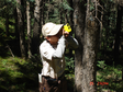
Trunk sap flow is an effective tool for measuring transpiration of a single plant. In this project, the trunk sap flow data of Populus euphratica in the lower reaches of Heihe River was measured by HRM (ICT, Australia) with a frequency of 0.5h. In the growth season of 2012-2013, the installation location is the north and lateral roots (50cm underground depth, 30cm away from the trunk) at the DBH (1.3m).
SI Jianhua
")
Lysimeter is the most effective tool for measuring water consumption per plant, which can provide daily, monthly and seasonal changes of transpiration water consumption per plant. In this project, a lysimeter measurement system for Populus euphratica seedlings is established in the lower reaches of Heihe River, with the observation frequency of 0.5h, mainly including water content changes, infiltration, evapotranspiration, etc.
SI Jianhua

The dataset of ground truth measurement synchronizing with PROBA CHRIS was obtained in the Yingke oasis and Huazhaizi desert steppe foci experimental areas on Jun. 22, 2008. Observation items included: (1) Albedo by the shortwave radiometer in Huazhaizi desert No. 2 plot. R =10H (R for FOV radius; H for the probe height). Data were archived in Excel format. (2) BRDF of maize in Yingke oasis maize field by ASD (350-2 500 nm) from Beijing University and the observation platform of BNU make. The maximum height of the platform was 5m above the ground with the azimuth 0~360° and the zenith angle -60°~60°; BRDF in Huazhaizi desert No. 2 plot by ASD from Institute of Remote Sensing Applications (CAS) and the observation platform of its own make, whose maximum height was 2m above the ground with the zenith angle -70°~70°. Raw data were binary files direct from ASD (by ViewSpecPro), and pre-processed data on reflectance were in Excel format. (3) Atmospheric parameters in Huazhaizi desert No. 2 plot by CE318 (produced by CIMEL in France). The total optical depth, aerosol optical depth, Rayleigh scattering coefficient, column water vapor in 936 nm, particle size spectrum and phase function were then retrieved from these observations. The optical depth in 1020nm, 936nm, 870nm, 670nm and 440nm were all acquired by CE318. Those data include the raw data in .k7 format and can be opened by ASTPWin. ReadMe.txt is attached for detail. Processed data (after retrieval of the raw data) in Excel format are on optical depth, rayleigh scattering, aerosol optical depth, the horizontal visibility, the near surface air temperature, the solar azimuth, zenith, solar distance correlation factors, and air column mass number.
CHEN Ling, GUO Xinping, REN Huazhong, ZOU Jie, LIU Sihan, ZHOU Chunyan, FAN Wenjie, TAO Xin

The dataset of ground truth measurement synchronizing with EO-1 Hyperion was obtained in the Yingke oasis and Huazhaizi desert steppe foci experimental areas on May 25, 2008. Observation items included: (1) Atmospheric parameters on the ICBC resort office roof by CE318 (produced by CIMEL in France). The total optical depth, aerosol optical depth, Rayleigh scattering coefficient, column water vapor in 936 nm, particle size spectrum and phase function were then retrieved from these observations. The optical depth in 1020nm, 936nm, 870nm, 670nm and 440nm were all acquired by CE318. Those data include the raw data in k7 format and can be opened by ASTPWin. ReadMe.txt is attached for detail. Processed data (after retrieval of the raw data) in Excel format are on optical depth, rayleigh scattering, aerosol optical depth, the horizontal visibility, the near surface air temperature, the solar azimuth, zenith, solar distance correlation factors, and air column mass number. (2) Ground object reflectance spectra f new-born rape and the bare land in Biandukou foci experimental area by ASD FieldSpec (350~2500 nm) from BNU. Raw data were binary files direct from ASD (by ViewSpecPro), and pre-processed data on reflectance were in Excel format. (3) Soil moisture (0-40cm) by the cutting ring and the soil temperature (0-40cm) by the thermocouple in Huazhaizi desert No. 1 plot and the windbreak forest; and soil moisture and the soil temperature (0-100cm) in Yingke oasis maize field. Data were archived in Excel format. (4) LAI. The maximum leaf length and width of each alfalfa and barley were measured. Data were archived in Excel format. (5) Coverage of maize and wheat in Yingke oasis maize field, of vegetation (Reaumuria soongorica) in Huazhaizi desert No. 1 and 2 plots by the self-made coverage instrument and the camera (2.5m-3.5m above the ground). Based on the length of the measuring tape and the bamboo pole, the size of the photo can be decided GPS date were also collected and the technology LAB was applied to retrieve the coverage of the green vegetation. Besides, such related information as surroundings environment was also recorded. Data included the primarily measured image and final fraction of vegetation coverage.
CHEN Ling, QIAN Yonggang, REN Huazhong, WANG Haoxing, YAN Guangkuo, GE Yingchun, SHU Lele, WANG Jianhua, XU Zhen, GUANG Jie, LI Li, XIN Xiaozhou, ZHANG Yang, ZHOU Chunyan, TAO Xin, YAN Binyan, YAO Yanjuan

The dataset of ground truth measurement synchronizing with MODIS was obtained in the Linze grassland foci experimental area on Jun. 22, 2008. Simultaneous east-west ground measurements on the canopy temperature, the half-height temperature and the land surface radiative temperature were carried out by the hand-held infrared thermometer at intervals of 125m in 8 quadrates (2km×2km), No.1 quadrate (H01-H08) on Jun. 22, No.2 quadrate (H09-H16) on Jun. 23,No.3 quadrate (H17-H24) on Jun. 22, No.4 quadrat (H25-H32) on Jun. 23, No.5 quadrate (H33-H40) on Jun. 22, No.6 quadrate (H41-H48) on Jun. 23, No,7 quadrate (H49-H56) and No.8 quadrate (H57-H64) on Jun. 23. Data were archived in Excel format. See WATER: Dataset of setting of the sampling plots and stripes in the foci experimental area of Linze station for more information.
CHAO Zhenhua, NIAN Yanyun, WANG Xufeng, LIANG Wenguang

The dataset of diurnal FPAR change observations was obtained in the Yingke oasis foci experimental areas. Observation items included: (1) Maize canopy reflectance spectra by ASD and 50% grey board, leaf SPAD by the chlorophyll meter and leaf photosynthesis by LI-6400 in Yingke oasis maize field on Jul. 5, 2008 (fixed point observations from 10:00-20:00 at intervals of one hour, and half an hour from 16:00) Besides, Photo: photosynthetic rate (µmol CO2 m-2 s-1), Cond: stomatal conductance (mol H2O m-2 s-1), Ci: intercellular CO2 viscosity (µmol CO2 mol-1), Trmmol: transpiration rate (mmol H2O m-2 s-1), VpdL: vapor pressure deficiency of leaves (kPa), Tleaf: leaf temperature (°C), ParIn_µm: active radiation of interior photosynthesis (µmol m-2 s-1), and ParOutµm: active radiation of outdoor photosynthesis (µmol m-2 s-1) were all archived. (2) Maize canopy reflectance spectra, leaf photosynthesis and diurnal FPAR change by ASD (Institute of Remote Sensing Applications), 50% grey board (Institute of Remote Sensing Applications), LI-6400 (Institute of Remote Sensing Applications) and SUNSCAN (Beijing academy of Agriculture and Forestry Sciences). Based on calibration lamp data (serial number: 64831), radiance spectrum on Jul. 9 by 1050 spectrometer (Beijing academy of Agriculture and Forestry Sciences) and 50% grey board and 99% white board calibration data, the spectrum data were preprocessed. Calibration was undertaken in accordance with the following precedures: a) The original DN was converted into radiance and further into readable EXCEL format by the spectrometer-matched calibration lamp data and ASD. b) Solar radiance was got by 99% white board radiance. solar radiance=the reference board radiance/the reference board reflectance. c) Spectrum from Agriculture and Forestry Sciences was sampled at an interval of 1.438nm, which was made into data at 1nm intervals by segmentation interpolation. d) Based on b=16.087a (where a is radiance before fitting and b after fitting), radiance data got by 68731 spectrograph were processed. The original maize leaf photosynthesis data (by LI-6400) were introduced into EXCEL format, diurnal changes of each leaf were archived as one single unit according to leaf classification. Maize FPAR (the fraction of photosynthetically active radiation) was got by FPAR= (canopyPAR-surface transmissionPAR-canopy reflection PAR+surface reflectionPAR) /canopy PAR; APAR= FPAR×canopy PAR. The unit for PAR was µmol m-2 s-1. The data included number (the whole leaf), observation time (hh:mm:ss), upper light (µmol m-2 s-1), upper reflectivity (µmol m-2 s-1), lower light (µmol m-2 s-1), lower reflectivity (µmol m-2 s-1) and Spread: variation coefficients of the probe optical intensity.
WANG Dacheng, YANG Guijun, CHENG Zhanhui, Liu Liangyun
")
The vegetation regulation mechanism project of soil water cycle in arid desert areas belongs to the national natural science foundation "environment and ecological science in western China" major research plan, led by li xinrong, a researcher of the institute of environment and engineering in dry and cold areas, Chinese academy of sciences, with the running time of 2003.1-2005.12. Remittance data of the project: 1. Dataset of observation field of shapotou railway vegetation sand fixation protection system (excel) Plant and soil information in the vegetation-sand fixation zone established in 1956, 1964, 1981 and 1987.Since the establishment of the observation field, long-term soil moisture and vegetation surveys have been conducted. This database records the soil moisture data after the neutron tube installation in August 2002, the vegetation data from 2003 to 2005 (vegetation structure, herb structure, shrub structure, etc.), and the soil physical and chemical properties data (particle size, total N,P2O5,K2O, hydrolyzed N) of the irregular surveys. 2. Physiological data set of desert plant stress (excel) From 2003 to 2005, the physiological and biochemical characteristics of typical plant communities and their dominant species in steppe desert under natural and simulated environmental conditions were analyzed.(including photosynthetic transpiration, fluorescence, biochemistry and other indicators) 3. Soil infiltration and evapotranspiration data set (excel) Precipitation infiltration process, soil water dynamics and evapotranspiration of fixed sand dunes monitored by desert artificial vegetation using TDR and Lysimeters from 2002 to 2005. 4. Data set of comprehensive survey on soil and vegetation in the southeastern margin of tengger desert (excel) In 2003-2004, silver (sichuan), yan (latour) highway, silver (sichuan) (state) highway through the tengger desert area, set up along the road of eight samples, 449 samples of soil conductivity, Ph, organic matter, total nitrogen (content) and vegetation (plants, coverage, average height, biomass, strains, coverage, high average, biomass).
LI Xinrong

This data includes experimental data of grassland interception control and observation data of maximum water holding capacity of grassland. The maximum water holding capacity experiment was carried out in 2011. The main vegetation types selected are Carex, Polygonum viviparum, Plantago asiatica and Potentilla chinensis. The maximum water holding capacity experiment was carried out on each type of samples and the samples were photographed. The specific data obtained are shown in the document. The grassland canopy interception was carried out in the growing season of 2012, and was completed by artificial rainfall control experiment. At the end of the growing season, the main types of grassland in the basin were sampled according to grazing and grazing ban. During artificial rainfall, rainfall and penetrating rainfall are recorded every 1min. Finally, the grassland canopy interception is calculated by the difference between rainfall and penetrating rainfall.
ZHAO Chuanyan, MA Wenying
")
Leaf area index (LAI), as a structural parameter of vegetation canopy, is an important input parameter for many inversion models such as energy and biomass inversion model. Firstly, vegetation points and ground points are separated in Terrasolid software. Then the transmittance of laser points is calculated, and the transmittance is the proportion of ground points to all points. After laser pulse hits the canopy, some energy passes through the voids between branches and leaves and continues to move forward until the energy is blocked, so some laser points will finally reach the ground. In this study, the ratio of the energy passing through the avoids to the energy of the canopy is used as the Laser Penetration Index (LPI). The LPI of each sample point at each scale in the study area was calculated.
ZHAO Chuanyan, MA Wenying
")
Background: this data interchange is the first data interchange of the key project of "integrated study of eco-hydrological processes in heihe basin", "genomics research on drought tolerance mechanism of typical desert plants in heihe basin".The main research targets of the key projects is a typical sand desert plants are Holly, using the current international advanced a new generation of gene sequencing technology to the whole genome sequence and gene transcription of Holly group sequence decoding, so as to explore related to drought resistance gene and gene groups, and transgenic technology in model to verify their drought resistance in plants. Process and content: as genome sequencing requires special sequencing equipment, the project is huge and the process is complex (mainly including genome library construction, sequencing, data analysis and genome assembly), so it needs to be completed by a professional sequencing company.After contacting with sequencing companies, we learned that before sequencing an unknown genome, the size and complexity of the genome should be predicted, which is a necessary prerequisite for designing sequencing schemes and strategies.Therefore, in 2013, we mainly predicted the chromosome composition, genome size and complexity of sand Holly, and successfully established the extraction and purification method of its genomic DNA.The results showed that the plant was diploid, the genome was composed of 9 staining lines (18 lines of diploid), and the genome size was 1.07G.The quality test results of the genomic DNA indicated that the requirements of the obtained DNA complex sequencing have been sent to the sequencing company for library construction and sequencing, which is now in progress.In addition, in order to obtain a large number of uniform plant materials, we have discussed the induction of callus, which has been successful.Due to these reasons, we were unable to complete the genome sequencing and submit the relevant data of sand Holly in accordance with the original plan of the project this year, mainly because we did not count the predicted contents of the genome before. Data usage: the data obtained in this year on ploidy, karyotype composition and genome size of lycopodium SPP.The success of the callus induction provides a high-quality material guarantee for the subsequent transcriptome sequencing and drought-resistance mechanism research experiments, and it is also a new contribution to the cytological and physiological research of the plant.
HE Junxian, GU Lifei
")
The dataset investigated the growth status of plants and leaf morphological indexes of single and conjoined red sand and pearl in the middle and lower reaches of heihe river basin in 2013. The growth indexes were crown width, plant height, and biomass of fine roots and thick roots.Leaf shape indicators are: length, width, thickness, and leaf area, volume, etc.The experimental observation indexes are: leaf nitrogen content, water potential, gas exchange data, chlorophyll fluorescence data. Data include: field observation data and explanatory documents.
SU Peixi
")
The year-end ecological investigation was conducted in the late September and early October when plants stopped growing. There are 8 investigation and observation fields, they are: piedmont desert, piedmont Gobi, desert in the middle, Gobi in the middle reaches, desert in the middle reaches, downstream desert, downstream Gobi, and downstream desert, the size of each filed is 40m×40m. Three large quadrats of 20m×20m were selected in each observation field, named S1, S2, and S3, to conduce the regular shrub investigation; four small quadrats were selected from each large quadrat with a size of 5m×5m, named A, B, C, D, to conduct herbal investigation.
SU Peixi
")
In July and mid August 2012, plant species: Caragana. Using Li-6400 portable photosynthesis system (li-cor, USA) and li-3100 leaf area meter, the photosynthetic physiological characteristics of desert plants were observed. The symbols in the observation data have the following meanings: Obs, number of observations;Photo, net photosynthetic rate, moles of CO2 times m minus 2 times s minus 1; Cond, stomatal conductance, mol H2O•m -- 2•s -- 1;Ci, intercellular CO2 concentration, moles of CO2 times mol-1; Trmmol, transpiration rate, mmol H2O•m -- 2•s -- 1;Vpdl, water vapor pressure deficit, kPa; Area, leaf Area, cm2;Tair, atmospheric temperature, ℃; Tleaf, leaf surface temperature, ℃;CO2R, CO2 concentration in the reference chamber, moles of CO2•mol-1; CO2S, sample chamber CO2 concentration, moles of CO2•mol-1;H2OR, water in the reference chamber, mmol H2O•mol-1; H2OS, sample chamber moisture, mmol H2O•mol-1;PARo, photon flux density, mole •m -- 2•s -- 1; Rh-r, reference room air relative humidity, %;Rh-s, relative humidity of air in sample room, %; PARi, photosynthetic effective radiation, moles •m -- 2•s -- 1;Press, atmospheric pressure, kPa; Others are the state parameters of the instrument at the time of measurement.
SU Peixi
")
A small lysimeter was made to simulate the natural conditions and select typical desert plants as the objects to study the water consumption of drought stress treatment. Repeat 3 times for each plant. In 2012, the soil water content was kept at (20 ± 5)% of the field water capacity, and experiments on physiological water demand and water consumption were carried out under stress. In 2013, the soil water content was kept at (10 ± 3)% of the field water capacity, and further experiments on water consumption and water consumption law were carried out under drought stress.
SU Peixi
")
As determined in mid-august 2013, planting species: bubbly spines (different habitats are mid-range intermountain lowland and gobi), red sand (different habitats are mid-range gobi and downstream gobi). Using the brother company of LI - 6400 Portable Photosynthesis System (Portable Photosynthesis System, LI - COR, USA) and LI - 3100 leaf area meter, etc., to the desert plant photosynthetic physiological characteristics were observed. The symbolic meaning of the observed data is as follows: Obs,observation frequency ; Photo ,net photosynthetic rate,μmol CO2•m–2•s–1; Cond stomatal conductance,mol H2O•m–2•s–1 ; Ci, Intercellular CO2 concentration, μmol CO2•mol-1; Trmmol,transpiration rate,mmol H2O•m–2•s–1; Vpdl,Vapor pressure deficit,kPa; Area,leaf area,cm2; Tair,free air temperature ,℃; Tleaf,Leaf temperature,℃; CO2R,Reference chamber CO2 concentration,μmol CO2•mol-1; CO2S,Sample chamber CO2 concentration,μmol CO2•mol-1; H2OR,Reference chamber moisture,mmol H2O•mol-1; H2OS,Sample chamber moisture,mmol H2O•mol-1; PARo,photon flux density,μmol•m–2•s–1; RH-R,Reference room air relative humidity,%; RH-S,Relative humidity of air in sample room,%; PARi,Photosynthetic effective radiation,μmol•m–2•s–1; Press,barometric pressure,kPa; Others are the state parameters of the instrument at the time of measurement.
SU Peixi
")
In the middle of August 2013, photosynthesis of population was measured, and plant species: red sand. The group photosynthesis measurement system consists of li-8100 closed-circuit soil carbon flux automatic measurement system (li-cor, USA) and assimilation box designed and manufactured by Beijing ligotai science and Technology Co., Ltd. li-8100 is an instrument produced by li-cor company of USA for soil carbon flux measurement. The concentration of CO2 and H2O is measured by infrared gas analyzer. The length, width and height of assimilation boxes were all 50 cm. The assimilator is controlled by li-8100. After the measurement parameters are set, the instrument can run automatically.
SU Peixi
")
On the basis of physiological and biochemical analysis of photosynthetic organs (leaves or assimilating branches) of typical desert plants in heihe river basin collected in mid-july 2011, some photosynthetic organs of desert plants were collected in mid-july 2012 and put into a liquid nitrogen tank and brought back to the laboratory for determination. Physiological analysis indexes mainly include: soluble protein unit: mg/g;Free amino acid unit: g/g;Chlorophyll content unit: mg/g;Superoxide dismutase (SOD) unit: U/g FW;Catalase (CAT) unit: U/(g•min);POD unit: U/(g•min);Proline (Pro) unit: g/g; Soluble sugar unit: g/g;Malondialdehyde (MDA) is given in moles per liter.
SU Peixi

At the end of September and the beginning of October, 2013, desert plants in typical areas of heihe basin stopped their growth period to conduct year-end ecological survey. There are altogether 8 survey and observation fields, which are: piedmont desert, piedmont gobi, middle reaches desert, middle reaches gobi, middle reaches desert, lower reaches desert, lower reaches gobi and lower reaches desert, with a size of 40m×40m. Three 20m×20m large quadrats were fixed in each observation field, named S1, S2 and S3, and regular shrub surveys were conducted.Each large quadrat was fixed with 4 5m x 5m small quadrats, named A, B, C, D, for the herbal survey.
SU Peixi
")
The VEGETATION sensor sponsored by the European Commission was launched by SPOT-4 in March 1998. Since April 1998, SPOTVGT data for global vegetation coverage observation has been received by Kiruna ground station in Sweden. The image quality monitoring center in Toulouse, France is responsible for image quality and provides relevant parameters (such as calibration coefficient number). Finally, the Belgian flemish institute for technological research (Vito)VEGETATION processing Centre (CTIV) is responsible for preprocessing into global data of 1km per day. Pretreatment includes atmospheric correction, radiation correction, geometric correction, production of 10 days to maximize the synthesized NDVI data, setting the value of -1 to -0.1 to -0.1, and then converting to the DN value of 0-250 through the formula DN= (NDVI+0.1)/0.004. The dataset is a long-time series vegetation index dataset of Qinghai Lake Basin, which is mainly aimed at normalized difference vegetation index (NDVI). It includes spectral reflectance of four bands synthesized every 10 days from 1998 to 2008 and maximum NDVI for 10 days, with a spatial resolution of 1km and a temporal resolution of 10 days.
Flemish Institute for Technological Research (VITO)
")
GIMMS (glaobal inventory modelling and mapping studies) NDVI data is the latest global vegetation index change data released by NASA C-J-Tucker and others in November 2003. This dataset is a long-term GIMMS vegetation index dataset of the Qinghai Lake Basin, which includes changes in the vegetation index from 1981 to 2006. The time resolution is 15 days and the spatial resolution is 8 km. GIMMS NDVI data recorded the changes of vegetation in 22a area in the format of satellite data.
National Aeronautics and Space Administration
")
Sponsored by the European commission VEGETATION sensors in March 1998 by SPOT - 4 was deployed, from April 1998 to receive SPOTVGT for global VEGETATION observation data, the data by the Swedish Kiruna ground station is responsible for receiving, the image quality monitoring center in Toulouse, France is responsible for the image quality and provide the related parameters (e.g., scaling),Eventually, Belgium's Flemish Institute for Technological Research (Vito) 's VEGETATION processing Centre (CTIV) was responsible for pre-processing the data into 1km of daily global data.Preprocessing includes atmospheric correction, radiometric correction, and geometric correction to produce the maximum synthesis of NDVI data in 10 days, and set the value from -1 to -0.1 to -0.1, and then convert to the DN value of 0-250 through the formula DN= (NDVI+0.1)/0.004. This data set is mainly for normalized vegetation index (NDVI) of the qaidam river basin in the long time series, including spectral reflectance of four bands synthesized every 10 days from 1998 to 2008 and maximum NDVI in 10 days. The spatial resolution is 1km and the temporal resolution is 10 days.File formats :.hfr and.img.The file naming rule is CHN_NDV_YYYYMMDD, where YYYYMMDD is the date of the day that the file represents and is the main identifier that distinguishes it from other files.Remote sensing image files with suffixes.img and.hdf, which are used by users to analyze vegetation index, can be opened in ENVI and ERDAS software
Greet Janssens, Flemish Institute for Technological Research (VITO)

The dataset of spectral reflectance observations was obtained by ASD (Analytical Sepctral Devices) in the Yingke oasis and Huazhaizi desert steppe foci experimental areas. Reflectance was calculated based on the equation R = (DN1/DN0)×R0, DN1 indicating DN of the targets, R0 and DN0 the reflectance and DN of the grey board. The reflectance spectra of maize and wheat canopy, the component leaf of the maize and BRDF in Yingke oasis maize field, Yingke oasis wheat field, Huazhaizi desert maize field, the transect spectrum in Huazhaizi desert No. 1 and 2 plots and Linze and Biandukou foci experimental area were measured on May 20, 24, 25, 28 and 30, Jun. 1, 4, 9, 14, 16, 18, 20, 22, 23, 24, 26, 29 and 30, Jul. 1, 4, 5, 6, 7, 9 and 11, 2008. Four ASD devices were used, from Peking University (350-2500nm), Institute of Remote Sensing Applications (350-2500nm), Beijing Academy of Agriculture and Forestry Sciences (350-1065nm) and BNU respectively. The reference boards were 40%, 50% and 99%. The above spectral reflectance dataset was synchronizing with WiDAS (Wide-angle Infrared Dual-mode line/area Array Scanner), OMIS-II and various spaceborne sensors. Raw data were binary files direct from ASD (by ViewSpecPro), and pre-processed data on reflectance were in Excel format.
CHEN Ling, REN Huazhong, WANG Haoxing, XIAO Yueting, YAN Guangkuo, ZHOU Hongmin, GE Yingchun, LI Xin, SHU Lele, GUANG Jie, LIU Sihan, SU Gaoli, XIA Chuanfu, Wen Jianguang, ZHANG Yang, ZHOU Chunyan, FAN Wenjie, TAO Xin, YAN Binyan, YAO Yanjuan, YANG Guijun, CHENG Zhanhui, Liu Liangyun, YANG Tianfu
202024test test data 202024test test data 202024Test test data 202024test test data 202024test test data 202024test test data 202024test test data 202024test test data 202024test test data 202024test test data 202024test test data 202024test test data 202024test test data
MA Mingguo, DING Songchuang, GAO Song, Qian Jinbo, BAI Yunjie, WANG Xufeng, TAN Junlei, WANG Shuguo, GU Juan, WANG Shunli, LUO Longfa, WANG Rongxin, CHE Zongxi, JING Wenmao

The dataset of ground truth measurements synchronizing with the airborne WiDAS mission was obtained in the Linze station foci experimental area on Jun. 29, 2008. WiDAS, composed of four CCD cameras, one mid-infrared thermal imager (AGEMA 550), and one infrared thermal imager (S60), can acquire CCD, MIR and TIR band data. The simultaneous ground data included: (1) soil moisture (0-5cm) nine times by the cutting ring (50cm^3) along LY06 and LY07 strips, and once by the cutting ring method and once by ML2X Soil Moisture Tachometer in the six points of Wulidun farmland quadrates. The preprocessed soil volumetric moisture data were archived as Excel files. (2) surface radiative temperature measured three times by three handheld infrared thermometer (5# and 6# from Cold and Arid Regions Environmental and Engineering Research Institute, and one from Institute of Geographic Sciences and Natural Resources, which were all calibrated) in LY06 and LY07 strips (98 sample points and repeated three times) and the Wulidun farmland quadrates (various points and repeated three times). Data were archived as Excel files. (3) maize canopy component temperature measured by the 5# handheld infrared thermometer (from Cold and Arid Regions Environmental and Engineering Research Institute) in Wulidun farmland quadrates. Six directions were measured, canopy backlighting and frontlighting, half height backlighting and frontlighting, the light and the shaded bareland, with each direction 20 measurements. (4) spectrum of maize, soil and soil with known moisture measured by ASD Spectroradiometer (350~2 500 nm) from BNU, and the reference board (40% before Jun. 15 and 20% hereafter) in Wulidun farmland quadrates. Raw spectral data were binary files , which were recorded daily in detail, and pre-processed data on reflectance (by ViewSpecPro) were archived as Excel.files (5) mltiangle maize spectrum measured by ASD Spectroradiometer (350~2 500 nm) from BNU, the reference board (40% before Jun. 15 and 20% hereafter), two observation platforms of BNU make and one of Institute of Remote Sensing Applications make in Wulidun farmland. Raw spectral data were archived as binary files, which were recorded daily in detail, and pre-processed data on reflectance and transmittivity were archived as text files (.txt). (6) LAI of maize measured by the fisheye camera (CANON EOS40D with a lens of EF15/28), shooting straight downwards, with exceptions of higher plants, which were shot upwards. Data included original photos (.JPG) and those processed by can_eye5.0 (in excel). (7) LAI of maize measured by LAI2000 in Wulidun farmland quadrates. Data educed from LAI2000 periodically were archived as text files (.txt) and marked with one ID. Raw data (table of word and txt) and processed data (Excel) were included. Besides, observation time, the observation method and the repetition were all archived. See the metadata record “WATER: Dataset of setting of the sampling plots and stripes in the Linze station foci experimental area” for more information of the quadrate locations.
DONG Jian, YU Yingjie, BAI Yanfen, HAO Xiaohua, Qian Jinbo, SHU Lele, WANG Yang, XU Zhen
")
The dataset of spectral reflectance measurements was obtained in the A'rou foci experimental area on Mar. 12, 2008. The land was covered with snow 10cm deep. Observed objects included snow, sandstone, grass and ice. The data were archived in the ASCII format, with the first five rows as the file header and the following two columns as wavelength (nm) and reflectance (percentage) respectively, and can be opened by .txt or wordpad. Raw data were binary files direct from ASD (by ViewSpecPro).
PENG Danqing, ZHENG Yue

The dataset of LAI measurements was obtained by LI-3000, the protractor and the ruler in the Yingke oasis and Huazhaizi desert steppe foci experimental areas on May, 20, 24, 25, 28 and 31, Jun. 6, 11, 12, 14, 16, 21 and 27, Jul. 2 and 9, 2008. The maximum leaf length and width of maize and wheat, the leaf angle, length and width of each section (one leaf was divided into 3 sections) were measured. And also the plant height, leaf base height, the crop spacing, the canopy height, row spacing and ridge spacing were measured. Two representative plants would be taken back for indoor observation for the stem length, stem width, stem circumference, and leaf area by LAI3000. Data were archived in Excel format.
CHEN Ling, REN Huazhong, WANG Tianxing, WANG Jindi, XIAO Yueting, YAN Guangkuo, LI Li, LIU Sihan, SU Gaoli, Wen Jianguang, XIA Chuanfu, XIN Xiaozhou, ZHANG Yang, ZHOU Chunyan, ZHOU Mengwei, FAN Wenjie, SHEN Xinyi, TAO Xin, YAN Binyan, YAO Yanjuan

The dataset of ground truth measurements synchronizing with MODIS, ALOS PALSAR and AMSR-E was obtained in the Biandukou foci experimental area on May 24, 2008. Observation items included: (1) the surface temperature in No. 1 (grassland), No. 2 (the rape land), No. 3 (the rape land), No. 4 (the wheat land) and No. 5 quadrate (wheat and rape); (2) the soil moisture by WET in No. 2 quadrate; (3) GPR and WET; (4) The spectrum by ASD Fieldspec FRTM (Boulder, Co, USA), 350nm-2500nm, 3nm for the visible near-infrared band and 10nm for the shortwave infrared band). The spectrum data were archived in the ASCII format, with the first five rows as the file header and the following two columns as wavelength (nm) and reflectance (percentage) respectively, and can be opened by .txt or wordpad. The .txt file was not reflectance but intermediate file for further calculation. Raw data were binary files direct from ASD (by ViewSpecPro). The surface radiative temperature and the physical temperature were measured by the handheld infrared thermometer. Besides, the cover type was also recorded. The data can be opened by Microsoft Office. Soil moisture was acquired by WET and the cutting ring. The data can be opened by Microsoft Office. Six data files were included, soil moisture, the surface temperature, GPR, coverage photos and preprocessed data, ground objects spectrum and satellite images.
BAI Yunjie, CAO Yongpan, CHE Tao, DU Ziqiang, HAO Xiaohua, WANG Zhixia, WU Yueru, CHAI Yuan, CHANG Sheng, QIAN Yonggang, SUN Xiaoqing, WANG Jindi, YAO Dongping, ZHAO Shaojie, ZHENG Yue, ZHAO Yingshi, LI Xiaoyu, PATRICK Klenk, HUANG Bo, LI Shihua, LUO Zhen

The dataset of ground truth measurements synchronizing with ASTER was obtained in the Linze station foci experimental area on May 28, 2008. Observation items included: (1) soil moisture (0-5cm) measured once by the cutting ring method at the corner points of the 40 subplots of the west-east desert transit zone strip once by cutting ring method in the corner points of nine subplots of the north-south desert transit zone, once by the cutting ring method and once by ML2X Soil Moisture Tachometer in the center points of nine subplots of the farmland. The preprocessed soil volumetric moisture data were archived as Excel files. (2) surface radiative temperature measured by the handheld infrared thermometer (5# and 6# from Cold and Arid Regions Environmental and Engineering Research Institute which were both calibrated) in 40 subplots of the west-east desert transit zone strip (repeated 14-30 times), and nine subplots of the north-south desert transit zone strip (repeated 12-30 times). Data were archived as Excel files. (3) BRDF of maize and desert scrub measured by ASD Spectroradiometer (350~2 500 nm) from BNU, the 40% reference board , two observation platforms of BNU make and one of Institute of Remote Sensing Applications make in Wulidun farmland quadrates and the desert transit zone strips. Raw spectral data were archived as binary files, which were recorded daily in detail, and pre-processed data on reflectance and transmittivity were archived as text files (.txt). (4) LAI measured by two methods in the the Wulidun farmland quadrates and Linze station quadrates. One is manual method. The LAI, plant height and the spacing of selected samples were measured by the ruler and the number of the sapmles in the quadrate were counted. Then the LAI can be calculated. The other method is LI-3100. Data were archived as Excel files.
Qian Jinbo, SONG Yi, WANG Zhixia, WANG Yang, PAN Xiaoduo, LI Jing, Li Xiangyun, Qu Yonghua, SUN Qingsong

The dataset of crop biochemical parameter measurements was obtained in the maize field (May 25-Jun. 8, 2008) and the wheat field (Jun. 18-Jul. 4, 2008) of Yingke oasis foci experimental area. Observation items included LAI by LAI-2000, the chlorophyll content by SPAD and leaf moisture by the oven and the scales. Four files were included, readme.txt, wheat sample coordinates.xls, wheat.xls for wheat biochemical parameters and Yingke oasis maize field.xls for maize biochemical parameters.
DONG Jingjing, GAO Shuai, WU Mingquan, WU Chaoyang

The dataset of ground truth measurements synchronizing with ASTER was obtained in the Yingke oasis and Huazhaizi desert steppe foci experimental areas on May 28, 2008. Observation items included: (1) Atmospheric parameters in Huazhaizi desert No. 2 plot by CE318 (produced by CIMEL in France). The total optical depth, aerosol optical depth, Rayleigh scattering coefficient, column water vapor in 936 nm, particle size spectrum and phase function were then retrieved from these observations. The optical depth in 1020nm, 936nm, 870nm, 670nm and 440nm were all acquired by CE318. Those data include the raw data in .k7 format and can be opened by ASTPWin. ReadMe.txt is attached for detail. Processed data (after retrieval of the raw data) in Excel format are on optical depth, rayleigh scattering, aerosol optical depth, the horizontal visibility, the near surface air temperature, the solar azimuth, zenith, solar distance correlation factors, and air column mass number. (2) Photosynthesis by LI-6400. Raw data were archived in the user-defined format (by notepat.exe) and processed data were in Excel format. (3) Reflectance spectra in Yingke oasis maize field by ASD FieldSpec (350-2500nm, the vertical canopy observation and the transect observation) from Institute of Remote Sensing Applications (CAS), and in Huazhaizi desert No. 2 plot by ASD FieldSpec (350-1603nm, the vertical observation and the transect observation for reaumuria soongorica and the bare land) from Beijing Academy of Agriculture and Forestry Sciences. The grey board and the black and white cloth were also used for calibration spectrum. Raw data were binary files direct from ASD (by ViewSpecPro), and pre-processed data on reflectance were in Excel format. (4) Coverage fraction of maize and wheat by the self-made instrument and the camera (2.5m-3.5m above the ground) in Yingke oasis maize field. Based on the length of the measuring tape and the bamboo pole, the size of the photo can be decided. GPS date were also collected and the technology LAB was applied to retrieve the coverage of the green vegetation. Besides, such related information as the surrounding environment was also recorded. Data included the primarily measured image and final fraction of vegetation coverage. (5) the radiative temperature of maize, wheat and the bare land in Yingke oasis maize field by ThermaCAM SC2000 using ThermaCAM SC2000 (1.2m above the ground, FOV = 24°×18°),. The data included raw data (read by ThermaCAM Researcher 2001), recorded data and the blackbody calibrated data (archived in Excel format). (6) the radiative temperature by the automatic thermometer (FOV: 10°; emissivity: 0.95), 3 for maize canopy, the bare land and wheat canopy in Yingke oasis maize field, one for maize canopy in Huazhaizi desert maize field, and 2 for vegetation and the desert bare land in Huazhaizi desert No. 2 plot,at nadir at a time interval of one second. Raw data, blackbody calibrated data and processed data were all archived in Excel format. (7) Maize albedo by the shortwave radiometer in Yingke oasis maize field. R =10H (R for FOV radius; H for the probe height). Data were archived in Excel format. (8) LAI in Yingke oasis maize field. The maximum leaf length and width of each maize and wheat were measured. Data were archived in Excel format. (9) FPAR (Fraction of Photosynthetically Active Radiation) of maize and wheat by SUNSACN and the digital camera in Yingke oasis maize field. FPAR= (canopyPAR-surface transmissionPAR-canopy reflection PAR+surface reflectionPAR) /canopy PAR; APAR=FPAR* canopy PAR. Data were archived in the table format of Word. (10) The radiative temperature in Yingke oasis maize field (the transect observation), Yingke oasis wheat field (the transect observation), Huazhaizi desert maize field (the transect observation) and Huazhaizi desert No. 2 plot (the diagonal observation) by the handheld infrared thermometer (BNU and Institute of Remote Sensing Applications). Raw data (in Word format), blackbody calibrated data and processed data (in Excel format) were all archived.
CHAI Yuan, CHEN Ling, KANG Guoting, QIAN Yonggang, REN Huazhong, WANG Haoxing, WANG Jianhua, SHU Lele, LI Li, LIU Sihan, XIN Xiaozhou, ZHANG Yang, ZHOU Chunyan, ZHOU Mengwei, TAO Xin, WANG Dacheng, LI Xiaoyu, CHENG Zhanhui, YANG Tianfu, HUANG Bo, LI Shihua, LUO Zhen

The dataset of ground truth measurements synchronizing with PROBA CHRIS was obtained in the Biandukou foci experimental area on Jun. 22, 2008. Observation items included: (1) quadrates investigation including GPS by GARMIN GPS 76, species by manual cognition, the plant number by manual work, the height by the measuring tape repeated 4-5 times, the chlorophyll content by SPAD 502, the coverage by manual work and the biomass (samples from 0.5m×0.5m) by wet weight and dry weight. Data were archived as Excel files. (2) LAI of maize, desert scrub and the poplar by the fisheye camera (CANON EOS40D with a lens of EF15/28), shooting straight downwards, with exceptions of higher plants, which were shot upwards. Data included original photos (.JPG) and those processed by can_eye5.0 (as Excel files). For more details, see Readme file. (3) ground object spectrum of grassland, barley and the rape by ASD FieldSpec (350~2 500 nm) from BNU, with 20% reference board. Raw data were binary files direct from ASD (by ViewSpecPro), which were recorded daily in detail, and pre-processed data on reflectance were in .txt. (4) BRDF of grassland, barley and the rape by ASD FieldSpec (350~2 500 nm), with 20% reference board. Raw data were binary files direct from ASD (by ViewSpecPro), which were recorded daily in detail. The processed reflectance and transmittivity were archived in .txt files. The dataset includes processed spectrum data, soil moisture, BRDF, quadrates investigation, integrating spheres data on the rape, LAI, CHRIS data and the fisheye camera data.
DING Songchuang, HAO Xiaohua, YU Yingjie

The dataset of ground truth measurements synchronizing with Envisat ASAR and ALOS PALSAR was obtained in the Linze station foci experimental area on May 24, 2008. The data were in AP mode and VV/VH polarization combinations, and the overpass time was approximately at 11:34 BJT. Observation items included: (1) soil moisture (0-5cm) measured once by cutting ring method at corner points of the 40 subplots of the west-east desert transit zone strip, one time by cutting ring method in nine subplots of the north-south desert transit zone, strip and once by the cutting ring and three times by ML2X Soil Moisture Tachometer in the center points of nine subplots of Wulidun farmland quadrates . The preprocessed soil volumetric moisture data were archived as Excel files. (2) surface radiative temperature by measured two handheld infrared thermometer (5# and 6# from Cold and Arid Regions Environmental and Engineering Research Institute which were both calibrated) in 40 subplots of the west-east desert transit zone strip (repeated 14-30 times each), and nine subplots of the north-south desert transit zone strip (repeated 12-30 times). There are 34 sample points in total and each was repeated three times synchronizing with the airplane. Photos were taken. Data were archived as Excel files. (3) LAI, the plant height and the spacing measured by the ruler and the set square in Wulidun farmland quadrates and Linze station quadrates. Part of the samples were also measured by LI-3100. Data were archived as Excel files. See the metadata record “WATER: Dataset of setting of the sampling plots and stripes in the Linze station foci experimental area” for more information of the quadrate locations.
BAI Yanfen, DING Songchuang, PAN Xiaoduo, WANG Yang, ZHU Shijie, LI Jing, XIAO Zhiqiang, SUN Jinxia

The dataset of ground truth measurement synchronizing with PROBA CHRIS was obtained in No. 2 and 3 quadrates of the A'rou foci experimental area on Jun. 23, 2008. Observation items included: (1) quadrates investigation including GPS by GARMIN GPS 76, plant species by manual cognition, the plant number by manual work, the height by the measuring tape repeated 4-5 times, phenology by manual work, the coverage by manual work (compartmentalizing 0.5m×0.5m into 100 to see the percentage the stellera takes) and the chlorophyll content by SPAD 502. Data were archived in Excel format. (2) roughness by the self-made roughness board and the camera. The processed data were archived as .txt files. (3) BRDF by ASD FieldSpec (350~2 500 nm), with 20% reference board and the observation platform made by Beijing Normal University. The processed reflectance and transmittivity were archived as .txt files. (4) LAI of stellera and pasture by the fisheye camera (CANON EOS40D with a lens of EF15/28), shooting straight downwards, with exceptions of higher plants, which were shot upwards. Data included original photos (.JPG) and those processed by can_eye5.0 (in Excel). For more details, see Readme file. Five files were included, spectrum in No.2 quadrate, multiangle observations in No.2 and 3 quadrates, roughness photos in No.2 and 3 quadrates, the fisheye camera observations, and the No.2 and 3 quadrates investigation.
CAO Yongpan, DING Songchuang, HAO Xiaohua, DONG Jian, Qu Yonghua, YU Yingjie
")
The dataset of ground truth measurements synchronizing with EO-1 Hyperion was obtained in the Yingke oasis foci experimental area from Sep. 5 to Sep. 10, 2007 during the pre-observation period. It was carried out by the 3rd and 2nd sub-projects of CAS’s West Action Plan along Zhangye city-Yingke oasis-Huazhaizi, and on the very day of 10, one scene of Hyperion was captured. sampling plot time north latitude east longitude elevation notes 1 9:58 38°53′53.2″ 100°26′09.7″ 1500 cauliflower land east to the road 2 10:51 38°52′39.8″ 100°25′33.1″ 1510 cabbage land east to the road 3 11:35 38°52′39.0″ 100°25′34.6″ 1510 east to No. 2 sampling plot, maize and intercropping wheat reaped 4 12:24 38°51′53.0″ 100°25′08.0″ 1510 maize seed 5 13:08 38°51′54.2″ 100°25′09.5″ 1520 north to No. 4 sampling plot, maize and intercropping wheat reaped 6 14:40 38°51′23.5″ 100°24′45.0″ 1510 west to the road, maize seed, serious blights (red spider) 7 15:40 38°49′26.6″ 100°23′23.7″ 1540 intercrop land of sea buckthorn and beet 8 16:18 38°49′06.9″ 100°23′30.5″ 1540 tomato land, rich of amaranth weeds 9 16:18 38°49′06.4″ 100°23′30.8″ 1540 beet land 10 16:18 38°49′06.9″ 100°23′30.5″ 1540 tomato land with less weeds 11 10:30 38°48′28.3″ 100°24′11.4″ 1540 sea buckthorn seedling land west to the road 12 11:24 38°48′09.3″ 100°24′10.1″ 1550 sun flower land east to the road, intercropping wheat reaped 13 12:38 38°46′16.3″ 100°23′14.2″ 1600 dry rice land 14 12:45 38°46′16.2″ 100°23′14.0″ 1600 rape land 15 12:54 38°46′15.6″ 100°23′13.8″ 1600 buckwheat land 16 14:52 38°45′55.5″ 100°23′00.1″ 1610 maize (without intercrop) 17 15:28 38°45′57.5″ 100°22′28.3″ 1630 maize (without intercrop) 18 16:20 38°43′17.3″ 100°22′53.4″ 1730 gobi (Bassia dasyphylla and margarite dominate) 19 17:40 38°42′31.8″ 100°22′56.8″ 1780 gobi (Bassia dasyphylla and Sympegma regelii dominate) 20 10:27 38°36′25.1″ 100°20′33.2″ 2260 wheatgrass dominates 21 11:10 38°36′24.4″ 100°20′38.1″ 2260 abandoned composite land 22 11:30 2260 near site 22, wheatgrass and composite cenosis 23 bare land 24 13:09 38°38′46.3″ 100°23′08.5″ 2030 alfalfa land 25 14:39 38°44′30.8″ 100°22′41.0″ 1660 poplar 26 9:47 38°58′11.4″ 100°26′18.3″ 1460 rice land Observation items included: (1) quadrat surveys (2) LAI by LAI-2000 (3) ground object reflectance spectra by ASD FieldSpec Pro (350-2500nm)from Gansu Meteorological Administration (4) the land surface temperature and the canopy radiative temperature by the hand-held thermal infrared sensor (5) the photosynthesis rate by LI-6400 (6) the radiative temperature by ThermaCAM SC2000 (7) Atmospheric parameters by CE318 to retrieve the total optical depth, aerosol optical depth, Rayleigh scattering coefficient, column water vapor in 936 nm, and various parameters at 550nm to obtain horizontal visibility with the help of MODTRAN or 6S codes (8) chlorophyll consistency by portable SPAD Those provide reliable ground data for developing and validating retrieval meathods of biophysical parameters from EO-1 Hyperion images.
MA Mingguo, LI Xin, SU Peixi, DING Songchuang, GAO Song, YAN Qiaodi, ZHANG Lingmei, WANG Xufeng, Qian Jinbo, BAI Yunjie, HAO Xiaohua, Liu Qiang, Wen Jianguang, XIN Xiaozhou, WANG Xiaoping, HAN Hui

The dataset of ground truth measurements synchronizing with Landsat TM was obtained in the A'rou foci experimental area on Jul. 22, 2008. The stellera coverage was mainly measured by photo taking. (1) Stellera coverage was measured by photo taking in 10 quadrates (51m×51m). Each quadrate was divided into 17×17 subsites, with each one spanning a 3×3 m2 plot. Only corner points of each subsite were chosen and 324 photos were taken for each quadrate. Photos were taken by Nikon D80 with a lens of 18-135mm, shooting straight downwards at the height of 1.5m. (2) quadrates investigation including GPS by GARMIN GPS 76, species by manual cognition, the plant number by manual work, the height by the measuring tape repeated 4-5 times, the coverage by manual work (compartmentalizing 0.5m×0.5m into 100 to see the percentage the stellera takes) and the biomass (samples from 0.5m×0.5m) by green weight and dry weight. Data were archived in Excel format. The dataset includes TM images, quadrate coverage investigation photos, GPS positions, coverage files and investigation tables.
CAO Yongpan, LI Hongxing, LIU Chao, MA Mingguo, Qian Jinbo, RAN Youhua
 mission in the Linze grassland foci experimental area on Jul. 8, 2008")
The dataset of ground truth measurements synchronizing with the airborne microwave radiometers (L&K bands) mission was obtained along the sample lines 1, 2, 3, 4, 5 and 6 of the Linze grassland foci experimental area on Jul. 8, 2008. 25 points at intervals of 100m were selected along each line. Simultaneous with the satellite overpass, numerous ground data were collected, soil gravimetric moisture, volumetric moisture, and soil bulk density by the cutting ring, the mean soil temperature from 0-5cm by the probe thermometer, the canopy and the land surface temperature by the hand-held infrared thermometer. See WATER: Dataset of setting of the sampling plots and stripes in the foci experimental area of Linze station for more information.
GE Chunmei, GE Yingchun, HU Xiaoli, HUANG Chunlin, LI Hongxing, WANG Yang, WANG Xufeng, WU Lizong, WU Yueru, ZHU Shijie, YU Fan, LI Xiaoyu
 mission in the Biandukou foci experimental area on Jul. 4, 2008")
The dataset of ground truth measurement synchronizing with the airborne microwave radiometers (L&K bands) mission was obtained in the Biandukou foci experimental area on Jul. 4, 2008. Observation items included: (1) the soil temperature by the handheld infrared thermometer from L1 to L8 (1km from one another) in Biandukou and soil moisture by ML2X; nine samples were collected every 200 m along each line (1.6km). (2) 5 quadrates (50cm×50cm) investigations including GPS, the vegetation cover types and the height, the actual numbering, the valve bag numbering, wet weight+the refuse bag (g), dry weight+the envelope (g), the envelope (g) and the photo numbering. The data were archived as Excel files.
CAO Yongpan, LI Hongxing, LIU Chao, MA Mingguo, RAN Youhua, WANG Yang

The dataset of ground truth measurement synchronizing with MODIS was obtained in the Linze grassland foci experimental area on Jun. 11, 2008. Simultaneous east-west ground measurements on the canopy temperature, the half-height temperature and the surface radiative temperature were carried out by the hand-held infrared thermometer at intervals of 125m in 8 quadrates (2km×2km), No.1 quadrate (H01-H08), No.2 quadrate (H09-H16), No.3 quadrate (H17-H24), No.4 quadrate (H25-H32), No.5 quadrate (H33-H40), No.6 quadrat (H41-H48), No.7 quadrate (H49-H56) and No.8 quadrat (H57-H64). Data were archived in Excel file. See WATER: Dataset of setting of the sampling plots and stripes in the foci experimental area of Linze station for more information.
CHAO Zhenhua, HUANG Chunlin, MA Mingguo, Qian Jinbo, RAN Youhua, WANG Xufeng, FENG Lei, YU Fan

The dataset of ground truth measurement synchronizing with Envisat ASAR was obtained in No. 1, 2 and 3 quadrates of the A'rou foci experimental area on Jul. 5 and Jul. 6, 2008. The Envisat ASAR data were in AP mode and VV/VH polarization combinations, and the overpass time was approximately at 11:14 BJT. The quadrates were divided into 4×4 subsites, with each one spanning a 30×30 m2 plot. Observation items included: (1) the quadrate investigation in No. 2 and 3 quadrates: GPS by GARMIN GPS 76, plant species by manual cognition, the plant number by manual work, the height by the measuring tape repeated 4-5 times, phenology by manual work, the coverage by manual work (compartmentalizing 0.5m×0.5m into 100 to see the percentage the stellera takes) and the chlorophyll content by SPAD 502. (2) spectrum of stellera and pasture by ASD FieldSpec (350~2 500 nm), with 20% reference board. The preprocessed canopy spectrum was archived. (3) BRDF by ASD FieldSpec (350~2 500 nm), with 20% reference board. The processed reflectance and transmittivity were archived as .txt files. (4) photosynthesis of stellera and pasture by LI-6400. The data were archived in Excel format. (5) soil moisture by WET soil moisture tachometer. Acquisition time, soil moisture (%vol), Ecp (ms/m), Tmp Eb and Ecb (ms/m) of 25 corner points were archived. (6) the soil temperature by the handheld infrared thermometer. Acquisition time, the soil temperature measured three times and the land cover types were archived. The data included the canopy reflectance on Jul. 5 and 6, photosynthesis on Jul. 5 and 6, BRDF on Jul. 5, photos on Jul. 5, the infrared land surface temperature and soil moisture by WET on Jul. 5, biomass on Jul. 5 and the surface temperature along No. 3 flight on Jul. 6.
DING Songchuang, GE Yingchun, LI Hongyi, MA Mingguo, Qian Jinbo, WANG Yang, YU Yingjie, LIU Sihan
")
The dataset of the structure parameter measurements for afforested forest was obtained in the Zhangye city foci experimental area. To be specific, the full height was measured by the altimeter 12km east of Zhangye city on May 30, the LAI by LAI-2000 in Linze grassland foci experimental area on Jun. 5, measurements in Yingke oasis on Jun. 14 and 17, afforested forest parameters in Jiulongjiang forest farm on Jun. 28 and LAI by LAI-2000 in Huazhaizi desert steppe foci experimental area on Jul.1, 2008. 6 files in total were archived, zhangyefroestpark.xls (31K, 5-30), Linzestation.xls (16K, 6-4), yingke1.xls ( 21K, 6-14), yingke2.xls (21K, 6-17), yingke3.xls (16K, 7-1), and jiulongjiangforestfarm.xls ( 22K, 6-28) respectively.
GAO Shuai, QIN Yuchu, WU Mingquan, WU Chaoyang

The dataset of ground truth measurements synchronizing with PROBA CHRIS was obtained in 21 quadrates of the Biandukou foci experimental area on Jul. 18, 2008. Observation items included: (1) GPS by GARMIN GPS 76; (2) species by manual cognition; (3) the plant number by manual work, (4) the height by the measuring tape repeated 4-5 times, (5) the chlorophyll content by SPAD 502; (6) the coverage by manual work; (7) photo taking by Nikon D80 with a lens of Sigma 8mm F3.5 EX DG CIRCULAR FISHEYE, shooting straight downwards at the height of 1.5m; original photos were in JPG format and the processed data in Excel format. (8) the biomass (samples over 0.5m×0.5m) by wet weight and dry weight; as Excel files.
CAO Yongpan, LI Hongxing, LIU Chao, MA Mingguo, RAN Youhua, WANG Yang

The dataset of ground truth measurement synchronizing with Envisat ASAR and MODIS was obtained in the arid region hydrological experimental area on May 24, 2008. The Envisat ASAR data were in AP mode and VV/VH polarization combinations, and the overpass time was approximately at 11:34 BJT. Observation items included: (1) The radiative temperature of Reaumuria soongorica and the bare soil in Huazhaizi desert No. 2 plot (HZZHMYD2)was collected using ThermaCAM SC2000 (1.2m above the ground, FOV = 24°×18°), along the diagonal (NW-SE). The data included raw data (read by ThermaCAM Researcher 2001), recorded data and the blackbody calibrated data (archived as Excel files). (2) The radiative temperature by the automatic thermometer (FOV: 10°; emissivity: 0.95), were measured at nadir with time intervals of one second. Raw data, blackbody calibrated data and processed data were all archived as Excel files. (3) The radiative temperature in Huazhaizi desert No. 2 plot by the handheld infrared thermometer (which belongs to BNU) along the diagonal (NW-SE). Raw data (.doc), blackbody calibrated data and processed data (in Excel format) were all archived. (4) Soil moisture (0-40cm) by the cutting ring and the soil temperature by the thermocouple thermometer in Yingke oasis and Huazhaizi foci experimental area. Besides, (a) roughness of No. 1 and 2 Huazhizi desert plots was also measured by self-made instruments . Sample points were selected every 30m along the diagonal of each plot. (b) soil profile moisture (0-100cm) and the temperature in the maize field of Yingke oasis. (c) soil profile moisture (0-100cm) and the temperature in one orchard of Yingke Oasis. Data were all archived as Excel files. (5) the photosynthetic rate of alfalfa and barley at Linze grass station by LI-6400. Raw data were archived in the user-defined format (by notepat.exe) and processed data were as Excel files. (6) ground object reflectance spectra of new-born rape and the bare land in Biandukou foci experimental area by ASD FieldSpec (350~2500 nm) from Institute of Remote Sensing Applications (CAS). Raw data were binary files direct from ASD (by ViewSpecPro), and pre-processed data on reflectance were in Excel format. (7) LAI by the measuring tape and the ruler in the alfalfa field of Linze grass station. The maximum length and width of alfalfa leaves and barley were measured. Data were archived as Excel files. (8) surface roughness in Huazhaizi desert No. 2 plot with the self-made roughness board (Cold and Arid Regions Environmental and Engineering Research Institute, CAS), the digital camera and the compass. Sample points were selected at equal intervals along the diagonals and marked in the photos.
CHEN Ling, KANG Guoting, QIAN Yonggang, REN Huazhong, WANG Haoxing, WANG Jindi, YAN Guangkuo, GE Yingchun, SHU Lele, WANG Jianhua, XU Zhen, GUANG Jie, LI Li, XIN Xiaozhou, ZHANG Yang, ZHOU Chunyan, TAO Xin, YAN Binyan, YAO Yanjuan, CHENG Zhanhui, YANG Tianfu

The dataset of BRDF observations was obtained in the Linze station foci experimental area from May 25 to Jul. 11, 2008. Spectrum of the maize field quadrate and desert scrub quadrate in Wulidun farmland (May 25, 28, 30, Jun. 29 and Jul. 11), the desert transit zone strip (May 28 and 30) and Linze station quadrates (Jun. 25, 30 and Jul. 9) was measured by ASD Spectroradiometer (350~2 500 nm) from BNU, the reference board (40% before Jun. 15 and 20% hereafter), two observation platforms of BNU make and one of Institute of Remote Sensing Applications make. Raw spectral data were archived as binary files, which were recorded daily in detail, and pre-processed data on reflectance and transmittivity were archived as text files (.txt). See the metadata record “WATER: Dataset of setting of the sampling plots and stripes in the Linze station foci experimental area” for more information of the quadrate locations.
LI Jing, Li Xiangyun, Qu Yonghua, SUN Qingsong, XIAO Zhiqiang, YU Yingjie, LIU Sihan, BAI Yanfen, WANG Yang, CHEN Shaohui, JIANG Hao, LI Shihua

The dataset of object spectral was obtained in the Linze station foci experimental area from May 25 to Jul. 11, 2008. The measurement instrument is ASD Spectroradiometer (350~2 500 nm) from BNU and the reference board (40% before Jun. 15 and 20% hereafter). The selected typical objects included maize field, soil, soil with known moisture and desert scrub. The measured quadrates included Wulidun farmland quadrates (May 28 and 30, Jun. 16 and 29 and Jul. 11), the desert transit zone strips (May 28 and 30 and Jun. 16) and Linze station quadrates (May 23 and Jul. 9) Besides, soil samples were collected inside Linze station quadrates on Jun. 24 and 30, 2008. Raw spectral data were archived as binary files, which were recorded daily in detail, and pre-processed data on reflectance and transmittivity were archived as text files (.txt). See the metadata record “WATER: Dataset of setting of the sampling plots and stripes in the Linze station foci experimental area” for more information of the quadrate locations.
LI Jing, Li Xiangyun, Qu Yonghua, SUN Qingsong, XIAO Zhiqiang, YU Yingjie, LIU Sihan, BAI Yanfen, WANG Yang, CHEN Shaohui, JIANG Hao, LI Shihua
 mission in the Yingke oasis and Huazhaizi desert steppe foci experimental areas on Jun. 16, 2008")
The dataset of ground truth measurement synchronizing with the airborne imaging spectrometer (OMIS-II) mission was obtained in the Yingke oasis and Huazhaizi desert steppe foci experimental areas on Jun. 16, 2008. Observation items included: (1) The radiative temperature by the handheld radiometer in Yingke oasis maize field (from BNU, the vertical canopy observation, the transect observation and the diagonal observation), Yingke oasis wheat field (only for the transect temperature), and Huazhaizi desert No. 2 plot (the NE-SW diagonal observation). Besides, the maize radiative temperature and the physical temperature were also measured both by the handheld radiometer and the probe thermometer in the maize plot of 30m near the resort. The data included raw data (in Word format), recorded data and the blackbody calibrated data (in Excel format). (2) Atmospheric parameters in Huazhaizi desert No. 2 plot by CE318 (produced by CIMEL in France). The total optical depth, aerosol optical depth, Rayleigh scattering coefficient, column water vapor in 936 nm, particle size spectrum and phase function were then retrieved from these observations. The optical depth in 1020nm, 936nm, 870nm, 670nm and 440nm were all acquired by CE318. Those data include the raw data in k7 format and can be opened by ASTPWin. ReadMe.txt is attached for detail. Processed data (after retrieval of the raw data) in Excel format are on optical depth, rayleigh scattering, aerosol optical depth, the horizontal visibility, the near surface air temperature, the solar azimuth, zenith, solar distance correlation factors, and air column mass number. (3) The radiative temperature of maize, wheat and the bare land in Yingke oasis maize field and Huazhaizi desert maize field by ThermaCAM SC2000 (1.2m above the ground, FOV = 24°×18°), The data included raw data (read by ThermaCAM Researcher 2001), recorded data and the blackbody calibrated data (archived in Excel format). (4) The reflectance spectra by ASD through the vertical canopy observation and the transect observation in Yingke oasis maize field (350-2500nm , from BNU), and Huazhaizi desert maize field and Huazhaizi desert No. 1 plot (350-2500nm , from Cold and Arid Regions Environmental and Engineering Research Institute, CAS). The data included raw data (in .doc format), recorded data and the blackbody calibrated data (in Excel format). (5) The radiative temperature by the automatic thermometer (FOV: 10°; emissivity: 1.0), observing straight downwards at intervals of 1s in Yingke oasis maize field (one from BNU and the other from Institute of Remote Sensing Applications), Huazhaizi desert maize field (only one from BNU for continuous radiative temperature of the maize canopy) and Huazhaizi desert No. 2 plot (two for reaumuria soongorica canopy and the bare land). Raw data, blackbody calibrated data and processed data were all archived in Excel format. (6) Photosynthesis of maize and wheat of Yingke oasis maize field by LI6400, carried out according to WATER specifications. Raw data were archived in the user-defined format (by notepat.exe) and processed data were in Excel format. (7) Soil moisture in Yingke oasis maize field. The sample was fetched by the soil auger and weighed by the scales before and after drying. Data were archived in Excel format. (8) FPAR (Fraction of Photosynthetically Active Radiation) of maize and wheat by SUNSACN and the digital camera in Yingke oasis maize field. FPAR= (canopyPAR-surface transmissionPAR-canopy reflection PAR+surface reflectionPAR) /canopy PAR; APAR=FPAR* canopy PAR. Data were archived in the table format of Word. (9) Maize albedo by the shortwave radiometer in Yingke oasis maize field. R =10H (R for FOV radius; H for the probe height). Data were archived in Excel format.
CHEN Ling, REN Huazhong, ZHOU Hongmin, CAO Yongpan, SHU Lele, WU Yueru, XU Zhen, LI Li, LIU Sihan, XIA Chuanfu, XIN Xiaozhou, ZHOU Chunyan, ZHOU Mengwei, FAN Wenjie, TAO Xin, FENG Lei, LIANG Wenguang, YU Fan, WANG Dacheng, YANG Guijun, LI Xiaoyu, Liu Liangyun

The dataset of ground truth measurement synchronizing with Landsat TM was obtained in the Yingke oasis and Huazhaizi desert steppe foci experimental areas on May 20, 2008. Observation items included: (1) LAI in Yingke oasis maize field. The maximum leaf length and width of each alfalfa and barley were measured. Data were archived in Excel format. (2) Reflectance spectra in Yingke oasis maize field by ASD FieldSpec (350-2500nm, the vertical canopy observation and the transect observation) from Institute of Remote Sensing Applications (CAS), and in Huazhaizi desert No. 2 plot by ASD FieldSpec (350-1603nm, the vertical observation and the transect observation for reaumuria soongorica and the bare land) from Beijing Academy of Agriculture and Forestry Sciences. The grey board and the black and white cloth were also used for calibration spectrum. Raw data were binary files direct from ASD (by ViewSpecPro), and pre-processed data on reflectance were in Excel format. (3) the radiative temperature by 3 handheld radiometers in Yingke oasis maize field (Institute of Remote Sensing Applications, BNU and Institute of Geographic Sciences and Natural Resources respectively, the vertical canopy observation and the transect observation), and by 3 handheld infrared thermometers in Huazhaizi desert No. 2 plot (the vertical vegetation and bare land observation). The data included raw data (in Word format), recorded data and the blackbody calibrated data (in Excel format). (4) the radiative temperature of maize, wheat and the bare land of Yingke oasis maize field by ThermaCAM SC2000 (1.2m above the ground, FOV = 24°×18°). The data included raw data (read by ThermaCAM Researcher 2001), recorded data and the blackbody calibrated data (archived in Excel format). (5) Photosynthesis of maize, wheat and the bare land of Yingke oasis maize field by LI6400, carried out according to WATER specifications. Raw data were archived in the user-defined format (by notepat.exe) and processed data were in Excel format. (6) Maize albedo by the shortwave radiometer in Yingke oasis maize field. R =10H (R for FOV radius; H for the probe height). Data were archived in Excel format. (7) Atmospheric parameters in Huazhaizi desert No. 2 plot by CE318 (produced by CIMEL in France). The total optical depth, aerosol optical depth, Rayleigh scattering coefficient, column water vapor in 936 nm, particle size spectrum and phase function were then retrieved from these observations. The optical depth in 1020nm, 936nm, 870nm, 670nm and 440nm were all acquired by CE318. Those data include the raw data in k7 format and can be opened by ASTPWin. ReadMe.txt is attached for detail. Processed data (after retrieval of the raw data) in Excel format are on optical depth, rayleigh scattering, aerosol optical depth, the horizontal visibility, the near surface air temperature, the solar azimuth, zenith, solar distance correlation factors, and air column mass number. (8) Coverage fraction of Reaumuria soongorica by the self-made coverage instrument and the camera (2.5m-3.5m above the ground) in Huazhaizi desert No. 2 plot. Based on the length of the measuring tape and the bamboo pole, the size of the photo can be decided. GPS data was used for the location and the technology LAB was used to retieve the coverage fractionof the green vegetation. Besides, such related information as the surrounding environment was also recorded. Data included the vegetation iamge and coverage (by .exe). (9) The radiative temperature of Reaumuria soongorica canopy and the bare land by 2 fixed automatic thermometers (FOV: 10°; emissivity: 0.95) in Huazhaizi desert No. 2 plot, observing straight downwards at intervals of 1s. Raw data, blackbody calibrated data and processed data were all archived in Excel format.
CHAI Yuan, CHEN Ling, KANG Guoting, LI Jing, QIAN Yonggang, REN Huazhong, WANG Haoxing, WANG Jindi, XIAO Zhiqiang, YAN Guangkuo, SHU Lele, GUANG Jie, LI Li, Liu Qiang, LIU Sihan, XIN Xiaozhou, ZHANG Hao, ZHOU Chunyan, TAO Xin, YAN Binyan, YAO Yanjuan, TIAN Jing, LI Xiaoyu

The dataset of ground truth measurement synchronizing with MODIS was obtained in the Linze grassland foci experimental area on Jun. 10, 2008. Simultaneous east-west ground measurements on the canopy temperature, the half-height temperature and the surface radiative temperature were carried out by the hand-held infrared thermometer at intervals of 125m in 8 quadrates (2km×2km), No.1 quadrat (H01-H08), No.2 quadrat (H09-H16), No.3 quadrat (H17-H24), No.4 quadrat (H25-H32), No.5 quadrat (H33-H40), No.6 quadrat (H41-H48), No.7 quadrat (H49-H56) and No.8 quadrat (H57-H64). Data were archived in Excel file. See WATER: Dataset of setting of the sampling plots and stripes in the foci experimental area of Linze station for more information.
GE Chunmei, HAO Xiaohua, HUANG Chunlin, WANG Xufeng

The dataset of ground truth measurements synchronizing with Envisat ASAR was obtained in the Linze grassland foci experimental area on Jul. 11, 2008. The data were in AP mode and VV/VH polarization combinations, and the overpass time was approximately at 11:26 BJT. Observations were carried out in the reed plot A, the saline plots B and C, the alfalfa plot D and the barley plot E, which were divided into 6×6 subsites, with each one spanning a 120×120 m2 plot. Soil gravimetric moisture, volumetric moisture, and soil bulk density after drying by using the cutting ring, the mean soil temperature from 0-5cm by the probe thermometer, and the canopy temperature and the land surface temperature by the hand-held infrared thermometer were measured in A, B and C; the soil temperature, soil moisture, the loss tangent, soil conductivity, the real part and the imaginary part of soil complex permittivity by the POGO soil sensor, the mean soil temperature from 0-5cm by the probe thermometer, the canopy temperature and the land surface temperature by the hand-held infrared thermometer in D and E. Data were archived in Excel file. See WATER: Dataset of setting of the sampling plots and stripes in the foci experimental area of Linze station for more information.
CAO Yongpan, CHAO Zhenhua, GE Chunmei, HU Xiaoli, HUANG Chunlin, LIU Chao, WU Yueru, SHEN Xinyi

The dataset of spectral reflectance of canopy leafs observed by the integrating sphere was obtained by ASD Spectroradiometer (350~2 500 nm) and integrating spheres from BNU and the reference board (40% before Jun. 15 and 20% hereafter), in the Linze station foci experimental area. Maize quadrate, the desert green quadrate and withered scrub quadrate in Linze station (on May 28, 30, Jun. 19, 30 and Jul. 9), Wulidun farmland quadrates (on Jun. 24, 29 and Jul. 11) and the desert strips were measured. According to the fact that the ratio of the two DN values equals that of their reflectivity, the reflectivity and the tranmittivity can be calculated with the caliberation coefficient, reflection DN of the observed objects and reference plates. The reflectivity and the tranmittivity of interior vegetation leaves can be got by the integrating spheres. Raw spectral data were archived as binary files, which were recorded daily in detail, and pre-processed data on reflectance and transmittivity were archived as text files (.txt).
LI Jing, Li Xiangyun, Qu Yonghua, SUN Qingsong, XIAO Zhiqiang, YU Yingjie, LIU Sihan, BAI Yanfen, WANG Yang, CHEN Shaohui, JIANG Hao, LI Shihua

The dataset of spectral reflectance observations was obtained in the Linze grassland foci experimental area. Spectral reflectance of the cement floor, reed, the saline field, alfalfa, barley and the pool in the reed plot A, the saline plot B, the alfalfa plot D and the barley plot E were measured by ASD and the reference board (20% and 40%). Observation date Plot 2008-05-30 A、B、D、E 2008-06-03 B 2008-06-06 E 2008-06-15 The cement floor (the station) 2008-06-15 The alfalfa field 2008-06-15 The pool in Majuntan 2008-06-15 The cement floor in Majuntan 2008-06-16 A、B、 D、 E Five files on original binary data, one software file and six record forms were archived. See WATER: Dataset of setting of the sampling plots and stripes in the foci experimental area of Linze station for more information.
Wang Jing, HU Xiaoli, JIANG Xi, MA Mingguo, WANG Xufeng, YU Yingjie, HAO Xiaohua
Contact Support
Links
National Tibetan Plateau Data CenterFollow Us

A Big Earth Data Platform for Three Poles © 2018-2020 No.05000491 | All Rights Reserved
|  No.11010502040845
Tech Support: westdc.cn

