
This data is the set of surface dust properties in high mountain and canyon area of Hengduan Mountain, including magnetic data and geochemical data. The analysis of magnetic susceptibility and geochemical elements was completed at the Key Laboratory of Western China's Environmental Systems (Ministry of Education), Lanzhou University, China. The magnetic susceptibility was measured by Bartington MS2 magnetic susceptibility meter. The geochemical elements were measured by PW2403 X-ray fluorescence spectrometer (XRF) produced by Philips in the Netherlands. This data provides the characteristics of magnetic susceptibility and geochemical elements of topsoil in the eastern Tibetan Plateau, which plays an important role in understanding the relationship between modern climate factors and magnetic susceptibility of topsoil in the eastern TP, and the source of dust source area, dust transport and atmospheric circulation model in the TP.
YANG Shengli, LI Qiong, XIA Dunsheng, LUO Yuanlong
")
Luanhaizi Borehole (LHZ18) was acquired by Huang Xiaozhong Research Group of Lanzhou University in August 2018. This data is 0-859 cm grain size data of the core of Luanhaizi Lake in Qilian Mountains. Grain size analysis was carried out at 0-4 m according to one sample, and grain size analysis was carried out at on ssample interval at the depth of 4-8.6 m, totaling 390 data were obtained. The experiment was completed in the Key Laboratory of the Ministry of Environmental Education of Lanzhou University, and grain size analysis was carried out with Mastersizer 2000 instrument. The data reflected the grain size change of the lake sediment, which is very important for the study of long-time series eolian activities in the Qinghai-Tibet Plateau.
HUANG Xiaozhong, ZHANG Jun, WANG Jiale, REN Xiuxiu, SUN Mingjie, XIANG Lixiong
")
Luanhaizi borehole (LHZ18) was obtained by huangxiaozhong research group of Lanzhou University in August 2018. This data is geochemical element data of 0-859 cm core of Luanhaizi Lake in Qilian Mountains. The experiment was completed in the Key Laboratory of Western Ministry of environmental education of Lanzhou University. This data provides long series and high-resolution geochemical element content. The data comes from core scanning, continuous elemental content changes were obtained 0-829 cm through element change and the field records. The data provided long-time-scale elemental content changes of lakes in Qilian Mountains, and played an important role in the study of paleoclimate and Paleoenvironment in the long time series of the Qinghai-Tibetan Plateau.
HUANG Xiaozhong, ZHANG Jun, WANG Jiale, REN Xiuxiu, SUN Mingjie, XIANG Lixiong

Sediment ancient DNA is biological ancient DNA scattered in Paleoenvironmental samples, which is different from ancient DNA directly extracted from ancient animal bones and plant remains. Paleoenvironmental DNA is mainly mixed with multi species ancient DNA extracted from environmental samples such as glaciers, frozen soil, lake sediments, peat sediments, site cultural layer, dental calculus and fecal fossils. These DNA enter the environment with biological residues (including remains, hair, feces and urine), degrade rapidly and denature slowly in the environment, and finally adsorb on minerals and other particles or integrate into their own genome by microorganisms for long-term preservation, thus forming paleoenvironmental DNA. Sediment DNA is a new ancient DNA analysis technology. The sediments of archaeological sites can track the DNA preservation status of relevant sites and possible humans, make up for the shortcomings that human fossils are generally available but not available, greatly expand the research object and open a new window to study the population evolution of Paleolithic archaeological sites. The ancient DNA of stratum sediments from baishiya karst cave site where Xiahe human mandible was found was systematically sampled and analyzed.
ZHANG Dongju , FU Qiaomei

The alpine and anoxic environment of the Qinghai Tibet Plateau is a major challenge for human survival and life. When human beings boarded the Qinghai Tibet Plateau and adapted to the extreme environment of the plateau has always been a hot issue in the academic circles. At present, in the study of prehistoric culture of the Qinghai Tibet Plateau, except the northeast, most areas of the Qinghai Tibet Plateau have not established archaeological cultural sequences. Yajiang river basin is one of the areas with dense distribution of human activity relics, but there are few archaeological excavations and studies, and the activity history of the ancients in this area is not clear. Based on the systematic dating of cultural archaeological sites in Linzhi Area, Southeast Tibet, 33 carbon fourteenth age data were obtained.
YANG Xiaoyan, WANG Yanren

The Tibetan Plateau has a harsh conditions for human to inhabit. When human beings went into the Tibetan Plateau and how they adapt to the extreme environment have attract broad attention. At present, extensive studies on this issue have been conducted in the northeastern Tibetan Plateau with few work in other regions. There are a lot of archaeological sites in the Yarlung Zangbo River Basin while most of them are lack of cultural layers. Systematic archaeological investigations had been done to 25 cultural layers and 3 tombs in Lhasa and Nyignchi
YANG Xiaoyan, WANG Yanren

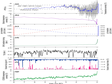
This data set consists of tree ring carbon and oxygen data in central Serbia in westerly region. The tree rings in central Serbia include two tree cores (C50 and C58), the tree species is Bosnia pine, and the measured isotopic data are 542. Cellulose was extracted from tree ring logs by chemical treatment, and the obtained cellulose samples were wrapped in a silver cup. The isotopic ratio was measured by Delta V advantage stable isotope mass spectrometer, and the analysis error was less than 0.21 ‰. The experimental analysis was completed in the laboratory of soil structure and minerals, Institute of Geology and Geophysics, Chinese Academy of Sciences. The climate type of Serbia is single. As shown in the thumbnail, the oxygen isotope sequences of tree rings (C50 and C58) in central Serbia and southern Serbia (H01, H02, H05 and H08) are highly correlated. Therefore, the carbon and oxygen isotope data sets of tree rings in central and southern Serbia (a total of 6 tree cores) are of certain significance for the study of Serbian paleoclimate in westerly region.
XU Chenxi

XRF data can quickly, nondestructive and high-resolution obtain the relative abundance of constant and trace geochemistry, which can be used to reconstruct the environmental change. This data includes the XRF multi-element data of Daze Co and Jiang Co and the age depth data of Lake cores, which can be used to reconstruct the climate and environmental changes in the East and west of the Qinghai Tibet Plateau in the past 20000 years. In Daze Co and Jiang Co lakes, Ti, K, Fe, Si and other elements show the same change trend. Through multi index comparative analysis, it is considered that Ti and other rock forming elements are mainly affected by the inner diameter flow conditions of the basin and can be used to reconstruct the changes of hydrological conditions in the basin in recent 20000 years.
HOU Juzhi

1) The data include the temperature records reconstructed by using the core depth, age and biomarker gdgts of Bangong Lake to reconstruct the annual average temperature change of Bangong Lake Basin in the west of Qinghai Tibet Plateau since the last deglaciation. At present, most paleoclimate records on the plateau are qualitative and semi quantitative, and the quantitative records are very limited, which restricts the in-depth understanding of the mechanism of climate change on the plateau. Bangongcuo, the largest lake in the west of Qinghai Tibet Plateau, was selected as the study area, and the average annual temperature change in this area since 16 ka BP was reconstructed by using biomarker indexes. 2) The record was reconstructed using gdgts of lake sediments. 3) The data are detailed and reliable. 4) This study not only provides data for understanding the past climate change in the western Qinghai Tibet Plateau, but also provides a basis for discussing the plateau climate change mechanism and verifying the reliability of regional climate model.
HOU Juzhi, WANG Mingda

1) The data includes 40 14C dating data of multiple Lake cores. The age control of most lake sediment cores is completed by radiocarbon isotope (14C) dating. The data sheet includes Lake core sample number, laboratory sample number, sample depth, 14C results, dating error and corrected results. The chronological framework of Lake cores is the basis for paleoclimate reconstruction. 2) All 14C data are completed in beta analytical Inc, and the laboratory operation is in strict accordance with the standard process. 3) The quality of the 40 dating data is good. 4) The data have been published, which provides basic data for the study of paleoclimate in the Qinghai Tibet Plateau.
HOU Juzhi

The water vapor isotopes transported by different atmospheric circulation systems are different, and the precipitation on the Qinghai Tibet Plateau is affected by monsoon and westerly circulation, which is very sensitive to climate and environmental change. Hydrogen isotopes of wax in lake sediments provide a means to restore past precipitation information. The stable hydrogen isotope records of sediments from different lakes (Qinghai Lake, linggecuo lake and Bangong Lake) in the East and west of the Qinghai Tibet Plateau provided by the author reconstruct the isotopic changes of precipitation in the East and west of the Qinghai Tibet Plateau in the past 20000 years, and study the effects of summer monsoon and westerly jet on water vapor in the Qinghai Tibet Plateau since the late Pleistocene, It also provides important basic data for reconstructing the paleoclimate and environmental changes of the Qinghai Tibet Plateau in the past.
HOU Juzhi
This data set is the oxygen isotope data ( δ 18O) and its temperature reconstruction from the Chongce ice cores, in western Kunlun Mountains, Northwestern Tibetan Plateau. The Chongce ice cores were dated back to 7 ka BP by a two-parameter flow model (2p model) constrained by the AMS 14C ages. The δ 18O measurements were performed at Nanjing University by a Wavelength Scanned Cavity Ring-Down Spectrometer (WS-CRDS, model: Picarro L2120-i), with the analytical uncertainty of less than 0.1‰. Our reconstructed temperature record shows a long-term warming trend until ~2 ka BP, followed by an abrupt change to a relatively cool period until the start of the industrial-era warming. In addition, the record shows that temperatures during the recent decades are almost the highest during the past 7 ka BP, highlighting the unusual warming forced by anthropogenic greenhouse gases.
Hongxi Pang PANG Hongxi

Qujing basin, located in the east of Yunnan Province, is a long and narrow faulted basin with a north-south trend. Thick and continuous Cenozoic sediments are preserved in the basin, which can be divided into Xiaotun Formation, Caijiachong Formation, and Ciying Formation from bottom to top. These sediments are ideal materials to explore the southeast escape and deformation affected by the India-Eurasian plate collision in the early Cenozoic and the formation and evolution history of the Indian monsoon. A total of a 320.1-meter core covering the entire Ciying Formation and the Caijiachong Formation was obtained through the continuous drilling mission carried out in the center of the basin in the previous study. The mass-specific magnetic susceptibility, anhysteretic remanent magnetization (ARM), and saturation isothermal remanent magnetization (SIRM) from parts of samples of Caijiachong core (320.1m) have been measured, and several important magnetic parameters were determined, including the high and low-frequency magnetic susceptibility (χlf), SIRM and ARM, thus providing important basic information for further mult-index climate reconstruction.
YAN Maodu

Simao basin is located in the south of Yunnan Province and the southeast of Qinghai Tibet Plateau. It belongs to the Sanjiang tectonic domain in the east of Tethys tectonic domain. Thick and continuous early Cenozoic strata are preserved in the basin, so it is an ideal material to restore the tectonic evolution history of the region and the southeast side of the plateau. a continuous and complete high-resolution sequence (361.86 m in thickness) of the Mengyejing Formation was obtained through the continuous drilling in the previous study. The mass-specific magnetic susceptibility, anhysteretic remanent magnetization, and saturation isothermal remanent magnetization from parts of samples of Xiaojinggu core (250 m) have been measured, and several important magnetic parameters were determined, including the high and low-frequency magnetic susceptibility (χlf), SIRM, and ARM. These records will provide an important insight into the paleoclimate change covering the Mengyejing Formation.
YAN Maodu

Based on the changes of tree ring stable oxygen isotope ratio Since 1750 established in Qilian mountain area, based on the negative correlation between tree ring oxygen isotope ratio and summer drought index, the linear correlation equation between tree ring oxygen isotope and drought index is established, and the quantitative reconstruction of drought index from 1750 to 2016 is preliminarily completed. This result is helpful to understand the characteristics of regional dry and wet change from interannual to interdecadal scale. At the same time, it can also compare and study the impact of global change caused by human activities on regional hydrology and climate since the industrial revolution. It is of certain significance in revealing the mechanism of regional dry and wet change and distinguishing the impact of human activities and natural variability on regional climate.
XU Chenxi

Based on the changes of tree ring stable oxygen isotope ratio since 1752 established in Northeast China, and based on the negative correlation between tree ring oxygen isotope ratio and summer drought index, the linear correlation equation between tree ring oxygen isotope and drought index is established, and the quantitative reconstruction of drought index from 1752 to 2015 is preliminarily completed. This result is helpful to understand the characteristics of regional dry and wet change from interannual to interdecadal scale. At the same time, it can also compare and study the impact of global change caused by human activities on regional hydrology and climate since the industrial revolution. It is of certain significance in revealing the mechanism of regional dry and wet change and distinguishing the impact of human activities and natural variability on regional climate.
XU Chenxi

This data set is composed of photoluminescence dating data of loess profiles in Luochuan (35 ° 43 ′ n, 109 ° 25 ′ E) and Xuyi (118 ° 39 ′ e, 32 ° 51 ′ n) in China, including the results of photoluminescence chronology of 45 samples. Among them, the luminescence chronology of 21 samples from Luochuan section of the Loess Plateau of China uses the potassium feldspar monolithic regeneration method (SAR) multi-step temperature rise post IR IRSL (met pirir) dating technique; The study on the luminescence chronology of 24 samples in Xuyi section is that 8 samples are based on the photoluminescence dating of 4-11 micron quartz particles according to the standard monolithic regeneration method (SAR) measurement process, and 8 samples are based on the infrared luminescence dating of 4-11 micron multi mineral fine particles heated to 225 ℃ (pir225) according to the monolithic regeneration method measurement process, And 8 samples based on the infrared luminescence dating of 4-11 micron multi mineral fine particles heated to 290 ℃ (pir290) according to the single chip regeneration method measurement process. The instrument used for the photoluminescence dating of Luochuan and Xuyi loess profiles is RIS ø thermoluminescence / photoluminescence dating instrument made in Denmark. The experimental analysis was completed in the Department of Geosciences of the University of Hong Kong and babes Bolyai University in Romania. The data provide further age constraints for the Loess in Luochuan and Xuyi, China, and are of great significance for the study of paleoclimate / Paleoenvironment in the two regions.
HAO Qingzhen

This data set is composed of principal and trace element analysis data of different particle size components of stari slankamen loess comprehensive profile in Serbia. There are two sets of particle size samples in total. One set is divided according to the Uddin Wentworth particle size standard. A single sample is divided into six particle size samples, which are < 2 μ m、2-4 μ m、4-8 μ m、8-16 μ m、16-32 μ M and 32-63 μ M component, 102 samples in total; The other set divides a single sample into < 10 μ M and 10-63 μ M two components, a total of 52 samples. The contents of major and trace elements in each sample were determined by Axios wavelength dispersive X-ray fluorescence spectrometer (XRF) manufactured by panalytical company and nexion300d inductively coupled plasma mass spectrometry (ICP-MS) manufactured by Perkin Elmer company, The experimental analysis was completed in the Key Laboratory of Cenozoic geology and environment, Chinese Academy of Sciences and the Institute of analysis and testing, Beijing Institute of geology, China nuclear industry. The data can be applied to determine the particle size effect of element geochemical indexes of loess in the westerly affected area, and has important guiding significance for loess provenance discrimination and paleoclimate research by using element geochemical indexes.
HAO Qingzhen

This data set consists of clay mineral analysis data of stari slankamen loess profile in Serbia. Using x'pert Pro MPD powder X-ray (XRD) manufactured by panalytical company in the Netherlands, we carried out clay mineral determination and Analysis on the comprehensive profile of stari slankamen loess at an interval of about 10-20 cm. The total thickness of the profile is about 41 meters and the number of samples is 279. The reproducibility of the scanning angle of the instrument is ± 0.0001 degrees. The experimental analysis was completed in Shandong Key Laboratory of tourism, resources and environment, Taishan University. This data reflects the change characteristics of clay minerals in the long-term loess sequence in Serbia, and is of great significance for the study of paleoclimate / Paleoenvironment in southeastern Europe.
HAO Qingzhen

The semi quantitative reconstruction of paleoclimate parameters such as Paleoprecipitation and paleotemperature in the Loess Plateau of Serbia and China in the past 1 million years is completed based on the magnetic susceptibility climate conversion function of loess established on the topsoil through the comprehensive magnetic susceptibility data of tiel stari slankamen loess profile in Serbia and Xifeng loess profile in the Loess Plateau of China in the past 1 million years. It is of great significance to study the difference and relationship of climate behavior characteristics (duration, amplitude, variability, etc.) between East Asian monsoon area and westerly affected area at different time scales during interglacial period with different temperature increase amplitude.
HAO Qingzhen
Contact Support
Links
National Tibetan Plateau Data CenterFollow Us

A Big Earth Data Platform for Three Poles © 2018-2020 No.05000491 | All Rights Reserved
|  No.11010502040845
Tech Support: westdc.cn

