Brief Introduction:The Tibetan Plateau, known as the " third pole " of the earth, has always been the focus of attention of the international community because it is an important area driving global environmental change research and has a profound regulatory effect on the ecology, environment and climate of the whole earth. Under the background of global warming, the cryosphere elements such as tripolar glaciers, frozen soils, and freeze-thaw lakes have undergone significant changes, with glaciers shrinking rapidly and permafrost active layers thickening. For a long time, China has carried out systematic and multidisciplinary research in the world ' s third pole with the Qinghai-Tibet Plateau as the main body, forming a rich research accumulation.
Publish Datetime:2022-12-13
Number of Datasets:184

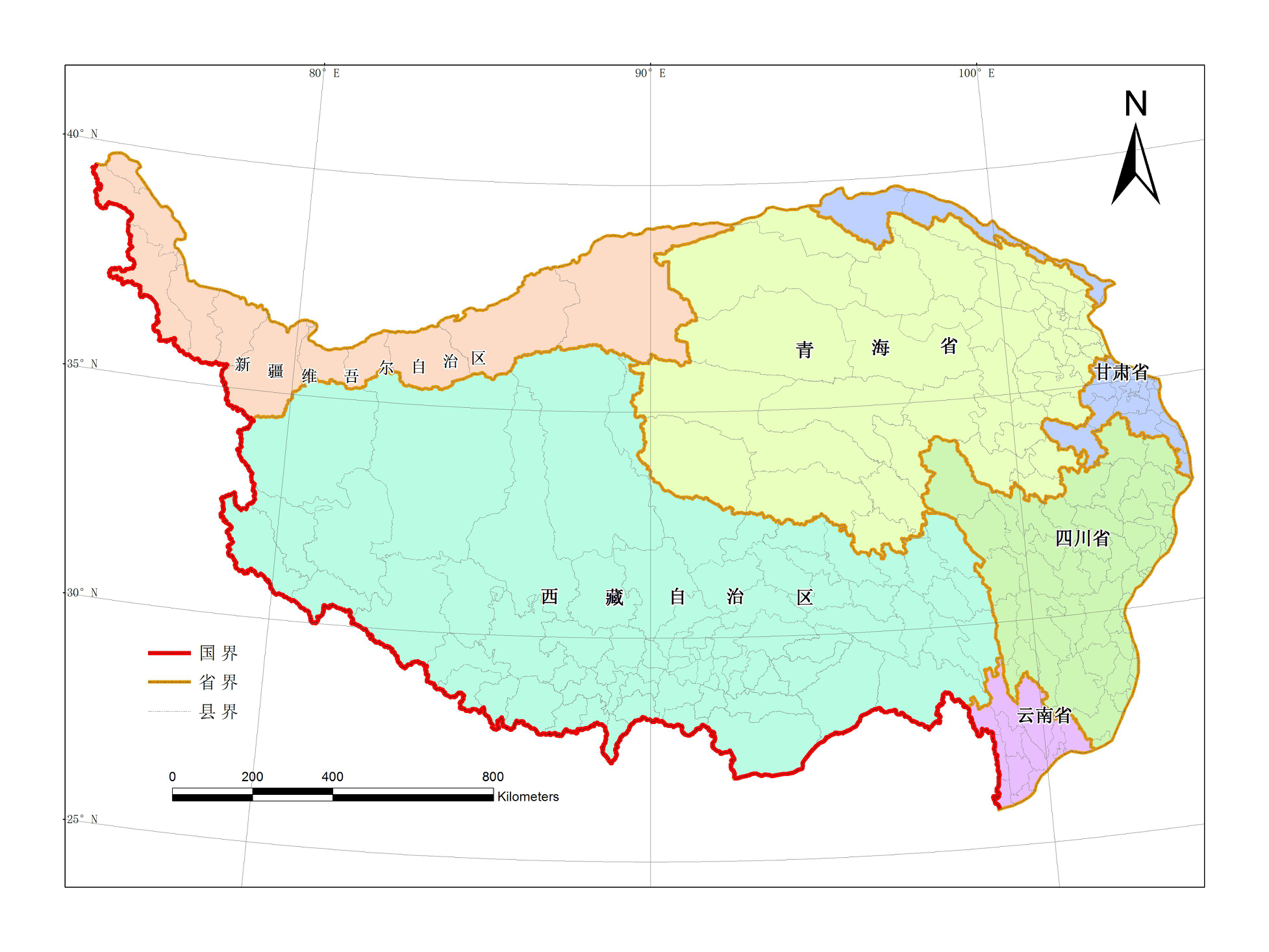
This data is originated from the 1:100,000 national basic geographic database, which was open freely for public by the National Basic Geographic Information Center in November 2017. The boundary of the Qinghai-Tibet Plateau was spliced and clipped as a whole, so as to facilitate the study on the Qinghai-Tibet plateau. This data set is the 1:100,000 administrative boundaries of the qinghai-tibet plateau, including National_Tibet_line、 Province_Tibet、City_Tibet、County_Tibet_poly and County_Tibet_line. Administrative boundary layer (County_Tibet_poly) property name and definition: Item Properties Describe Example PAC Administrative division code 513230 NAME The name of the County line name Administrative boundary layer (BOUL) attribute name and definition: Item Properties Describe Example GB classification code 630200 Administrative boundary layer (County_Tibet_line) attribute item meaning: Item Properties Describe Example GB 630200 Provincial boundary GB 640200 Prefectural, municipal and state administrative boundaries GB 650201 county administrative boundaries (determined)
2019-07-04 View Details

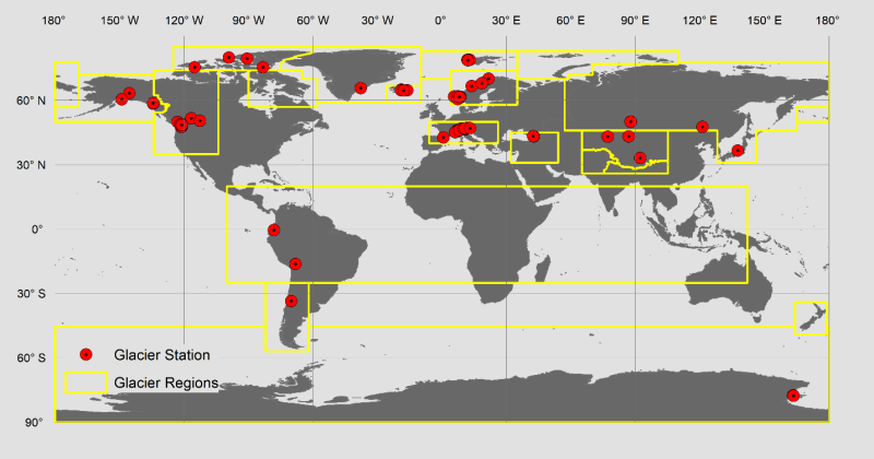
Glacier monitoring mass balance data are the most direct and reliable data for glaciers responding to climate change. The data set of global glacier monitoring mass balance collects information on 76 glaciers and their glacier mass balance data, both with continuous (uninterrupted) observation time series and by collecting and arranging globally accessible mass balance data with a time resolution of one year from 1950 to 2016.
2019-05-30 View Details

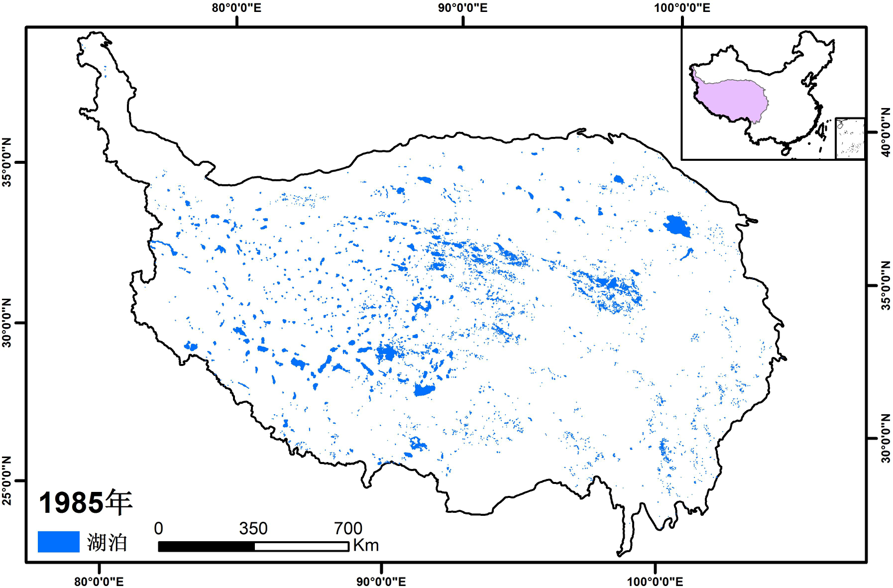
The data set of lake dynamics on the Tibetan Plateau was mainly derived from Landsat remote sensing data. Band ratio and the threshold segmentation method were applied. The temporal coverage of the data set was from 1984 to 2016, with a temporal resolution of 5 years. It covered the whole Tibetan Plateau at a spatial resolution of 30 meters. The water body area extraction method mainly adopted the band ratio (B4/B2) or water body index to construct the classification tree. The algorithm construction considered the spatial and temporal variations of the spectral characteristics of the water body and adjusted the threshold of the decision tree by the slope and the slope aspect information of the water body. The long-term sequence satellite-borne data came from different sensors, e.g., Landsat MSS, TM, ETM+, and OLI. The minimum unit for extracting water body information was 2*2 pixels, and all water body areas less than 0.36*10^-2 Km² were removed. The water body information extracted by high-resolution remote sensing data and the verification of the water body checkpoint determined by visual interpretation indicated that the overall accuracy of the water body area information for the Tibetan Plateau was above 95%. The data were saved as a shape file, and projected by Albers projection, with a central meridian of 105 ° and a double standard latitude of 25 ° and 47 °.
2019-05-30 View Details

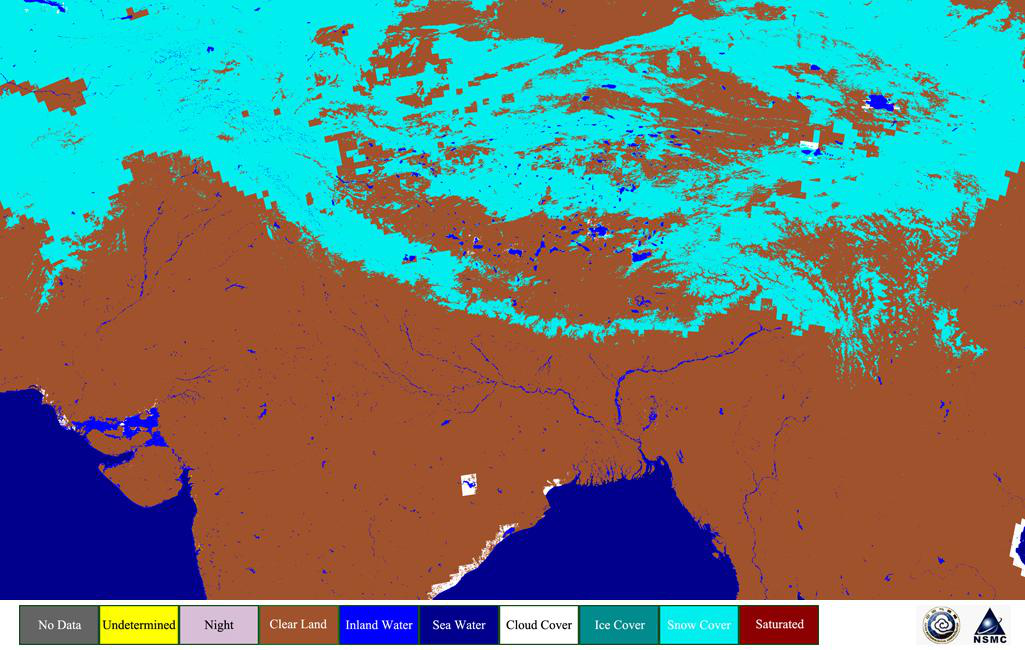
This dataset is blended by two other sets of data, snow cover dataset based on optical instrument remote sensing with 1km spatial resolution on the Qinghai-Tibet Plateau (1989-2018) produced by National Satellite Meteorological Center, and near-real-time SSM/I-SSMIS 25km EASE-grid daily global ice concentration and snow extent (NISE, 1995-2018) provided by National Snow and Ice Data Center (NSIDC, U.S.A). It covers the time from 1995 to 2018 (two periods, from January to April and from October to December) and the region of Qinghai-Tibet Plateau (17°N-41°N, 65°E-106°E) with daily product, which takes equal latitude and longitude projection with 0.01°×0.01° spatial resolution, and characterizes whether the ground is covered by snow. The input data sources include daily snow cover products generated by NOAA/AVHRR, MetOp/AVHRR, and alternative to AVHRR taken from TERRA/MODIS corresponding observation, and snow extent information of NISE derived from observation by SSM/I or SSMIS of DMSP satellites. The processing method of data collection is as following: first, taking 1km snow cover product from optical instruments as initial value, and fully trusting its snow and clear sky without snow information; then, under the aid of sea-land template with relatively high resolution, replacing the pixels or grids where is cloud coverage, no decision, or lack of satellite observation, by NISE's effective terrestrial identification results. For some water and land boundaries, there still may be a small amount of cloud coverage or no observation data area that can’t be replaced due to the low spatial resolution of NISE product. Blended daily snow cover product achieves about 91% average coincidence rate of snow and non-snow identification compared to ground-based snow depth observation in years. The dataset is stored in the standard HDF4 files each having two SDSs of snow cover and quality code with the dimensions of 4100-column and 2400-line. Complete attribute descriptions is written in them.
2019-05-28 View Details
Contact Support
Links
National Tibetan Plateau Data CenterFollow Us

A Big Earth Data Platform for Three Poles © 2018-2020 No.05000491 | All Rights Reserved
|  No.11010502040845
Tech Support: westdc.cn