")
Soil heat flux is an important part of surface energy balance, and it is the basis of energy balance analysis. In 2011-2013, hfp01 was installed at 5cm and 10cm of Tamarix community in the lower reaches of Heihe River to measure soil heat flux, with the frequency of 0.5h.
SI Jianhua
")
Soil moisture, also known as soil moisture. It's the water that stays in the pores of the soil. The main source of soil water in Picea crassifolia forest is atmospheric precipitation, which is the only source of water absorbed by Picea crassifolia to maintain its growth. This data is the soil moisture data of Picea crassifolia forest measured by the soil moisture intelligent neutron instrument.
CHANG Xuexiang
")
1. Data overview The sampling period of this data set was from July 19, 2012 to August 17, 2012. The location of the sampling point was near the original hongnigou outlet of the small cucurbitou watershed in the upper reaches of the heihe river, with the latitude and longitude of 99 ° 52 '25.3 "E, 38 ° 15' 37.97" 2. data content A soil profile with a depth of 2m was dug at the sampling point and a soil water collector was placed at depths of 60cm, 90cm and 140cm respectively.When soil water is collected by the soil collector, different depths of soil water can be obtained by extracting tubes of different depths with a 50ml disposable syringe. This data set contains the DOC value, ammonia nitrogen value, silica content and anion value of soil water at three different depths. Data acquisition method - ammonia nitrogen value was determined by using a hash DR2800 ultraviolet spectrophotometer;The DOC value was determined by the analytikjena multi N/C 3100 total nitrogen and carbon tester.The anion value was determined by Swiss wantong model 761/813 ion chromatograph.Cation is to use the model to the United States thermoelectric IRIS Intrepid Ⅱ XSPICP - AES determination.
SUN Ziyong, CHANG Qixin
")
At the same time with the observation of soil moisture content, the project measures the soil temperature data of Tamarix Tamarix forest in the lower reaches of Heihe River from 2011 to 2012, with a depth of 10, 30, 50, 80, 140cm and a frequency of 0.5h. The measuring instrument is 109ss produced by Campell company of the United States.
SI Jianhua
")
Soil survey data corresponding to the ejin delta and the ecological vegetation sample during the project implementation period. Soil profile sampling corresponding to the ecological vegetation survey in ejin delta (5), 20 cm stratified sampling.Investigation items included: soil salinity, soil organic matter, C, N, P, etc., time: August 2011.
YU Jingjie
")
Soil water content is the key factor affecting the transpiration water consumption of plants in desert riparian forest. In this project, the typical plant communities in the lower reaches of Heihe River are selected, with coordinates of 42 ° 02 ′ 00.07 ″ N and 101 ° 02 ′ 59.41 ″ E. through continuous measurement of soil water data in 2010-2012, the observation instrument is environscan (Australia, ICT), with observation depth of 10, 30, 50, 80 and 140cm, and observation frequency of 0.5h Understanding the mechanism of environmental regulation of transpiration water consumption of desert riparian forest in the lower reaches of Heihe River provides basic data support.
SI Jianhua
")
1. Data overview The data set of the base camp integrated environmental observation system is a set of ENVIS (IMKO, Germany) which was installed at the base camp observation point by qilian station.It is stored automatically by ENVIS data mining system. 2. Data content This data set is the scale data from January 1, 2012 to December 31, 2012.Including air temperature 1.5m, humidity 1.5m, air temperature 2.5m, humidity 2.5m, soil moisture 0cm, precipitation, wind speed 1.5m, wind speed 2.5m, wind direction 1.5m, geothermal flux 5cm, total radiation, surface temperature, ground temperature 20cm, ground temperature 40cm, ground temperature 60cm, ground temperature 80cm, ground temperature 120cm, ground temperature 160cm, CO2, air pressure. 3. Space and time scope Geographical coordinates: longitude: 99° 53’e;Latitude: 38°16 'N;Height: 2980.2 m.
CHEN Rensheng, HAN Chuntan
")
This data set contains the observation data of Zhangye National Climate Observatory from 2008 to 2009. The station is located in Zhangye, Gansu Province, with longitude and latitude of 100 ° 17 ′ e, 39 ° 05 ′ N and altitude of 1456m. The observation items include: atmospheric wind temperature and humidity gradient observation (2cm, 4cm, 10cm, 20m and 30m), wind direction, air pressure, photosynthesis effective radiation, precipitation, radiation four components, surface temperature, multi-layer soil temperature (5cm, 10cm, 15cm, 20cm and 40cm), soil moisture (10cm, 20cm, 50cm, 100cm and 180cm) and soil heat flux (5cm, 10cm and 15cm). Please refer to the instruction document published with the data for specific header and other information.
Zhangye city meteorological bureau

This dataset include soil moisture and soil temperature observations of 50 SoilNET Nodes during June 2012~March 2013 (UTC+8), which located in a MODIS pixel in the observation matrix of the HiWATER artificial oasis eco-hydrology experimental area, and aim to capture the spatial-temporal variance at the ~100 m scale. Each SoilNET node observe the soil moisture and soil temperature at 4 cm, 10 cm, 20 cm and 40 cm depth using the SPADE sensor with 10 minutes interval. This dataset can be used in the estimation of surface hydrothermal variables and their validation, eco-hydrological research, irrigation management and so on. The detail description please refers to "SoilNET_data_document.docx".
WANG Xufeng, KANG Jian, Li Dazhi, Wang Zuocheng, Dong Cunhui, LI Xin, MA Mingguo

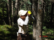
Soil moisture, also known as soil humidity. It is the moisture that remains in the pore space of the soil. The main source of soil moisture in Qinghai spruce forest is atmospheric precipitation, which is the only source of water absorption of Qinghai spruce to survive. The data is the soil moisture of Qinghai spruce forest in Pailugou of Heihe River Basin measured by the EM50 soil moisture meter produced in the United States.
CHANG Xuexiang

The dataset of ground truth measurements synchronizing with Envisat ASAR was obtained in No. 1 and 2 quadrates of the E'bao foci experimental area on Oct. 17, 2007 during the pre-observation period The data were in AP mode and VV/VH polarization combinations, and the overpass time was approximately at 23:04 BJT. Both the quadrates were divided into 3×3 subsites, with each one spanning a 30×30 m2 plot. 25 sampling points were chosen, including centers and corners. Simultaneous with the satellite overpass, numerous ground data were collected, soil volumetric moisture, soil conductivity, the soil temperature, and the real part of soil complex permittivity by the WET soil moisture tachometer; the surface radiative temperature by the hand-held infrared thermometer; soil gravimetric moisture, volumetric moisture, and soil bulk density by drying soil samples from the cutting ring. Meanwhile, vegetation parameters as height, coverage and water content were also observed. Meanwhile, vegetation parameters as height, coverage and water content were also observed. Those provide reliable ground data for retrieval and verification of soil moisture, soil freeze/thaw status and the microwave radiative transfer model from active remote sensing approaches.
CHAO Zhenhua, CHE Tao, QIN Chun, WU Yueru

The dataset of ground truth measurements synchronizing with Envisat ASAR was obtained in No.2 quadrate of the A'rou foci experimental area on Oct. 17, 2007 during the pre-observation period. The Envisat ASAR data were in AP mode and VV/VH polarization combinations, and the overpass time was approximately at 23:04 BJT. The quadrate was divided into 3×3 subsites, with each one spanning a 30×30 m2 plot. 25 sampling points were chosen, including centers and corners of each subsites. Simultaneous with the satellite overpass, numerous ground data were collected, soil volumetric moisture by ML2X; soil volumetric moisture, soil conductivity, soil temperature, and the real part of soil complex permittivity by WET soil moisture sensor; the surface radiative temperature by the hand-held infrared thermometer; soil gravimetric moisture, volumetric moisture, and soil bulk density after drying by the cutting ring (100cm^3). Meanwhile, vegetation parameters as height, coverage and water content were also observed. Surface roughness was detailed in the "WATER: Surface roughness dataset in the A'rou foci experimental area". Those provide reliable ground data for retrieval and validation of soil moisture and freeze/thaw status from active remote sensing approaches.
BAI Yunjie, HAO Xiaohua, LI Hongyi, LI Xin, LI Zhe

The dataset of PR2 soil moisture profile observations (10cm, 20cm, 30cm, 40cm, 60cm and 100cm) was obtained in the Linze grassland foci experimental area. The sample points, with various underlying surface and depth were measured by PR2 probe in PR2 quadrate (3Grid×3Grid, 90m×90m) and PR2 line. Observations were carried out from May 31 to Jul. 13, 2008 with exceptions on Jun. 6, 8, 10, 13, 21, 27, 28, 29, Jul. 3 and 12. Data were archived in Excel and Word file. See WATER: Dataset of setting of the sampling plots and stripes in the foci experimental area of Linze station for more information.
CAO Yongpan, CHAO Zhenhua, GE Chunmei, HAN Xujun, HU Xiaoli, HUANG Chunlin, JIANG Xi, LI Hongxing, LIANG Ji, LIU Chao, NIAN Yanyun, WANG Shuguo, WANG Xufeng, WU Yueru, ZHU Shijie, FENG Lei, YU Fan, WANG Jing, LI Xiaoyu

The dataset of ground truth measurements synchronizing with Envisat ASAR was obtained in No. 1 and 2 quadrates of the Biandukou foci experimental area on Oct. 17, 2007 during the pre-observation period. The ASAR data were in AP mode and VV/VH polarization combinations, and the overpass time was approximately at 23:04 BJT. Both the quadrates were divided into 3×3 subsites, with each one spanning a 30×30 m2 plot. 25 sampling points were chosen, including centers and corners. Simultaneous with the satellite overpass, numerous ground data were collected: the soil temperature , volumetric soil moisture (cm^3/cm^3), soil salinity (s/m), soil conductivity (s/m) by the Hydra probe, the surface radiative temperature by the handheld infrared thermometer, gravimetric soil moisture, volumetric soil moisture, and soil bulk density by drying soil samples from the cutting ring (100cm^3). Meanwhile, vegetation parameters as height, coverage and water content were also observed. Those provide reliable ground data for the development and validation of soil moisture, soil freeze/thaw algorithms and the forward model from active remote sensing approaches.
BAI Yunjie, CAO Yongpan, LI Xin, Wang Weizhen, WANG Xufeng

The dataset of ground truth measurement synchronizing with EO-1 Hyperion was obtained in the Yingke oasis and Huazhaizi desert steppe foci experimental areas on May 25, 2008. Observation items included: (1) Atmospheric parameters on the ICBC resort office roof by CE318 (produced by CIMEL in France). The total optical depth, aerosol optical depth, Rayleigh scattering coefficient, column water vapor in 936 nm, particle size spectrum and phase function were then retrieved from these observations. The optical depth in 1020nm, 936nm, 870nm, 670nm and 440nm were all acquired by CE318. Those data include the raw data in k7 format and can be opened by ASTPWin. ReadMe.txt is attached for detail. Processed data (after retrieval of the raw data) in Excel format are on optical depth, rayleigh scattering, aerosol optical depth, the horizontal visibility, the near surface air temperature, the solar azimuth, zenith, solar distance correlation factors, and air column mass number. (2) Ground object reflectance spectra f new-born rape and the bare land in Biandukou foci experimental area by ASD FieldSpec (350~2500 nm) from BNU. Raw data were binary files direct from ASD (by ViewSpecPro), and pre-processed data on reflectance were in Excel format. (3) Soil moisture (0-40cm) by the cutting ring and the soil temperature (0-40cm) by the thermocouple in Huazhaizi desert No. 1 plot and the windbreak forest; and soil moisture and the soil temperature (0-100cm) in Yingke oasis maize field. Data were archived in Excel format. (4) LAI. The maximum leaf length and width of each alfalfa and barley were measured. Data were archived in Excel format. (5) Coverage of maize and wheat in Yingke oasis maize field, of vegetation (Reaumuria soongorica) in Huazhaizi desert No. 1 and 2 plots by the self-made coverage instrument and the camera (2.5m-3.5m above the ground). Based on the length of the measuring tape and the bamboo pole, the size of the photo can be decided GPS date were also collected and the technology LAB was applied to retrieve the coverage of the green vegetation. Besides, such related information as surroundings environment was also recorded. Data included the primarily measured image and final fraction of vegetation coverage.
CHEN Ling, QIAN Yonggang, REN Huazhong, WANG Haoxing, YAN Guangkuo, GE Yingchun, SHU Lele, WANG Jianhua, XU Zhen, GUANG Jie, LI Li, XIN Xiaozhou, ZHANG Yang, ZHOU Chunyan, TAO Xin, YAN Binyan, YAO Yanjuan

The dateset of soil texture measurements was obtained by the pipette method in the Biandukou and A'rou foci experimental area. Observation items were mainly the soil texture and the soil temperature. Data were archived as Excel files. Sampling locations were not recorded.
PAN Jinmei, ZHAO Shaojie
")
The data set contains observation data from the Tianlaochi small watershed automatic weather station. The latitude and longitude of the station are 38.43N, 99.93E, and the altitude is 3100m. Observed items are time, average wind speed (m/s), maximum wind speed (m/s), 40-60cm soil moisture, 0-20 soil moisture, 20-40 soil moisture, air pressure, PAR, air temperature, relative humidity, and dew point temperature , Solar radiation, total precipitation, 20-40 soil temperature, 0-20 soil temperature, 40-60 soil temperature. The observation period is from May 25, 2011 to September 11, 2012, and all parameter data are compiled on a daily scale.
ZHAO Chuanyan, MA Wenying
")
The data of soil moisture in the Pailougou include the grassland on the shady slope of 2700m above sea level and the Picea crassifolia forest of 2800m above sea level. The soil water content monitoring system EM50 was used to measure the water content in five soil layers, 10cm, 20cm, 30cm, 40cm and 60cm respectively. The in-forest survey period is from June 2012 to September 2012, and there are also data for June 2013. The meadows were measured from June 2013 to October 2013. The measurement results are all volume water content in%.
HE Zhibin

The dataset of ground truth measurement synchronizing with Envisat ASAR was obtained in No. 1, 2 and 3 quadrates of the A'rou foci experimental area on Jun. 19, 2008. GPR observations were also carried out in one sampling strip. The Envisat ASAR data were in AP mode and VV/VH polarization combinations, and the overpass time was approximately at 11:17 BJT. Simultaneous with the satellite overpass, numerous ground data were collected, the soil temperature, soil volumetric moisture, the loss tangent, soil conductivity, and the real part and the imaginary part of soil complex permittivity were acquired by the POGO soil sensor, and the mean soil temperature from 0-5cm by the probe thermometer. Those provide reliable ground data for retrieval and validation of the surface temperature and evapotranspiration from remote sensing approaches. Four files were included, ASAR data, No. 1, 2 and 3 quadrates data.
CAO Yongpan, GE Chunmei, HAN Xujun,
202024test test data 202024test test data 202024Test test data 202024test test data 202024test test data 202024test test data 202024test test data 202024test test data 202024test test data 202024test test data 202024test test data 202024test test data 202024test test data
MA Mingguo, DING Songchuang, GAO Song, Qian Jinbo, BAI Yunjie, WANG Xufeng, TAN Junlei, WANG Shuguo, GU Juan, WANG Shunli, LUO Longfa, WANG Rongxin, CHE Zongxi, JING Wenmao
Contact Support
Links
National Tibetan Plateau Data CenterFollow Us

A Big Earth Data Platform for Three Poles © 2018-2020 No.05000491 | All Rights Reserved
|  No.11010502040845
Tech Support: westdc.cn

