
This data includes animal products and labor prices; economic income structure, level and per capita net income; economic expenditure structure, productive and living expenditure structure; population composition, labor and household head age and education level; pasture area, grade, suitable stocking capacity; , livestock sheds, human and animal drinking water, pastoral roads, fence construction scale; maintenance scale, and livestock structure.
ZHAO Chengzhang

The “Eco-Hydrology Integrated Atlas of the Heihe River Basin ” was supported by the major program: Synthetic Research on the Eco-hydrological Process of the Heihe River Basin. It provided data collation and service for Synthetic Research on the Eco-hydrological Process of the Heihe River Basin. The Atlas will provide researchers with a comprehensive and detailed introduction of the background and basic data sets of the Heihe River Basin. Eco-Hydrology Integrated Atlas of the Heihe River Basin: Remote Sensing Mosaicing of the Heihe River Basin, scale 1:2500000, positive-axis equivalence conical projection, standard parallel: north latitude 25 47 Data source: Landsat TM Mosaic Image of the Heihe River Basin in 2010, Heihe River Basin Boundary,River Network Dataset of the Heihe River Basin, The Resident Site Distribution Data of the Heihe River Basin, etc.
WANG Jianhua, ZHAO Jun
202024test test data 202024test test data 202024Test test data 202024test test data 202024test test data 202024test test data 202024test test data 202024test test data 202024test test data 202024test test data 202024test test data 202024test test data 202024test test data
MA Mingguo, DING Songchuang, GAO Song, Qian Jinbo, BAI Yunjie, WANG Xufeng, TAN Junlei, WANG Shuguo, GU Juan, WANG Shunli, LUO Longfa, WANG Rongxin, CHE Zongxi, JING Wenmao
")
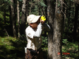
Canopy interception field is located in 2700m forest in Pailugou watershed of Qilian mountain, with 60 precipitation interception barrels arranged at equal intervals on the ground. The specifications of the interception barrel are: the radius of the bottom surface is 10cm and the height is 35cm. The observation period was from June to July 2012 and from July to September 2013, and 17 precipitation events (including each precipitation) were recorded. The unit is mm.
HE Zhibin
")
According to the characteristics of the selected field and its surrounding area, a trime tube is arranged in the corn field, and 5 trime tubes are arranged in a direction perpendicular to the field path. When monitoring soil moisture content in the TDR vertical direction, the unit is every 10cm. Monitor down. Location: N 38 ° 52′27.6 ″ E 100 ° 21′14.0 ″ The submitted data includes the water content of the farmland and its surrounding soil (TDR monitoring) after three irrigations in a selected farmland in Yingke Irrigation District, encrypted monitoring after irrigation, one group every 3 hours within 24 hours, and 3 groups per day for the next 5 days. -10 days are two groups per day, and 10-15 days are one group per day.
HUANG Guanhua, JIANG Yao
")
China 1:100000 data of land use is a major application in the Chinese Academy of Sciences "five-year" project "the national resources and environment remote sensing macroscopic investigation and study of dynamic organized 19 Chinese Academy of Sciences institute of remote sensing science and technology team, by means of satellite remote sensing, in three years based on Landsat MSS, TM and ETM remote sensing data established China 1:100000 images and vector of land use database.The main contents include: China 1:100,000 land use data;China 1:100,000 land use graph data and attribute data. The data was directly clipped from China's 1:100,000 land-use data.A hierarchical land cover classification system was adopted for the land use data of heihe basin of 1:100,000, and the whole basin was divided into 6 primary categories (arable land, forest land, grassland, water area, urban and rural areas, industrial and mining areas, residential land and unused land) and 26 secondary categories.The data type is vector polygon, which is stored in Shape format.There are two types of data projection: WGS84/ALBERS;Data coverage covers the new heihe watershed boundary (lack of outer Mongolia data). Land use classification attributes: The first class type and the second class type attributes encode the spatial distribution position Cultivated paddy field 113 is mainly distributed in alluvial plain, basin and valley Cultivated paddy field 112 distributed in hilly valley narrow valley platform or beach (with irrigation conditions) Cultivated paddy field 111 is mainly distributed in mountain valley narrow valley platform or beach (with better irrigation conditions) Arable land 124 is mainly distributed in mountainous areas, the slope is generally more than 25 degrees (belongs to the steep slope hanging land), should be returned to forest. Cultivated dry land 123 is mainly distributed in basins, piedmont belts, river alluvial, diluvial or lacustrine plains (water shortage and poor irrigation conditions). Cultivated dry land 122 is mainly distributed in hilly areas (shaanxi, gan, ning, qing).In general, the plot is distributed on gentle slopes and x and sockets of hills. Arable land 121 is mainly distributed in the mountainous area, with an elevation of 4000 meters below the slope (gentle slope, mountainside, steep slope platform, etc.) and mountain front belt. Woodlands have woodlands (trees) 21 mainly distributed in the mountains (below 4000 meters above sea level) or in the slope, valley two slopes, mountain tops, plains.In qinghai nanshan, qilian mountains are. Woodland shrub 22 is mainly distributed in the higher mountain areas (below 4500 m), most of the distribution of hillside and valley and sand. Forest dredging 23 mainly distributed in the mountains, hills, plains and sandy land, gobi (soil, gravel) edge. Other woodlands 24 are mainly distributed in the oasis ridge, river, roadside and rural residential areas around. Grassland 31 is generally distributed in mountainous areas (gentle slopes), hills (steep slopes) and interriver beaches, gobi desert, sandy hills, etc. The covered grassland 32 is mainly distributed in dry places (next door low-lying land and sandy hills, etc.). Grassland low cover grassland 33 mainly grows in drier places (loess hills and sandy edges). The river channel 41 is mainly distributed in the plain, the cultivated land between the rivers and the valleys in the mountains. Water lakes are mainly distributed in low-lying areas. The reservoirs are mainly distributed in the intermountain lowlands and intersandy hills in qinghai province. Water area glaciers and permanent snow 44 mainly distributed in the plain, the valley between the river, there are surrounding residents and arable land. Waters and beaches are mainly distributed on the top of (over 4000) mountains.
WANG Jianhua, LIU Jiyuan
")
This data is based on the DEM data generated by 1:250,000 digital contour lines and elevation points in China released by national basic geographic information center, and the DEM data set of heihe river basin is generated by the nearest neighbor method resampling method of ARCGIS spatial analysis module with a spatial resolution of 30 SEC.
National Basic Geographic Information Center
 with 30 sec spatial resolution over the Heihe River Basin (1981-2013)")
Agricultural irrigation, which accounts for about 80% of human water consumption, is the most important part of human water resources management and closely related to human survival and development.Irrigation is also an important part of the water cycle. Large-scale irrigation can affect the water cycle and even the local climate by affecting evapotranspiration.Excessive diversion of irrigation water will lead to unsustainable utilization of water resources, and at the same time, will reduce river flow and aquifer water reserves, thus harming the ecological environment. Therefore, determining the spatial and temporal distribution and variation of irrigation is critical to studying past human water use, the impact of irrigation on ecological and hydrological processes, the environment and climate, and the development of future irrigation plans. By integrating the irrigation amount of channel diversion water and irrigation amount of groundwater intake from different data sources, and combining the evapotranspiration data of land surface model CLM4.5 simulation and remote sensing inversion, a set of spatio-temporal continuous surface water and groundwater irrigation amount data set with spatial resolution of 30 arcseconds (0.0083 degrees) on the scale of 1981-2013 in heihe river basin was made. It has been verified that this data set has a high reliability from 2000 to 2013, and a lower reliability from 1981 to 1999 than from 2000 to 2013 due to the absence of remote sensing data and the absence of soil utilization changes. The document is described as follows: Monthly surfacewater irrigation volume file name: monthly_surfacewater_irrigation gation_1981-2013.nc Monthly groundwater_irrigation gation_1981-2013.nc The data is in netcdf format.There are three dimensions, which are month, lat, and lon. Where, month is a month, and the value is 0-395, representing each month from 1981 to 2013. Lat is grid latitude information, and lon is grid longitude information.
XIE Zhenghui
")
Image format: tif Image size: about 925M per scene Time range: may-october 2012 Time resolution: month Spatial resolution: 30m The algorithm firstly adopts the canopy BRDF model and presents the canopy reflectivity as a function of a series of parameters such as FAPAR, wavelength, reflectance of soil and leaves, aggregation index, incidence and observation Angle.The parameter table is established for several key parameters as the input of inversion.Then input the pre-processed surface reflectance data and land cover data, and invert LAI/FAPAR products by look-up table (LUT) method. See references for detailed algorithm.
")
QuickBird satellite was launched by Digital Globe corporation on October 18, 2001. It has 4 multi-spectral bands and 1 panchromatic band, with a spatial resolution of 0.61m for panchromatic bands and a spatial resolution of 2.5m for multi-spectral bands and a width of 16.5 * 16.5 km. There are two QuickBird remote sensing images in heihe river basin.The acquisition time and coverage were: 2004-03-23, covering zhangye area;2004-08-08, covering danokou and drainage ditch drainage basin. The product level is level L2 and has been geometrically corrected by the system.
LI Xin, GUO Jianwen
")
At the end of September and the beginning of October, 2011, a year-end ecological survey was carried out in heihe river basin for plants of different desert types to stop growing. There are altogether 8 survey and observation fields, which are: piedmont desert, piedmont gobi, middle reaches desert, middle reaches gobi, middle reaches desert, lower reaches desert, lower reaches gobi and lower reaches desert, with a size of 40m×40m. Three 20m×20m large quadrats were fixed in each observation field, named S1, S2 and S3, and regular shrub surveys were conducted.Each large quadrat was fixed with 4 5m x 5m small quadrats, named A, B, C, D, for the herbal survey.
SU Peixi

At the end of September and the beginning of October, 2013, desert plants in typical areas of heihe basin stopped their growth period to conduct year-end ecological survey. There are altogether 8 survey and observation fields, which are: piedmont desert, piedmont gobi, middle reaches desert, middle reaches gobi, middle reaches desert, lower reaches desert, lower reaches gobi and lower reaches desert, with a size of 40m×40m. Three 20m×20m large quadrats were fixed in each observation field, named S1, S2 and S3, and regular shrub surveys were conducted.Each large quadrat was fixed with 4 5m x 5m small quadrats, named A, B, C, D, for the herbal survey.
SU Peixi
")
Correlation data of vegetation functional traits with topographic factors and pastoral animal husbandry activity factors, including: 1) observation data of main functional traits of 2-3 kinds of grassland plants in elevation, slope and slope upward; 2) correlation analysis data of vegetation functional traits and topographic factors; 3) correlation analysis data between vegetation functional traits and livestock activity intensity factors.
ZHAO Chengzhang
")
We produced surface photosynthetic effective radiation (PAR), solar radiation (SSR) and net radiation (NR) products with 1KM resolution in the heihe basin in 2012.The temporal resolution ranges from instantaneous to hourly and daily.Day-by-day ancillary data were also produced, including aerosol optical thickness, moisture content, NDVI, snow cover, and surface albedo.Among them, PAR and SSR use the method of lookup table to directly invert by combining the stationary weather satellite and polar orbit satellite MODIS product.NR was calculated by analyzing the relationship between net short-wave and net surface radiation.Hourly instantaneous products are weighted by average and integral to obtain hourly and daily cumulative products.
HUANG Guanghui
")
The dataset includes the saturated hydraulic conductivity data of typical soil samples in Heihe River Basin from July 2012 to August 2013. The collection method of typical soil sample points in Heihe River Basin is representative sampling, which means that the typical soil types in the landscape area can be collected, and the sample points with higher representativeness can be collected as much as possible, and the saturated hydraulic conductivity of each type of soil can be measured three times for the average value.
ZHANG Ganlin,
")
This dataset contains soil organic matter content data of typical soil samples in heihe river basin from July 2012 to August 2013.The collection method of typical soil sample points in heihe river basin is representative sampling, which refers to the collection of typical soil types in the landscape area and the collection of highly representative sample points as far as possible.Soil samples from each profile were taken on the basis of diagnostic layers and diagnostic characteristics, classified according to the Chinese soil system.
ZHANG Ganlin

Three artificial rainfall events were performed on the shady grassland at the altitude of 2700m in the Pailugou watershed of the Qilian Mountains. The times were July 15, 2011, July 16, and July 22, 2011, respectively. Runoff rate, data is recorded every half an hour. Two rainfall simulations were also performed on the sun-slope grassland at the same altitude. As a comparative experiment, the time was July 24 and 25, 2011.
HE Zhibin

Nine and six evaporation barrels were arranged in the 2700m Qinghai spruce forest and the shady grassland outside the forest in the Pailugou watershed of the Qilian Mountains. Specifications are 20cm in diameter and 80cm in height. The measurement date is from June 2012 to September 2012. Daily measurement is performed and the daily precipitation is recorded. The unit is mm.
HE Zhibin

A total of 137 soil samples of different vegetation types, different altitudes and different terrains were collected from June 2012 to August 2012. The soil layer of each sample point was divided into three layers of 0-10cm, 10-20cm and 20-30cm, with an altitude of 2700-3500m m. The vegetation types were divided into five types: Picea crassifolia forest, Sabina przewalskii, subalpine scrub meadow, grassland and dry grassland. At the same time of sampling, hand-held GPS is used to record the location information and environmental information of each sampling point, including longitude, latitude, altitude, slope, aspect, terrain curvature, vegetation type, soil thickness, maximum root depth, etc. Soil bulk density: The measurement method of soil bulk density is to put the sample into an envelope and dry it in an oven at 105℃ for 24 hours, then take it out and place it for 30 minutes to weigh. The ratio of the weighing result to the volume of the ring cutter is the soil bulk density, and the unit is g/cm3. Soil mechanical composition: hydrometer method is used to measure the soil mechanical composition, which includes the content of soil sand, silt and clay.
ZHAO Chuanyan, MA Wenying
")
Through the questionnaire survey of different water users in Zhangye City, the data on the implementation of water-saving society construction policies in Zhangye City are sorted out. The survey is mainly carried out on farmers and urban residents in all counties under Zhangye City's jurisdiction. The main contents include: people's awareness of water resources, water pollution, water-saving policies and willingness to participate in water conservation; The social and economic situation, gender, age, educational level, occupation, etc. of the interviewees. Survey objects: urban and rural residents over 18 years old in Minle County, Shandan County, Ganzhou District, Linze County, Gaotai County and Sunan County of Zhangye City.
ZHANG Zhiqiang
Contact Support
Links
National Tibetan Plateau Data CenterFollow Us

A Big Earth Data Platform for Three Poles © 2018-2020 No.05000491 | All Rights Reserved
|  No.11010502040845
Tech Support: westdc.cn

