
Brief Introduction:Located in the hinterland of the Tibetan Plateau, Sanjiangyuan region has an important strategic position in the national ecological civilization construction. To effectively promote the construction of a national park system, the National Development and Reform Commission and 13 other ministries and commissions jointly issued the Pilot plan for establishing national park system, and chose Qinghai Province to carry out the pilot program. On December 9, 2015, the General Secretary presided over the 19th meeting of the Central Leading Group for Comprehensively Deepening Reform, at which “The General Plan for Piloting China's Sanjiangyuan National Park System” was reviewed and approved. In March 2016, the State Office of the Office of the People's Republic of China issued a pilot plan, clarifying that Sanjiangyuan National Park consists of the Yellow River Source Park, the Yangtze River Source Park and the Lancang River Source Park, thus establishing the real beginning of the exploration of the national park system in China. In order to better support the construction of Sanjiangyuan National Park, with the support of the major science and technology project " Sanjiangyuan National Park Star-Space-Ground Integrated Ecological Monitoring and Data Platform Construction and Development and Application " in Qinghai Province, the Sanjiangyuan Star-Space-Ground Integrated Ecological Monitoring Data Platform was constructed to significantly improve the ecological monitoring coverage and multi-source heterogeneous data fusion capabilities of Sanjiangyuan National Park.
Publish Datetime:2022-12-13
Number of Datasets:53
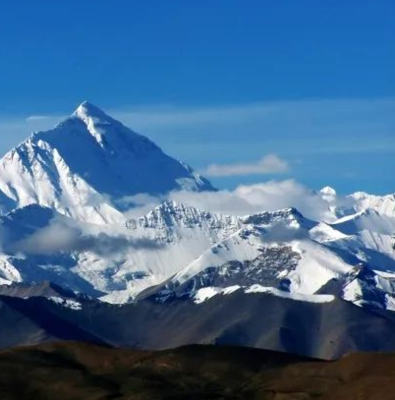
The data set collects the long-term monitoring data on atmosphere, hydrology and soil from the Integrated Observation and Research Station of Multisphere in Namco, the Integrated Observation and Research Station of Atmosphere and Environment in Mt. Qomolangma, and the Integrated Observation and Research Station of the Alpine Environment in Southeast Tibet. The data have three resolutions, which include 0.1 seconds, 10 minutes, 30 minutes, and 24 hours. The temperature, humidity and pressure sensors used in the field atmospheric boundary layer tower (PBL) were provided by Vaisala of Finland. The wind speed and direction sensor was provided by MetOne of the United States. The radiation sensor was provided by APPLEY of the United States and EKO of Japan. Gas analysis instrument was provided by Licor of the United States, and the soil moisture content, ultrasonic anemometer and data collector were provided by CAMPBELL of the United States. The observing system is maintained by professionals on a regular basis (2-3 times a year), the sensors are calibrated and replaced, and the collected data are downloaded and reorganized to meet the meteorological observation specifications of the National Weather Service and the World Meteorological Organization (WMO). The data set was processed by forming a time continuous sequence after the raw data were quality-controlled, and the quality control included eliminating the systematic error caused by missing data and sensor failure.
2019-09-14 View Details

The data set contains land cover data sets from the Yellow River Source, the Yangtze River Source, and the Lancang River from 1992 to 2015. A total of 22 land cover classifications based on the UN Land Cover Classification System were included. NOAA AVHRR, SPOT, ENVISAT, PROBA-V and other vegetation classification products were integrated. In China, (1) first, combined with the 1:100,000 vegetation classification (2007) of China, quality correction and control were performed, and (2) the vegetation classification of China emphasized the combination with climate zones, when correcting CCI-LC, climate divisions and the corresponding vegetation types were combined, and the data label was comprehensively revised.
2019-09-13 View Details
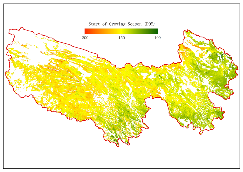
The data set includes the estimated data of the SOS (start of season) and the EOS (end of season) of vegetation in Sanjiangyuan based on 10-day synthetic NDVI products from the SPOT satellite. Two common phenological estimation methods were adopted: the threshold extraction method based on polynomial fitting (the term “poly” was included in the file names) and the inflection point extraction method based on double logistic function fitting (the term “sig” was included in the file names). These data can be used to analyse the relationship between vegetation phenology and climate change. The temporal coverage is from 1999 to 2013, and the spatial resolution is 1 km.
2019-09-13 View Details
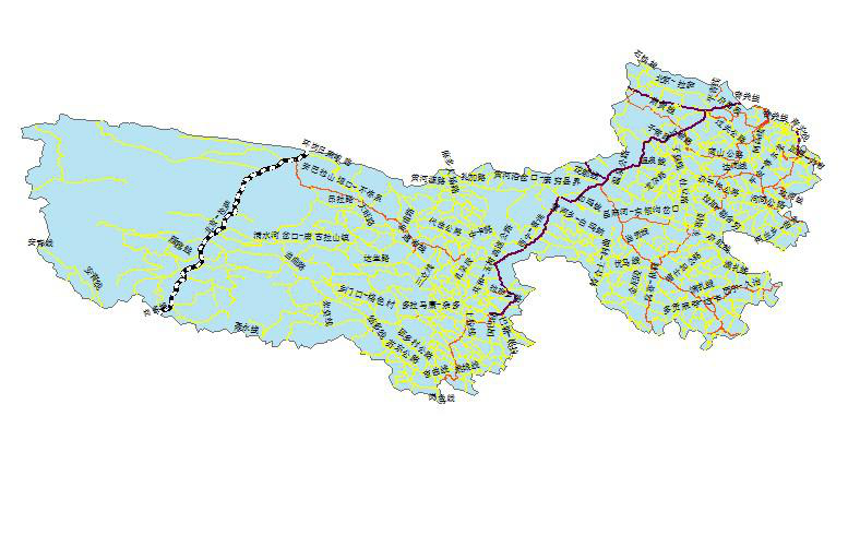
This data comes from the National Geographic Information Resources Catalogue Service System, which was provided free to the public by the National Basic Geographic Information Center in November 2017. We have spliced and cut the source of the three rivers as a whole, so as to facilitate the use of the study of the source area of the three rivers. The data trend is 2017. The data set is 1:1 million traffic data in Sanjiangyuan area, including road (LRDL) and railway (LRRL) layers. Highway (LRDL) includes national, provincial, county, Township and other highways; Railway (LRRL) includes standard rail, narrow rail, subway and light rail. Highway (LRDL) Attribute Item Name and Definition: Attribute Item Description Fill in Example GB National Standard Classification Code 420301 RN Road Number X828 NAME Road Name RTEG Road Grade IV TYPE Road Type Viaduct Meaning of Highway (LRDL) Attribute Item: Attribute Item Code Description GB 420101 National Highway 420102 Building China Road 420201 Provincial Highway 420102 Provincial Highway in Architecture 420301 County Road 420302 Jianzhong County Road 420400 Rural Road 420800 Tractor ploughing Road 440100 Simple Highway 440200 Rural Road 440300 Trail Name and definition of railway (LRRL) attribute item: Attribute Item Description Fill in Example GB National Standard Classification Code 410101 RN Railway No. 0907 NAME Railway Name Qinghai-Tibet Railway TYPE Railway Type Elevated
2019-05-28 View Details

The data set was obtained from the background survey of wildlife diversity in Three River Source National Park by Northwest Institute of Plateau Biology, Chinese Academy of Sciences. The time range of the data set is 2017, and the survey area is Three River Source National Park. The survey species include a variety of rare wildlife such as Equus kiang, Canis lupus, Vulpes vulpes, Cervus elaphus, Accipiter nisus, Phoenicurus erythrogastrus, Prionailurus bengalensis, Buteo hemilasius, Procapra picticaudata, Tetraogallus tibetanus, Perdix hodgsoniae, Falco cherrug, etc.
2019-05-28 View Details
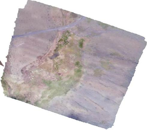
On August 19, 2018, DJI UAV was used to aerial photograph the alpine meadow sample in Qumali County, the source Park of the Yangtze River. The overlap degree of adjacent photographs was not less than 70% according to the set flight route. The Orthophoto Image and DSM were generated using the photographs taken. The Orthophoto Image included three bands of red, green and blue. The ground resolution of the Orthophoto Image was 2.5 cm, and the area of the image was 860 m x 770 m, and the resolution of DSM. It's 4.5cm.
2019-05-25 View Details

On August 20, 2018, a DJI Elf 4 UAV camera was used to take aerial photographs of the alpine meadow sample in Qumali County, which is located in the source area of the Yangtze River. A total of 31 routes were set up. The flight altitude was 100 m, and the overlap degree of adjacent photographs was not less than 70%. A total of 664 aerial photographs were obtained and stored in the Drone Photoes of Qumalai (2018) folder.
2019-05-22 View Details
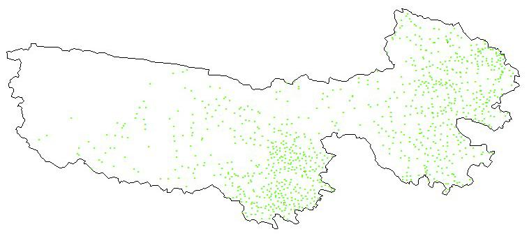
This data comes from the National Geographic Information Resources Catalogue Service System, which was provided free to the public by the National Basic Geographic Information Center in November 2017. In order to use the data more conveniently, the source of the three rivers is spliced and cut as a whole, so as to facilitate the use of the source area of the three rivers. The data trend is 2017. This data set is composed of 1:1 million residential areas in Sanjiangyuan area, including residential land (RESA) and residential place (RESP) layers, RESP residential area (point) layers, including ordinary houses, grazing areas and so on.
2019-05-20 View Details
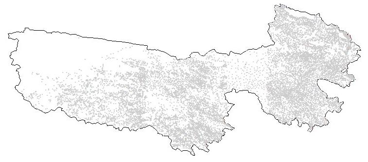
This data comes from the National Geographic Information Resources Catalogue Service System, which was provided free to the public by the National Basic Geographic Information Center in November 2017. We have spliced and cut the source of the three rivers as a whole, so as to facilitate the use of the study of the source area of the three rivers. The data trend is 2015. This data set consists of 1:250,000 residential areas in Sanjiangyuan area, including two layers of residential land (RESA) and residential place (RESP). Resident land (RESA) mainly refers to the outline of surface residential area, and residential place (RESP) includes ordinary houses, shacks, caves, Mongolian yurts, grazing places, etc. Names and definitions of RESA attribute items: Attribute Item Description Fill in Example GB National Standard Classification Code 310200 Name and Definition of Residential Place (RESP) Attribute Item: Attribute Item Description Fill in Example GB National Standard Classification Code 310200 ANGLE Angle 67
2019-05-16 View Details
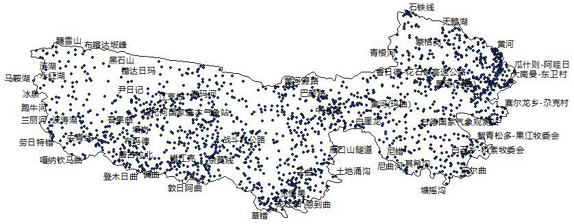
This data was originated from the National Geographic Information Resources Catalogue Service System, which was provided free to the public by the National Basic Geographic Information Center in November 2017. We have spliced and cut the source of the three rivers as a whole, so as to facilitate the use of the study of the source area of the three rivers. The data trend is 2017. This data set is AGNP data of 1:1 million residential place names in Sanjiangyuan area, including administrative place names at all levels and urban and rural residential place names. Names and Definitions of Attribute Items of Residential Place Name Data (AGNP): Attribute Item Description Fill in Example CLASS Geographical Name Classification Code AK NAME Name Quanqu Village PINYIN Chinese Pinyin Quanqucun GNID Place Name Code 632524000000 XZNAME Township Name Ziketan Township
2019-05-13 View Details
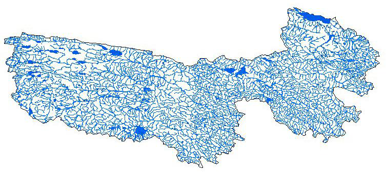
This data originates from the National Geographic Information Resources Catalogue Service System, which was provided free to the public in November 2017. We have spliced and cut the source of the three rivers as a whole, so as to facilitate the use of the study of the source area of the three rivers. This data set is composed of 1:1 million water coefficient data in Sanjiangyuan area, including three layers: water system surface (HYDA), water system line (HYDL) and water system point (HYDP). The water system surface (HYDA) includes lakes, reservoirs and double-line rivers; the water system line (HYDL) includes single-line rivers, ditches, river structure lines; and the water system point (HYDP) includes springs and wells. HYDA Attribute Item Name and Definition: Attribute Item Description Fill in Example GB National Standard Classification Code 210101 HYDC Water System Name Code KJ2103 NAME Name Heihe WQL Water Quality PERIOD Seasonal Month 7-9 TYPE Type Pass HYDL property item name and definition: Attribute Item Description Fill in Example GB National Standard Classification Code 210101 HYDC Water System Name Code KJ2103 NAME Name Heihe PERIOD Seasonal Month 7-9 HYDP property item name and definition: Attribute Item Description Fill in Example GB National Standard Classification Code 210101 NAME TYPE Type ANGLE Angle 75 Water coefficient data GB code and its meaning: Attribute Item Code Description GB 210101 Surface rivers 210200 Seasonal River 210300 Dry River 230101 Lakes 230102 Ponds 230200 Seasonal Lake 230300 Dry Lake 240101 Build Reservoir 240102 Built-in Reservoir
2019-05-10 View Details

On August 22, 2018, in the Lancang River Source Park, a camera was carried on DJI Elf 4 UAV to take aerial photographs of the sample area. A total of 20 routes (5 missing routes) were set up, flying at a height of 100 m, and the overlap degree of adjacent photos was not less than 70%. A total of 1160 aerial photographs were obtained and stored in two folders of "100 MEDIA" and "101 MEDIA".
2019-05-10 View Details
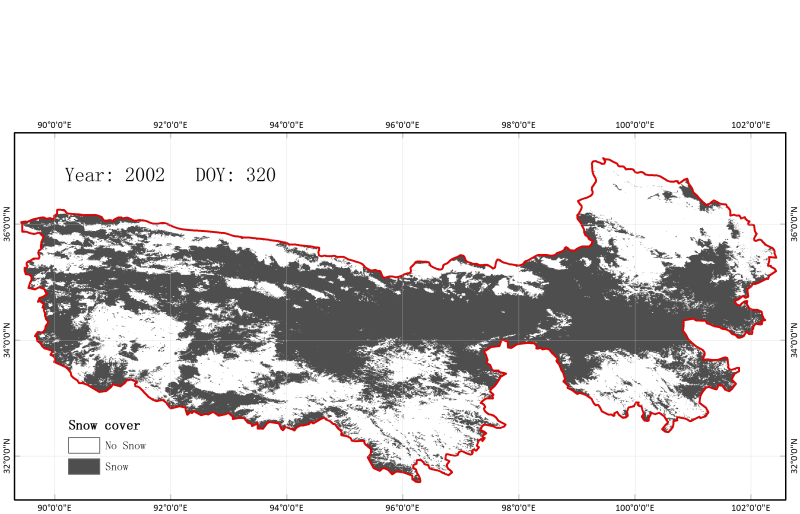
This data set was derived from MODIS version 005 and the IMS data set. It is a daily cloudless snow area product processed by cloud removal. Value range: 0%-100%. 200: snow; 100: lake ice; 25: land; 37: sea. The spatial resolution is 0.005 degrees (approximately 500 m), and the temporal coverage is from July 5, 2002, to December 31, 2014.
2019-04-28 View Details
Contact Support
Links
National Tibetan Plateau Data CenterFollow Us

A Big Earth Data Platform for Three Poles © 2018-2020 No.05000491 | All Rights Reserved
|  No.11010502040845
Tech Support: westdc.cn