")
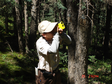
In the middle of August 2013, photosynthesis of population was measured, and plant species: red sand. The group photosynthesis measurement system consists of li-8100 closed-circuit soil carbon flux automatic measurement system (li-cor, USA) and assimilation box designed and manufactured by Beijing ligotai science and Technology Co., Ltd. li-8100 is an instrument produced by li-cor company of USA for soil carbon flux measurement. The concentration of CO2 and H2O is measured by infrared gas analyzer. The length, width and height of assimilation boxes were all 50 cm. The assimilator is controlled by li-8100. After the measurement parameters are set, the instrument can run automatically.
SU Peixi
")
On the basis of physiological and biochemical analysis of photosynthetic organs (leaves or assimilating branches) of typical desert plants in heihe river basin collected in mid-july 2011, some photosynthetic organs of desert plants were collected in mid-july 2012 and put into a liquid nitrogen tank and brought back to the laboratory for determination. Physiological analysis indexes mainly include: soluble protein unit: mg/g;Free amino acid unit: g/g;Chlorophyll content unit: mg/g;Superoxide dismutase (SOD) unit: U/g FW;Catalase (CAT) unit: U/(g•min);POD unit: U/(g•min);Proline (Pro) unit: g/g; Soluble sugar unit: g/g;Malondialdehyde (MDA) is given in moles per liter.
SU Peixi

At the end of September and the beginning of October, 2013, desert plants in typical areas of heihe basin stopped their growth period to conduct year-end ecological survey. There are altogether 8 survey and observation fields, which are: piedmont desert, piedmont gobi, middle reaches desert, middle reaches gobi, middle reaches desert, lower reaches desert, lower reaches gobi and lower reaches desert, with a size of 40m×40m. Three 20m×20m large quadrats were fixed in each observation field, named S1, S2 and S3, and regular shrub surveys were conducted.Each large quadrat was fixed with 4 5m x 5m small quadrats, named A, B, C, D, for the herbal survey.
SU Peixi

The dataset of spectral reflectance observations was obtained by ASD (Analytical Sepctral Devices) in the Yingke oasis and Huazhaizi desert steppe foci experimental areas. Reflectance was calculated based on the equation R = (DN1/DN0)×R0, DN1 indicating DN of the targets, R0 and DN0 the reflectance and DN of the grey board. The reflectance spectra of maize and wheat canopy, the component leaf of the maize and BRDF in Yingke oasis maize field, Yingke oasis wheat field, Huazhaizi desert maize field, the transect spectrum in Huazhaizi desert No. 1 and 2 plots and Linze and Biandukou foci experimental area were measured on May 20, 24, 25, 28 and 30, Jun. 1, 4, 9, 14, 16, 18, 20, 22, 23, 24, 26, 29 and 30, Jul. 1, 4, 5, 6, 7, 9 and 11, 2008. Four ASD devices were used, from Peking University (350-2500nm), Institute of Remote Sensing Applications (350-2500nm), Beijing Academy of Agriculture and Forestry Sciences (350-1065nm) and BNU respectively. The reference boards were 40%, 50% and 99%. The above spectral reflectance dataset was synchronizing with WiDAS (Wide-angle Infrared Dual-mode line/area Array Scanner), OMIS-II and various spaceborne sensors. Raw data were binary files direct from ASD (by ViewSpecPro), and pre-processed data on reflectance were in Excel format.
CHEN Ling, REN Huazhong, WANG Haoxing, XIAO Yueting, YAN Guangkuo, ZHOU Hongmin, GE Yingchun, LI Xin, SHU Lele, GUANG Jie, LIU Sihan, SU Gaoli, XIA Chuanfu, Wen Jianguang, ZHANG Yang, ZHOU Chunyan, FAN Wenjie, TAO Xin, YAN Binyan, YAO Yanjuan, YANG Guijun, CHENG Zhanhui, Liu Liangyun, YANG Tianfu
202024test test data 202024test test data 202024Test test data 202024test test data 202024test test data 202024test test data 202024test test data 202024test test data 202024test test data 202024test test data 202024test test data 202024test test data 202024test test data
MA Mingguo, DING Songchuang, GAO Song, Qian Jinbo, BAI Yunjie, WANG Xufeng, TAN Junlei, WANG Shuguo, GU Juan, WANG Shunli, LUO Longfa, WANG Rongxin, CHE Zongxi, JING Wenmao

The dataset of ground truth measurements synchronizing with the airborne WiDAS mission was obtained in the Linze station foci experimental area on Jun. 29, 2008. WiDAS, composed of four CCD cameras, one mid-infrared thermal imager (AGEMA 550), and one infrared thermal imager (S60), can acquire CCD, MIR and TIR band data. The simultaneous ground data included: (1) soil moisture (0-5cm) nine times by the cutting ring (50cm^3) along LY06 and LY07 strips, and once by the cutting ring method and once by ML2X Soil Moisture Tachometer in the six points of Wulidun farmland quadrates. The preprocessed soil volumetric moisture data were archived as Excel files. (2) surface radiative temperature measured three times by three handheld infrared thermometer (5# and 6# from Cold and Arid Regions Environmental and Engineering Research Institute, and one from Institute of Geographic Sciences and Natural Resources, which were all calibrated) in LY06 and LY07 strips (98 sample points and repeated three times) and the Wulidun farmland quadrates (various points and repeated three times). Data were archived as Excel files. (3) maize canopy component temperature measured by the 5# handheld infrared thermometer (from Cold and Arid Regions Environmental and Engineering Research Institute) in Wulidun farmland quadrates. Six directions were measured, canopy backlighting and frontlighting, half height backlighting and frontlighting, the light and the shaded bareland, with each direction 20 measurements. (4) spectrum of maize, soil and soil with known moisture measured by ASD Spectroradiometer (350~2 500 nm) from BNU, and the reference board (40% before Jun. 15 and 20% hereafter) in Wulidun farmland quadrates. Raw spectral data were binary files , which were recorded daily in detail, and pre-processed data on reflectance (by ViewSpecPro) were archived as Excel.files (5) mltiangle maize spectrum measured by ASD Spectroradiometer (350~2 500 nm) from BNU, the reference board (40% before Jun. 15 and 20% hereafter), two observation platforms of BNU make and one of Institute of Remote Sensing Applications make in Wulidun farmland. Raw spectral data were archived as binary files, which were recorded daily in detail, and pre-processed data on reflectance and transmittivity were archived as text files (.txt). (6) LAI of maize measured by the fisheye camera (CANON EOS40D with a lens of EF15/28), shooting straight downwards, with exceptions of higher plants, which were shot upwards. Data included original photos (.JPG) and those processed by can_eye5.0 (in excel). (7) LAI of maize measured by LAI2000 in Wulidun farmland quadrates. Data educed from LAI2000 periodically were archived as text files (.txt) and marked with one ID. Raw data (table of word and txt) and processed data (Excel) were included. Besides, observation time, the observation method and the repetition were all archived. See the metadata record “WATER: Dataset of setting of the sampling plots and stripes in the Linze station foci experimental area” for more information of the quadrate locations.
DONG Jian, YU Yingjie, BAI Yanfen, HAO Xiaohua, Qian Jinbo, SHU Lele, WANG Yang, XU Zhen
")
The dataset of spectral reflectance measurements was obtained in the A'rou foci experimental area on Mar. 12, 2008. The land was covered with snow 10cm deep. Observed objects included snow, sandstone, grass and ice. The data were archived in the ASCII format, with the first five rows as the file header and the following two columns as wavelength (nm) and reflectance (percentage) respectively, and can be opened by .txt or wordpad. Raw data were binary files direct from ASD (by ViewSpecPro).
PENG Danqing, ZHENG Yue

The dataset of LAI measurements was obtained by LI-3000, the protractor and the ruler in the Yingke oasis and Huazhaizi desert steppe foci experimental areas on May, 20, 24, 25, 28 and 31, Jun. 6, 11, 12, 14, 16, 21 and 27, Jul. 2 and 9, 2008. The maximum leaf length and width of maize and wheat, the leaf angle, length and width of each section (one leaf was divided into 3 sections) were measured. And also the plant height, leaf base height, the crop spacing, the canopy height, row spacing and ridge spacing were measured. Two representative plants would be taken back for indoor observation for the stem length, stem width, stem circumference, and leaf area by LAI3000. Data were archived in Excel format.
CHEN Ling, REN Huazhong, WANG Tianxing, WANG Jindi, XIAO Yueting, YAN Guangkuo, LI Li, LIU Sihan, SU Gaoli, Wen Jianguang, XIA Chuanfu, XIN Xiaozhou, ZHANG Yang, ZHOU Chunyan, ZHOU Mengwei, FAN Wenjie, SHEN Xinyi, TAO Xin, YAN Binyan, YAO Yanjuan

The dataset of ground truth measurements synchronizing with MODIS, ALOS PALSAR and AMSR-E was obtained in the Biandukou foci experimental area on May 24, 2008. Observation items included: (1) the surface temperature in No. 1 (grassland), No. 2 (the rape land), No. 3 (the rape land), No. 4 (the wheat land) and No. 5 quadrate (wheat and rape); (2) the soil moisture by WET in No. 2 quadrate; (3) GPR and WET; (4) The spectrum by ASD Fieldspec FRTM (Boulder, Co, USA), 350nm-2500nm, 3nm for the visible near-infrared band and 10nm for the shortwave infrared band). The spectrum data were archived in the ASCII format, with the first five rows as the file header and the following two columns as wavelength (nm) and reflectance (percentage) respectively, and can be opened by .txt or wordpad. The .txt file was not reflectance but intermediate file for further calculation. Raw data were binary files direct from ASD (by ViewSpecPro). The surface radiative temperature and the physical temperature were measured by the handheld infrared thermometer. Besides, the cover type was also recorded. The data can be opened by Microsoft Office. Soil moisture was acquired by WET and the cutting ring. The data can be opened by Microsoft Office. Six data files were included, soil moisture, the surface temperature, GPR, coverage photos and preprocessed data, ground objects spectrum and satellite images.
BAI Yunjie, CAO Yongpan, CHE Tao, DU Ziqiang, HAO Xiaohua, WANG Zhixia, WU Yueru, CHAI Yuan, CHANG Sheng, QIAN Yonggang, SUN Xiaoqing, WANG Jindi, YAO Dongping, ZHAO Shaojie, ZHENG Yue, ZHAO Yingshi, LI Xiaoyu, PATRICK Klenk, HUANG Bo, LI Shihua, LUO Zhen

The dataset of ground truth measurements synchronizing with ASTER was obtained in the Linze station foci experimental area on May 28, 2008. Observation items included: (1) soil moisture (0-5cm) measured once by the cutting ring method at the corner points of the 40 subplots of the west-east desert transit zone strip once by cutting ring method in the corner points of nine subplots of the north-south desert transit zone, once by the cutting ring method and once by ML2X Soil Moisture Tachometer in the center points of nine subplots of the farmland. The preprocessed soil volumetric moisture data were archived as Excel files. (2) surface radiative temperature measured by the handheld infrared thermometer (5# and 6# from Cold and Arid Regions Environmental and Engineering Research Institute which were both calibrated) in 40 subplots of the west-east desert transit zone strip (repeated 14-30 times), and nine subplots of the north-south desert transit zone strip (repeated 12-30 times). Data were archived as Excel files. (3) BRDF of maize and desert scrub measured by ASD Spectroradiometer (350~2 500 nm) from BNU, the 40% reference board , two observation platforms of BNU make and one of Institute of Remote Sensing Applications make in Wulidun farmland quadrates and the desert transit zone strips. Raw spectral data were archived as binary files, which were recorded daily in detail, and pre-processed data on reflectance and transmittivity were archived as text files (.txt). (4) LAI measured by two methods in the the Wulidun farmland quadrates and Linze station quadrates. One is manual method. The LAI, plant height and the spacing of selected samples were measured by the ruler and the number of the sapmles in the quadrate were counted. Then the LAI can be calculated. The other method is LI-3100. Data were archived as Excel files.
Qian Jinbo, SONG Yi, WANG Zhixia, WANG Yang, PAN Xiaoduo, LI Jing, Li Xiangyun, Qu Yonghua, SUN Qingsong

The dataset of crop biochemical parameter measurements was obtained in the maize field (May 25-Jun. 8, 2008) and the wheat field (Jun. 18-Jul. 4, 2008) of Yingke oasis foci experimental area. Observation items included LAI by LAI-2000, the chlorophyll content by SPAD and leaf moisture by the oven and the scales. Four files were included, readme.txt, wheat sample coordinates.xls, wheat.xls for wheat biochemical parameters and Yingke oasis maize field.xls for maize biochemical parameters.
DONG Jingjing, GAO Shuai, WU Mingquan, WU Chaoyang

The dataset of ground truth measurements synchronizing with ASTER was obtained in the Yingke oasis and Huazhaizi desert steppe foci experimental areas on May 28, 2008. Observation items included: (1) Atmospheric parameters in Huazhaizi desert No. 2 plot by CE318 (produced by CIMEL in France). The total optical depth, aerosol optical depth, Rayleigh scattering coefficient, column water vapor in 936 nm, particle size spectrum and phase function were then retrieved from these observations. The optical depth in 1020nm, 936nm, 870nm, 670nm and 440nm were all acquired by CE318. Those data include the raw data in .k7 format and can be opened by ASTPWin. ReadMe.txt is attached for detail. Processed data (after retrieval of the raw data) in Excel format are on optical depth, rayleigh scattering, aerosol optical depth, the horizontal visibility, the near surface air temperature, the solar azimuth, zenith, solar distance correlation factors, and air column mass number. (2) Photosynthesis by LI-6400. Raw data were archived in the user-defined format (by notepat.exe) and processed data were in Excel format. (3) Reflectance spectra in Yingke oasis maize field by ASD FieldSpec (350-2500nm, the vertical canopy observation and the transect observation) from Institute of Remote Sensing Applications (CAS), and in Huazhaizi desert No. 2 plot by ASD FieldSpec (350-1603nm, the vertical observation and the transect observation for reaumuria soongorica and the bare land) from Beijing Academy of Agriculture and Forestry Sciences. The grey board and the black and white cloth were also used for calibration spectrum. Raw data were binary files direct from ASD (by ViewSpecPro), and pre-processed data on reflectance were in Excel format. (4) Coverage fraction of maize and wheat by the self-made instrument and the camera (2.5m-3.5m above the ground) in Yingke oasis maize field. Based on the length of the measuring tape and the bamboo pole, the size of the photo can be decided. GPS date were also collected and the technology LAB was applied to retrieve the coverage of the green vegetation. Besides, such related information as the surrounding environment was also recorded. Data included the primarily measured image and final fraction of vegetation coverage. (5) the radiative temperature of maize, wheat and the bare land in Yingke oasis maize field by ThermaCAM SC2000 using ThermaCAM SC2000 (1.2m above the ground, FOV = 24°×18°),. The data included raw data (read by ThermaCAM Researcher 2001), recorded data and the blackbody calibrated data (archived in Excel format). (6) the radiative temperature by the automatic thermometer (FOV: 10°; emissivity: 0.95), 3 for maize canopy, the bare land and wheat canopy in Yingke oasis maize field, one for maize canopy in Huazhaizi desert maize field, and 2 for vegetation and the desert bare land in Huazhaizi desert No. 2 plot,at nadir at a time interval of one second. Raw data, blackbody calibrated data and processed data were all archived in Excel format. (7) Maize albedo by the shortwave radiometer in Yingke oasis maize field. R =10H (R for FOV radius; H for the probe height). Data were archived in Excel format. (8) LAI in Yingke oasis maize field. The maximum leaf length and width of each maize and wheat were measured. Data were archived in Excel format. (9) FPAR (Fraction of Photosynthetically Active Radiation) of maize and wheat by SUNSACN and the digital camera in Yingke oasis maize field. FPAR= (canopyPAR-surface transmissionPAR-canopy reflection PAR+surface reflectionPAR) /canopy PAR; APAR=FPAR* canopy PAR. Data were archived in the table format of Word. (10) The radiative temperature in Yingke oasis maize field (the transect observation), Yingke oasis wheat field (the transect observation), Huazhaizi desert maize field (the transect observation) and Huazhaizi desert No. 2 plot (the diagonal observation) by the handheld infrared thermometer (BNU and Institute of Remote Sensing Applications). Raw data (in Word format), blackbody calibrated data and processed data (in Excel format) were all archived.
CHAI Yuan, CHEN Ling, KANG Guoting, QIAN Yonggang, REN Huazhong, WANG Haoxing, WANG Jianhua, SHU Lele, LI Li, LIU Sihan, XIN Xiaozhou, ZHANG Yang, ZHOU Chunyan, ZHOU Mengwei, TAO Xin, WANG Dacheng, LI Xiaoyu, CHENG Zhanhui, YANG Tianfu, HUANG Bo, LI Shihua, LUO Zhen

The dataset of ground truth measurements synchronizing with PROBA CHRIS was obtained in the Biandukou foci experimental area on Jun. 22, 2008. Observation items included: (1) quadrates investigation including GPS by GARMIN GPS 76, species by manual cognition, the plant number by manual work, the height by the measuring tape repeated 4-5 times, the chlorophyll content by SPAD 502, the coverage by manual work and the biomass (samples from 0.5m×0.5m) by wet weight and dry weight. Data were archived as Excel files. (2) LAI of maize, desert scrub and the poplar by the fisheye camera (CANON EOS40D with a lens of EF15/28), shooting straight downwards, with exceptions of higher plants, which were shot upwards. Data included original photos (.JPG) and those processed by can_eye5.0 (as Excel files). For more details, see Readme file. (3) ground object spectrum of grassland, barley and the rape by ASD FieldSpec (350~2 500 nm) from BNU, with 20% reference board. Raw data were binary files direct from ASD (by ViewSpecPro), which were recorded daily in detail, and pre-processed data on reflectance were in .txt. (4) BRDF of grassland, barley and the rape by ASD FieldSpec (350~2 500 nm), with 20% reference board. Raw data were binary files direct from ASD (by ViewSpecPro), which were recorded daily in detail. The processed reflectance and transmittivity were archived in .txt files. The dataset includes processed spectrum data, soil moisture, BRDF, quadrates investigation, integrating spheres data on the rape, LAI, CHRIS data and the fisheye camera data.
DING Songchuang, HAO Xiaohua, YU Yingjie

The dataset of ground truth measurements synchronizing with Envisat ASAR and ALOS PALSAR was obtained in the Linze station foci experimental area on May 24, 2008. The data were in AP mode and VV/VH polarization combinations, and the overpass time was approximately at 11:34 BJT. Observation items included: (1) soil moisture (0-5cm) measured once by cutting ring method at corner points of the 40 subplots of the west-east desert transit zone strip, one time by cutting ring method in nine subplots of the north-south desert transit zone, strip and once by the cutting ring and three times by ML2X Soil Moisture Tachometer in the center points of nine subplots of Wulidun farmland quadrates . The preprocessed soil volumetric moisture data were archived as Excel files. (2) surface radiative temperature by measured two handheld infrared thermometer (5# and 6# from Cold and Arid Regions Environmental and Engineering Research Institute which were both calibrated) in 40 subplots of the west-east desert transit zone strip (repeated 14-30 times each), and nine subplots of the north-south desert transit zone strip (repeated 12-30 times). There are 34 sample points in total and each was repeated three times synchronizing with the airplane. Photos were taken. Data were archived as Excel files. (3) LAI, the plant height and the spacing measured by the ruler and the set square in Wulidun farmland quadrates and Linze station quadrates. Part of the samples were also measured by LI-3100. Data were archived as Excel files. See the metadata record “WATER: Dataset of setting of the sampling plots and stripes in the Linze station foci experimental area” for more information of the quadrate locations.
BAI Yanfen, DING Songchuang, PAN Xiaoduo, WANG Yang, ZHU Shijie, LI Jing, XIAO Zhiqiang, SUN Jinxia

The dataset of ground truth measurement synchronizing with PROBA CHRIS was obtained in No. 2 and 3 quadrates of the A'rou foci experimental area on Jun. 23, 2008. Observation items included: (1) quadrates investigation including GPS by GARMIN GPS 76, plant species by manual cognition, the plant number by manual work, the height by the measuring tape repeated 4-5 times, phenology by manual work, the coverage by manual work (compartmentalizing 0.5m×0.5m into 100 to see the percentage the stellera takes) and the chlorophyll content by SPAD 502. Data were archived in Excel format. (2) roughness by the self-made roughness board and the camera. The processed data were archived as .txt files. (3) BRDF by ASD FieldSpec (350~2 500 nm), with 20% reference board and the observation platform made by Beijing Normal University. The processed reflectance and transmittivity were archived as .txt files. (4) LAI of stellera and pasture by the fisheye camera (CANON EOS40D with a lens of EF15/28), shooting straight downwards, with exceptions of higher plants, which were shot upwards. Data included original photos (.JPG) and those processed by can_eye5.0 (in Excel). For more details, see Readme file. Five files were included, spectrum in No.2 quadrate, multiangle observations in No.2 and 3 quadrates, roughness photos in No.2 and 3 quadrates, the fisheye camera observations, and the No.2 and 3 quadrates investigation.
CAO Yongpan, DING Songchuang, HAO Xiaohua, DONG Jian, Qu Yonghua, YU Yingjie
")
The dataset of ground truth measurements synchronizing with EO-1 Hyperion was obtained in the Yingke oasis foci experimental area from Sep. 5 to Sep. 10, 2007 during the pre-observation period. It was carried out by the 3rd and 2nd sub-projects of CAS’s West Action Plan along Zhangye city-Yingke oasis-Huazhaizi, and on the very day of 10, one scene of Hyperion was captured. sampling plot time north latitude east longitude elevation notes 1 9:58 38°53′53.2″ 100°26′09.7″ 1500 cauliflower land east to the road 2 10:51 38°52′39.8″ 100°25′33.1″ 1510 cabbage land east to the road 3 11:35 38°52′39.0″ 100°25′34.6″ 1510 east to No. 2 sampling plot, maize and intercropping wheat reaped 4 12:24 38°51′53.0″ 100°25′08.0″ 1510 maize seed 5 13:08 38°51′54.2″ 100°25′09.5″ 1520 north to No. 4 sampling plot, maize and intercropping wheat reaped 6 14:40 38°51′23.5″ 100°24′45.0″ 1510 west to the road, maize seed, serious blights (red spider) 7 15:40 38°49′26.6″ 100°23′23.7″ 1540 intercrop land of sea buckthorn and beet 8 16:18 38°49′06.9″ 100°23′30.5″ 1540 tomato land, rich of amaranth weeds 9 16:18 38°49′06.4″ 100°23′30.8″ 1540 beet land 10 16:18 38°49′06.9″ 100°23′30.5″ 1540 tomato land with less weeds 11 10:30 38°48′28.3″ 100°24′11.4″ 1540 sea buckthorn seedling land west to the road 12 11:24 38°48′09.3″ 100°24′10.1″ 1550 sun flower land east to the road, intercropping wheat reaped 13 12:38 38°46′16.3″ 100°23′14.2″ 1600 dry rice land 14 12:45 38°46′16.2″ 100°23′14.0″ 1600 rape land 15 12:54 38°46′15.6″ 100°23′13.8″ 1600 buckwheat land 16 14:52 38°45′55.5″ 100°23′00.1″ 1610 maize (without intercrop) 17 15:28 38°45′57.5″ 100°22′28.3″ 1630 maize (without intercrop) 18 16:20 38°43′17.3″ 100°22′53.4″ 1730 gobi (Bassia dasyphylla and margarite dominate) 19 17:40 38°42′31.8″ 100°22′56.8″ 1780 gobi (Bassia dasyphylla and Sympegma regelii dominate) 20 10:27 38°36′25.1″ 100°20′33.2″ 2260 wheatgrass dominates 21 11:10 38°36′24.4″ 100°20′38.1″ 2260 abandoned composite land 22 11:30 2260 near site 22, wheatgrass and composite cenosis 23 bare land 24 13:09 38°38′46.3″ 100°23′08.5″ 2030 alfalfa land 25 14:39 38°44′30.8″ 100°22′41.0″ 1660 poplar 26 9:47 38°58′11.4″ 100°26′18.3″ 1460 rice land Observation items included: (1) quadrat surveys (2) LAI by LAI-2000 (3) ground object reflectance spectra by ASD FieldSpec Pro (350-2500nm)from Gansu Meteorological Administration (4) the land surface temperature and the canopy radiative temperature by the hand-held thermal infrared sensor (5) the photosynthesis rate by LI-6400 (6) the radiative temperature by ThermaCAM SC2000 (7) Atmospheric parameters by CE318 to retrieve the total optical depth, aerosol optical depth, Rayleigh scattering coefficient, column water vapor in 936 nm, and various parameters at 550nm to obtain horizontal visibility with the help of MODTRAN or 6S codes (8) chlorophyll consistency by portable SPAD Those provide reliable ground data for developing and validating retrieval meathods of biophysical parameters from EO-1 Hyperion images.
MA Mingguo, LI Xin, SU Peixi, DING Songchuang, GAO Song, YAN Qiaodi, ZHANG Lingmei, WANG Xufeng, Qian Jinbo, BAI Yunjie, HAO Xiaohua, Liu Qiang, Wen Jianguang, XIN Xiaozhou, WANG Xiaoping, HAN Hui

The dataset of ground truth measurements synchronizing with Landsat TM was obtained in the A'rou foci experimental area on Jul. 22, 2008. The stellera coverage was mainly measured by photo taking. (1) Stellera coverage was measured by photo taking in 10 quadrates (51m×51m). Each quadrate was divided into 17×17 subsites, with each one spanning a 3×3 m2 plot. Only corner points of each subsite were chosen and 324 photos were taken for each quadrate. Photos were taken by Nikon D80 with a lens of 18-135mm, shooting straight downwards at the height of 1.5m. (2) quadrates investigation including GPS by GARMIN GPS 76, species by manual cognition, the plant number by manual work, the height by the measuring tape repeated 4-5 times, the coverage by manual work (compartmentalizing 0.5m×0.5m into 100 to see the percentage the stellera takes) and the biomass (samples from 0.5m×0.5m) by green weight and dry weight. Data were archived in Excel format. The dataset includes TM images, quadrate coverage investigation photos, GPS positions, coverage files and investigation tables.
CAO Yongpan, LI Hongxing, LIU Chao, MA Mingguo, Qian Jinbo, RAN Youhua
 mission in the Linze grassland foci experimental area on Jul. 8, 2008")
The dataset of ground truth measurements synchronizing with the airborne microwave radiometers (L&K bands) mission was obtained along the sample lines 1, 2, 3, 4, 5 and 6 of the Linze grassland foci experimental area on Jul. 8, 2008. 25 points at intervals of 100m were selected along each line. Simultaneous with the satellite overpass, numerous ground data were collected, soil gravimetric moisture, volumetric moisture, and soil bulk density by the cutting ring, the mean soil temperature from 0-5cm by the probe thermometer, the canopy and the land surface temperature by the hand-held infrared thermometer. See WATER: Dataset of setting of the sampling plots and stripes in the foci experimental area of Linze station for more information.
GE Chunmei, GE Yingchun, HU Xiaoli, HUANG Chunlin, LI Hongxing, WANG Yang, WANG Xufeng, WU Lizong, WU Yueru, ZHU Shijie, YU Fan, LI Xiaoyu
 mission in the Biandukou foci experimental area on Jul. 4, 2008")
The dataset of ground truth measurement synchronizing with the airborne microwave radiometers (L&K bands) mission was obtained in the Biandukou foci experimental area on Jul. 4, 2008. Observation items included: (1) the soil temperature by the handheld infrared thermometer from L1 to L8 (1km from one another) in Biandukou and soil moisture by ML2X; nine samples were collected every 200 m along each line (1.6km). (2) 5 quadrates (50cm×50cm) investigations including GPS, the vegetation cover types and the height, the actual numbering, the valve bag numbering, wet weight+the refuse bag (g), dry weight+the envelope (g), the envelope (g) and the photo numbering. The data were archived as Excel files.
CAO Yongpan, LI Hongxing, LIU Chao, MA Mingguo, RAN Youhua, WANG Yang

The dataset of ground truth measurement synchronizing with MODIS was obtained in the Linze grassland foci experimental area on Jun. 11, 2008. Simultaneous east-west ground measurements on the canopy temperature, the half-height temperature and the surface radiative temperature were carried out by the hand-held infrared thermometer at intervals of 125m in 8 quadrates (2km×2km), No.1 quadrate (H01-H08), No.2 quadrate (H09-H16), No.3 quadrate (H17-H24), No.4 quadrate (H25-H32), No.5 quadrate (H33-H40), No.6 quadrat (H41-H48), No.7 quadrate (H49-H56) and No.8 quadrat (H57-H64). Data were archived in Excel file. See WATER: Dataset of setting of the sampling plots and stripes in the foci experimental area of Linze station for more information.
CHAO Zhenhua, HUANG Chunlin, MA Mingguo, Qian Jinbo, RAN Youhua, WANG Xufeng, FENG Lei, YU Fan
Contact Support
Links
National Tibetan Plateau Data CenterFollow Us

A Big Earth Data Platform for Three Poles © 2018-2020 No.05000491 | All Rights Reserved
|  No.11010502040845
Tech Support: westdc.cn

