
Digital Elevation Model (DEM) is a kind of solid ground Model that represents the ground Elevation in the form of a set of ordered numerical arrays. The arctic region within 66 ° 34 'refers to the arctic regions and parts of Greenland in the arctic.Elevation data include arctic digital dem and hillshade data in tif format.Range of 66 ° ~ 90 ° N N, the spatial resolution of 0.008 ° x 0.008 °. The data is downloaded from NASA global elevation data DEM describes ground elevation information, which is widely used in surveying and mapping, hydrology, meteorology, geomorphology, geology, soil, engineering construction, communication, military and other fields of national economy and national defense as well as humanities and natural sciences.
National Aeronautics and Space Administration
")
This data set provides a 1 km resolution Digital Elevation Model (DEM) of Antarctica. The DEM combines measurements from the European Remote Sensing Satellite-1 (ERS-1) Satellite Radar Altimeter (SRA) and the Ice, Cloud, and land Elevation Satellite (ICESat) Geosciences Laser Altimeter System (GLAS). The ERS-1 data are from two long repeat cycles of 168 days initiated in March 1994, and the GLAS data are from 20 February 2003 through 21 March 2008. The data set is approximately 240 MB comprised of two gridded binary files and two Environment for Visualizing Images (ENVI) header files viewable using ENVI or other similar software packages. The data are available via FTP.
National Aeronautics and Space Administration

A total of 137 soil samples of different vegetation types, different altitudes and different terrains were collected from June 2012 to August 2012. The soil layer of each sample point was divided into three layers of 0-10cm, 10-20cm and 20-30cm, with an altitude of 2700-3500m m. The vegetation types were divided into five types: Picea crassifolia forest, Sabina przewalskii, subalpine scrub meadow, grassland and dry grassland. At the same time of sampling, hand-held GPS is used to record the location information and environmental information of each sampling point, including longitude, latitude, altitude, slope, aspect, terrain curvature, vegetation type, soil thickness, maximum root depth, etc. Soil bulk density: The measurement method of soil bulk density is to put the sample into an envelope and dry it in an oven at 105℃ for 24 hours, then take it out and place it for 30 minutes to weigh. The ratio of the weighing result to the volume of the ring cutter is the soil bulk density, and the unit is g/cm3. Soil mechanical composition: hydrometer method is used to measure the soil mechanical composition, which includes the content of soil sand, silt and clay.
ZHAO Chuanyan, MA Wenying
")
Based on the field survey results of this project, the previous hydrogeological survey results and the prediction and judgment of desert depressions, we obtained more than 600 known water level points in badain jaran desert and its surrounding areas, and drew a first-order approximate contour map of the groundwater level in badan jaran desert by using the measured or predicted groundwater level data.This isometric chart fills a gap in the study of groundwater in badain jaran desert. The so-called first-order approximation is the distribution of the macroscopic groundwater level, which reaches a resolution of 1 km on the spatial scale, and it is assumed that the groundwater level in the shallow and deep layers is the same, and the groundwater in the quaternary and bedrock distribution areas remains continuous.The error level of the first-order approximate contour is ± 10 m, which mainly comes from the uncertainty of ground elevation data. This data set contains a vector diagram of the groundwater level contour line and a raster data file.
WANG Xusheng, HU Xiaonong

"Heihe River Basin Ecological hydrological comprehensive atlas" is supported by the key project of Heihe River Basin Ecological hydrological process integration research. It aims at data arrangement and service of Heihe River Basin Ecological hydrological process integration research. The atlas will provide researchers with a comprehensive and detailed background introduction and basic data set of Heihe River Basin. Heihe River Basin water system map is one of the hydrological and water resources part of the atlas, with a scale of 1:2500000, positive axis isometric conic projection and standard latitude of 25 47 n. Data sources: river data of Heihe River Basin, reservoir distribution data of Heihe River Basin, residential area data of Heihe River Basin in 2009, administrative boundary data of one million Heihe River Basin in 2008, Lake data of Heihe River Basin and other basic geographic data. The upper reaches of Heihe River Basin are located in Qilian County, Haibei Tibetan Autonomous Prefecture, Qinghai Province, and the northern foot of Qilian Mountain in Zhangye, Jiuquan City, Sunan and Subei counties of Gansu Province. The middle reaches are located in Shandan, Minle, Ganzhou, Linze, Gaotai, Sunan, Suzhou, Jiayuguan and Yumen counties of Gansu Province. The lower reaches are located in Jinta, Gansu Province, Ejina Banner and Alxa Right Banner of Inner Mongolia, involving three provinces (autonomous regions), 16 cities and counties (District, banner), 56 towns, 45 townships and 4 Sumu. Table 1 shows the information about the administrative divisions of Heihe River Basin.
WANG Jianhua, ZHAO Jun, WANG Xiaomin, FENG Bin
")
This dataset contains three basic remote sensing data of digital topography (DEM), TM remote sensing image and NDVI vegetation index of badan jilin desert. 1. DEM, digital terrain data, from the SRTM1 data set released by NASA in the United States, was cropped in the desert area.The resolution is 30 m.The data is stored in the DEM folder, and the dm.ovr file can be opened by ArcGIS. 2. TM image data.The composite data of Landsat TM/ETM + 543 band released by NASA were cropped in the desert lake group distribution area.The resolution is 30 m.From 1990 to 2010, one scene was selected in summer and one scene in autumn every five years to analyze the long-term changes of the lake.In 2002, there was a scene for each quarter to analyze the changes of the lake during the year.The data is stored in TM folder, TIFF format, can be opened by ArcGIS or ENVI software.The file naming rule is yyyymm.tif, where yyyy refers to the year and mm to the month. For example, 199009 refers to the time corresponding to the impact data of September 1990. 3. NDVI, vegetation index.The modis-ndvi product MOD13Q1, released by NASA, was cropped in desert areas.The NDVI data of every ten days of the growing season (June, July, August and September) from 2000 to 2012 are included. The spatial resolution is 250 m and the temporal resolution is 16 days.Stored in NDVI folder, TIFF format, can be opened by ArcGIS or ENVI software.Mosaic_tmp_yyyyddd.hdfout.250m_16_days_ndvi_roi.tif, Where yyyy represents the year and DDD represents the day of DDD of the year.
JIN Xiaomei, HU Xiaonong
")
Two sets of grid data, aster GDEM data with a resolution of 30 meters and SRTM data with a resolution of 90 meters provided by the data management center of Heihe project, as well as point data from multiple sources, are used. By using the HASM scaling up algorithm, the grid data of different sources and different precision are fused with the elevation point data to obtain the high precision slope direction data of Heihe River Basin. First of all, the accuracy of two groups of grid data is verified by using various point data. According to the results of accuracy verification, different grid data are used as the trend surface of data fusion in different regions. The residuals of various point data and trend surface are calculated, and the residual surface is obtained by interpolation with HASM algorithm, and the trend surface and residual surface are superposed to obtain the final slope surface. The spatial resolution is 500 meters.
YUE Tianxiang, ZHAO Na
The landform near Qilian in the upper reaches of Heihe River includes the first level denudation surface (wide valley surface) and the Ninth level river terrace. The stage surface distribution data is mainly obtained through field investigation. GPS survey is carried out for the distribution range of all levels of geomorphic surface. The field data is analyzed in the room, and then combined with remote sensing image, topographic map, geological map and other data, the distribution map of all levels of geomorphic surface in the upper reaches of Heihe river is drawn. The age of the denudation surface is about 1.4ma, and the formation of Heihe terrace is later than this age, all of which are terraces since late Pleistocene.
HU Xiaofei, PAN Baotian
")
From 2012 to 2013, the geomorphic surface near the Zhengyi gorge in the middle reaches of the Heihe River was investigated, mainly including the 4-level river terrace. The data are mainly obtained through field investigation, and analyzed and mapped indoors to obtain the distribution map of geomorphic surface at all levels near the middle reaches of Zhengyi gorge.
HU Xiaofei, PAN Baotian
")
Soil bulk density, porosity, water content, water characteristic curve, saturated hydraulic conductivity, particle analysis, infiltration rate, and sampling point location information in the upper reaches of the Heihe River Basin. 1. The data is for 2014 supplementary sampling for 2012, using the ring knife to take the original soil; 2. The soil bulk density is the dry bulk density of the soil and is measured by the drying method. The original ring-shaped soil sample collected in the field was thermostated at 105 ° C for 24 hours in an oven, and the soil dry weight was divided by the soil volume (100 cubic centimeters) , unit: g/cm 3 . 3. Soil porosity is obtained according to the relationship between soil bulk density and soil porosity; 4. Soil infiltration analysis data set, the data is the field experimental measurement data from 2013 to 2014. 5. The infiltration data is measured by “MINI DISK PORTABLE TENSION INFILTROMETER”, and the approximate saturated hydraulic conductivity under a certain negative pressure is obtained. 6. Soil particle size data was measured at the Grain Granulation Laboratory of the Key Laboratory of the Ministry of Education of Lanzhou University. The measuring instrument is a Malvern laser particle size analyzer MS2000. 7. The saturated hydraulic conductivity is measured according to the enamel hair self-made instrument of Yi Yanli (2009). The Marioot bottle was used to maintain the head during the experiment; at the same time, the Ks measured at the time was converted to the Ks value at 10 °C for analysis and calculation. 8. Soil water content data is measured using ECH2O, including 5 layers of soil water content and soil temperature. 9. The water characteristic curve is measured by the centrifuge method: the undisturbed soil of the ring cutter collected in the field is placed in a centrifuge, and each of the speeds is measured at 0, 310, 980, 1700, 2190, 2770, 3100, 5370, 6930, 8200, 11600. The secondary rotor weight is obtained.
HE Chansheng

The data is clipped from "1: 1 million wetland data of China". "1: 1 million wetland data of China" mainly reflects the national marsh wetland information in the 2000s. It is expressed in geographic coordinates using the decimal degree. The main contents include: marsh wetland types, wetland water supply types, soil types, main vegetation types, geographical area, etc. Implemented the "Standard for Information Classification and Coding of Sustainable Development Information Sharing System of China". Data source of this database: 1:20 swamp map (internal version), Tibetan Plateau 1: 500,000 swamp map (internal version), swamp survey data 1: 1 million and national 1: 4 million swamp map; processing steps are: data source selection, preprocessing, digitization and encoding of marsh wetland elements, data editing processing, establishing topological relationships, edge processing, projection conversion, linking with attribute databases such as place names and obtaining attribute data.
ZHANG Shuqing

The Shiyang River Basin Information System thematic data set is one of the results of the technical assistance project “Optimization of Desertification Control in Gansu Province” assisted by the Asian Development Bank, including 5 folders including document, investigation_point, maps, photo, and spatial. Each file The folder contains several files. The document folder includes the target design, data processing, thematic summary report, and projection information.The gpspoint folder includes files recorded in shapefile point format sampled by gps according to different purposes.The maps folder contains Chinese, english, and fonts files. Folder, the first two folders represent 14 Chinese and English maps stored in A4 format and pdf format, and fonts contain some special fonts: the photo folder contains field survey digital photos stored in bmp format: spatial The folder contains the dem folder of the digital elevation model, the gansu folder of the outline map of Gansu Province and the Hexi Corridor, the generate folder of the site data file shapefile, the grid folder of the raster data of various geographic features, and the remote sensing image. image folder, meteoHydro folder for original site text data, and vector folder for vector data for various geographic features. The data includes: 1. DEM folder: 100m dem, hillshade, divided into GRID and geotif formats 2. Gansu folder: Gansu border, Hexi border 3. Grid folder: NDVI (vegetation index), lndchange (land transfer matrix), landscape86 (land landscape map in 86 years), landscape2k (land landscape map in 2000), Desertiftype (desert type landscape map), Desersevrt (desert type map ), Annprecip 4. Meteohydro folder: Minqin, Wuwei, Yongchang meteorological data (1) daily daily observation items: Airpress (humidity), Precipitation (radiation), Sunlight (sunlight), Temperature (temperature) ), Wind (wind speed) (2) Months (monthly): Airpress (air pressure), Humidity (humidity), Rain (precipitation), Sunlight (sunlight), Temperature (temperature), Wind (wind speed) (3) tendays: Airpress, Humidity, Rain, Sunlight, Temperature, Wind (4) years (year by year): Precipitation, Temperature 5. Vectro folder: (1) Admwhole (county boundary map), (2) Lake (lake), (3) Hydrasta (hydrological site), (4) Basin (watershed boundary), (5) Landscape2000 (land use 200 (Year), (6) landscape86 (land use 1986), (7) Meteosta (meteorological station), (8) Lakep (reservoir point), (9) Place (residential point), (10) Rainfallcontour (railway), ( 11) Rainfallcontour (rainfall contour map), (12) Road (highway), (13) Stream (water system map), (14) Town (county name), (15) Township (county township boundary), (16) Vegetation (vegetation map) Data projection information: PROJCS ["Albers", GEOGCS ["GCS_Krasovsky_1940", DATUM ["Not_specified_based_on_Krassowsky_1940_ellipsoid", SPHEROID ["Krasovsky_1940", 6378245.0,298.3]], PRIMEM ["Greenwich", 0.0], UNIT ["Degree", 0.0174532925199433]], PROJECTION ["Albers_Conic_Equal_Area"], PARAMETER ["False_Easting", 0.0], PARAMETER ["False_Northing", 0.0], PARAMETER ["longitude_of_center", 105.0], PARAMETER ["Standard_Parallel_1", 25.0], PARAMETER ["Standard_Parallel_2", 47.0], PARAMETER ["latitude_of_center", 0.0], UNIT ["Meter", 1.0]] For detailed data description, please refer to the data file
LI Xin
")
The data set contains the slope aspect (resolution: 30 m) factor affecting soil erosion on the Loess Plateau and the slope aspect data extracted from the elevation data of the Loess Plateau. Each theme map is divided into frames according to the 1:250000 scale standard map cartography method, and the frames are denoted by the 1:250000 scale standard map cartography number. The geographical coordinate is WGS1984; the accuracy can meet the requirements of regional scale hydrology and soil erosion analysis and forecasting.
LIU Baoyuan, SHI Haijing

The data is clipped from "1: 1 million wetland data of China". "1: 1 million wetland data of China" mainly reflects the national marsh wetland information in the 2000s. It is expressed in geographic coordinates using the decimal degree. The main contents include: marsh wetland types, wetland water supply types, soil types, main vegetation types, geographical area, etc. Implemented the "Standard for Information Classification and Coding of Sustainable Development Information Sharing System of China". Data source of this database: 1:20 swamp map (internal version), Tibetan Plateau 1: 500,000 swamp map (internal version), swamp survey data 1: 1 million and national 1: 4 million swamp map; processing steps are: data source selection, preprocessing, digitization and encoding of marsh wetland elements, data editing processing, establishing topological relationships, edge processing, projection conversion, linking with attribute databases such as place names and obtaining attribute data.
ZHANG Shuqing
")
Two sets of grid data, aster GDEM data with a resolution of 30 meters and SRTM data with a resolution of 90 meters provided by the data management center of Heihe project, as well as point data from multiple sources, are used. By using the HASM scaling algorithm, the grid data of different sources and different precision are fused with the elevation point data to obtain the high precision slope data of Heihe River Basin. First of all, the accuracy of two groups of grid data is verified by using various point data. According to the results of accuracy verification, different grid data are used as the trend surface of data fusion in different regions. The residuals of various point data and trend surface are calculated, and the residual surface is obtained by interpolation with HASM algorithm, and the trend surface and residual surface are superposed to obtain the final slope surface. The spatial resolution is 500 meters.
YUE Tianxiang, ZHAO Na
The dataset contains all individual glacial storage (unit: km3) over the Qinghai-Tibetan Plateau in 1970s and 2000s. It is sourced from the resultant data of the paper entitled "Consolidating the Randolph Glacier Inventory and the Glacier Inventory of China over the Qinghai-Tibetan Plateau and Investigating Glacier Changes Since the mid-20th Century". The first draft of this paper has been completed and is planned to be submitted to Earth System Science Data journal. The baseline glacier inventories in 1970s and 2000s are the Randolph Glacier Inventory 4.0 dataset, and the Glacier Inventory of China, respectively. Based on the individual glacial boundaries extracted from the above-mentioned two datasets, the grid-based bedrock elevation dataset (https://www.ngdc.noaa.gov/mgg/global/global.html, DOI: 10.7289/v5c8276m), and the glacier surface elevation obtained by a slope-dependent method, the individual glacier volumes in 1970s and 2000s are then calculated. In addition, the calculated results of individual glacier volumes in this study have been compared and verified with the existent results of several glacier volumes, relevant remote sensing datasets, and the global glacier thickness dataset based on the average of multiple glacier model outputs (https://www.research-collection.ethz.ch/handle/20.500.11850/315707, doi:10.3929/ethz-b-000315707), and the errors in the calculations have also been quantified. The established dataset in this study is expected to provide the data basis for the future regional water resources estimation and glacier ablation-involved researches. Moreover, the acquisition of the data also provides a new idea for the future glacier storage estimation.
HU Xiaofei, PAN Baotian
")
The section data of the upper reaches of Heihe River mainly show the structure and cross section distribution characteristics of the terrace of Heihe River. These data are mainly obtained through field investigation and measurement. The data include the forest farm section and raft section near Qilian County in the upper reaches of Heihe River, and the Heihekou section in Yingluoxia.
HU Xiaofei, PAN Baotian

The data is clipped from "1: 1 million wetland data of China". "1: 1 million wetland data of China" mainly reflects the national marsh wetland information in the 2000s. It is expressed in geographic coordinates using the decimal degree. The main contents include: marsh wetland types, wetland water supply types, soil types, main vegetation types, geographical area, etc. Implemented the "Standard for Information Classification and Coding of Sustainable Development Information Sharing System of China". Data source of this database: 1:20 swamp map (internal version), Tibetan Plateau 1: 500,000 swamp map (internal version), swamp survey data 1: 1 million and national 1: 4 million swamp map; processing steps are: data source selection, preprocessing, digitization and encoding of marsh wetland elements, data editing processing, establishing topological relationships, edge processing, projection conversion, linking with attribute databases such as place names and obtaining attribute data.
ZHANG Shuqing

Chinese Cryospheric Information System is a comprehensive information system for the management and analysis of cryospheric data over China. The establishment of Chinese Cryospheric Information System is to meet the needs of earth system science, and provide parameters and verification data for the development of response and feedback models of permafrost, glacier and snow cover to global changes under GIS framework. On the other hand, the system collates and rescues valuable cryospheric data to provide a scientific, efficient and safe management and analysis tool. Chinese Cryospheric Information System selected three regions with different spatial scales as its main research areas to highlight the research focus. The research area along the Qinghai-Tibet highway is mainly about 700 kilometers long from Xidatan to Naqu, and 20 to 30 kilometers wide on both sides of the highway. The datasets of the Tibetan highway contains the following types of data: 1. Cryosphere data.Including: snow depth distribution. 2. Natural environment and resources.Include: Digital elevation topography (DEM) : elevation elevation, elevation zoning, slope and slope direction; Fundamental geology: Quatgeo 3. Boreholes: drilling data of 200 boreholes along the qinghai-tibet highway. Engineering geological profile (CAD) : lithologic distribution, water content, grain fraction data, etc 4. Model of glacier mass equilibrium distribution along qinghai-tibet highway: prediction of frozen soil grid data. The graphic data along the qinghai-tibet highway includes 13 map scales of 1:250,000.The grid size is 100×100m. For details, please refer to the documents (in Chinese): "Chinese Cryospheric Information System design. Doc", "Chinese Cryospheric Information System data dictionary. Doc", "Database of the Tibetan highway. Doc".
LI Xin
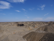
 in the Kubuqi Desert")
I. Overview This data set contains the terrain data, soil data, meteorological data, land use data, NDVI data, etc. required for the operation of the IWEMS model. All maps and relevant point coordinates (weather stations) use the isometric projection UTM / WGS94 coordinate system. Ⅱ. Data processing description All maps and related point coordinates (weather stations) use the isometric projection UTM / WGS84 coordinate system. Ⅲ. Data content description The data content mainly includes: The basic terrain data includes the Cuneiform Desert (DEM) and the river network. The river network is used as the boundary for wind and sand transmission. The size of the DEM grid is 250 * 250 m. The river network was extracted using the ASTER-GDEM terrain data with the river burning method. Soil data, including soil physics, chemistry, and spatial distribution of soil types. It is derived from 1: 1 million soil database of China and converted to ESRI-grid format with a grid size of 250 * 250 m. Meteorological data, including daily data from Baotou, Dongsheng and Linhe meteorological stations around the Kubuqi Desert, from 2002 to 2010. Includes precipitation, wind speed and wind direction data. Land use data, 2000 land use data, scale is 1: 100,000. Convert it to ESRI-grid format with a grid size of 250 * 250 m. Ⅳ. Data usage description Evaluate wind and sand hazards along the Yellow River, estimate the amount of wind and sand entering the upper reaches of the Yellow River, and provide data support for establishing an early warning system for wind and sand hazards in the region.
XUE Xian, DU Heqiang
Contact Support
Links
National Tibetan Plateau Data CenterFollow Us

A Big Earth Data Platform for Three Poles © 2018-2020 No.05000491 | All Rights Reserved
|  No.11010502040845
Tech Support: westdc.cn

